Education
Type of resources
Keywords
Publication year
Scale
Topics
-
<div>The A1 poster incorporates 4 images of Australia taken from space by Earth observing satellites. The accompanying text briefly introduces sensors and the bands within the electromagnetic spectrum. The images include examples of both true and false colour and the diverse range of applications of satellite images such as tracking visible changes to the Earth’s surface like crop growth, bushfires, coastal changes and floods. Scientists, land and emergency managers use satellite images to analyse vegetation, surface water or human activities as well as evaluate natural hazards.</div>
-
Four posters approximately A1 in size (31.5 x 25.59 inches) on prehistoric creatures. Each creature is described with its name, diet, geological period, dimension, and interesting facts. Full-colour sketches are included on the posters. Creatures are Brachiosaurus, Trilobite, Stegosaurus, and Tyrannosaurus Rex.
-
Class set of 30 A4 elevation images of Australia. The teachers' guide provides information about the creation of this special image and gives suggestions for classroom activities.
-
No abstract available
-
Printed colour bookmark (295mm x 70mm) that shows a simple geological timescale (2012) on one side. The back includes a brief explanation of the geological timescale and contact information for Geoscience Australia.
-
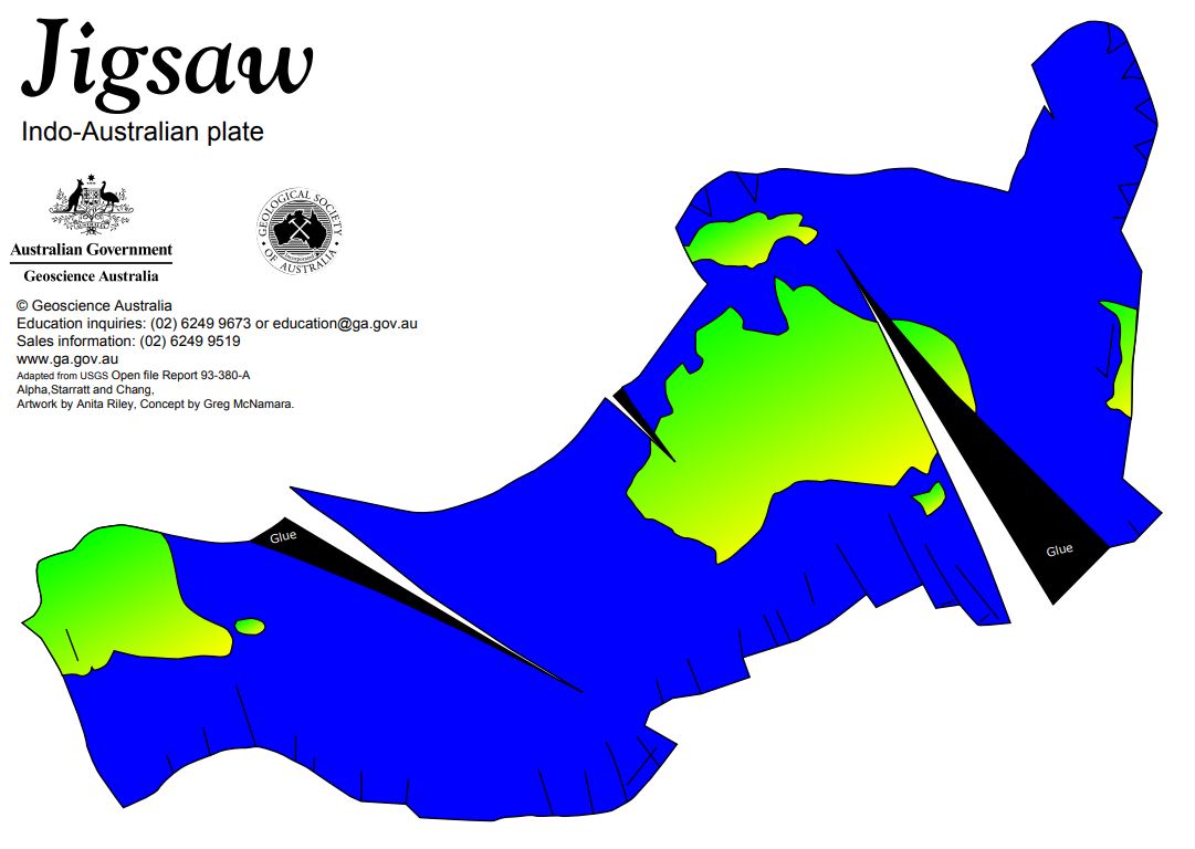
Help students visualise plate boundaries on a spherical Earth, rather than on a flat map. The model shows plate boundaries and land masses, and highlights our own Indo-Australian plate. Ready to cut out and construct (basketball required). Assembly instructions included. Suitable for primary Years 5 - 6 and secondary Years 7 - 12.
-
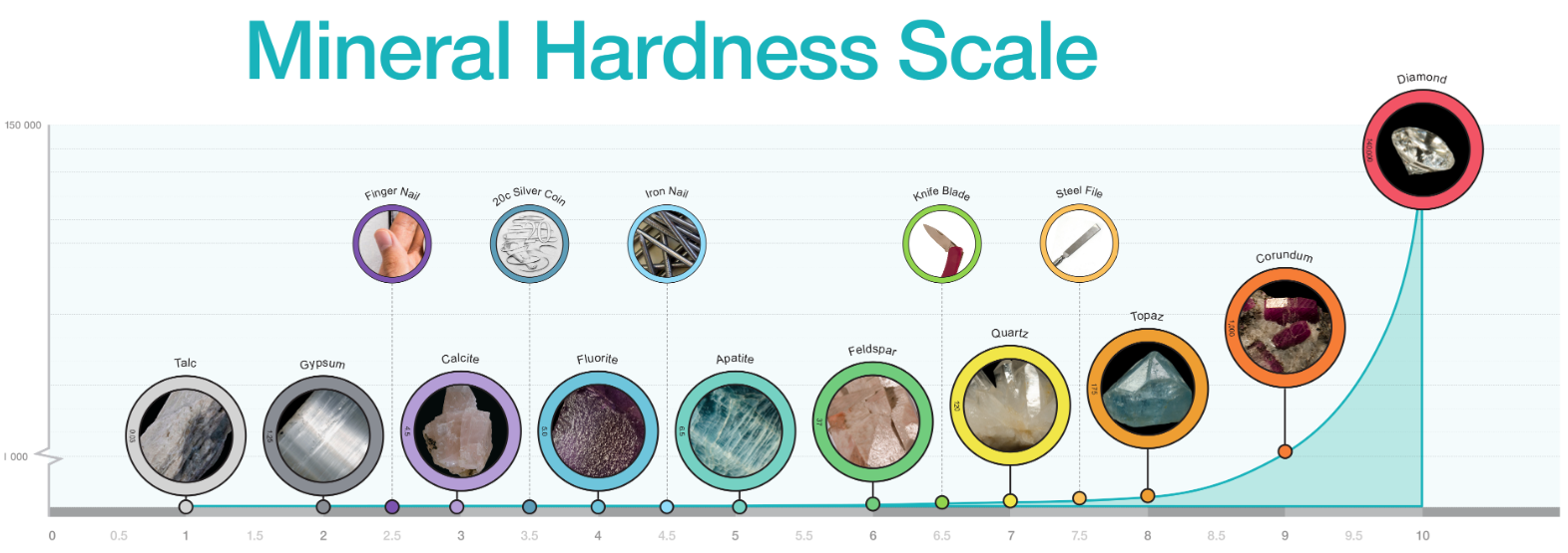
Diagram of mineral hardness comparing Mohs relational scale and Rosiwal absolute hardness. Includes photographs of specimens for each number on Mohs Hardness Scale. Best printed in colour at A3 or larger.
-
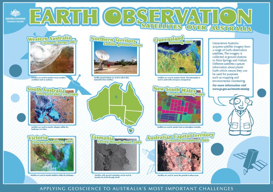
A children's educational poster showing a variety of applications of satellite observation. Includes an image from every State and Territory, and minimal text describing how Geoscience Australia uses remote sensing in its work. Many of the images show natural hazards. Suitable for Year 6 and below.
-
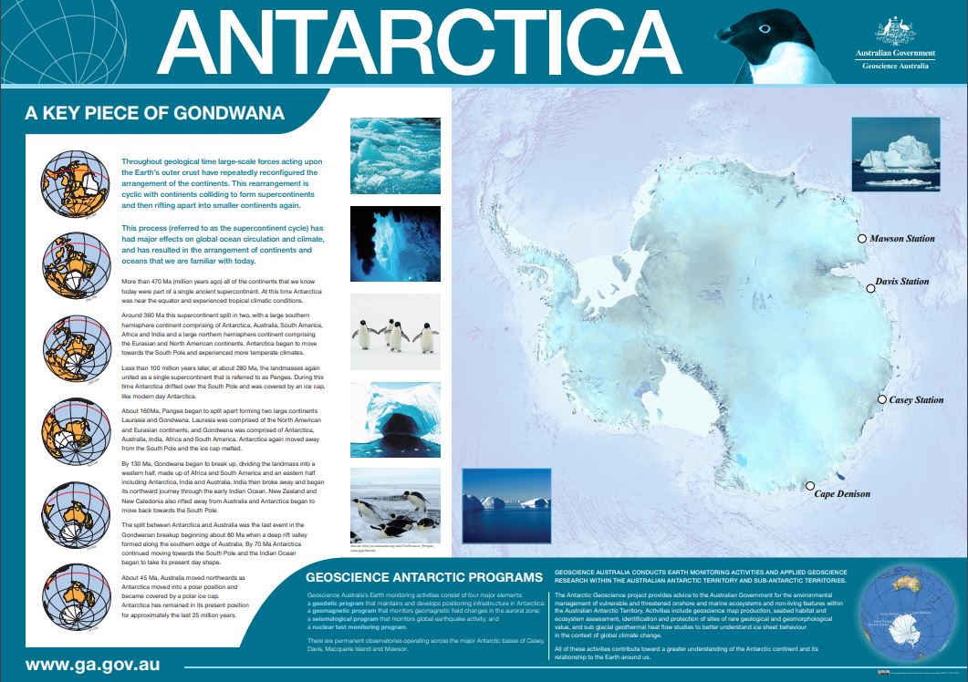
Poster on Antarctica, featuring a large satellite image of the continent with research stations highlighted. Poster also features a geological history of the continent from Gondwana (470 million years ago) including global maps of the shape of the continents through time and accompanying paragraphs of information.
-
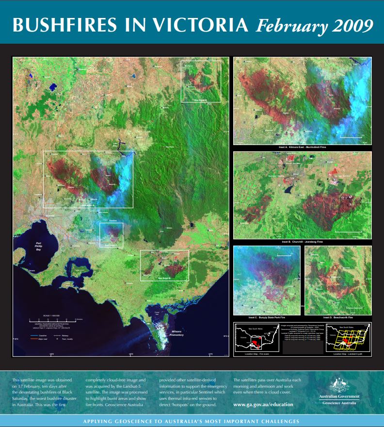
The main part of this spliced satellite image was obtained on 17 February, ten days after the devastating bushfires of Black Saturday. This was the first cloud-acceptable image of the fires and was acquired by the Landsat-5 satellite. Close-ups of Kilmore East-Murrindindi, CHurchill-Teeralang, Bunyip State Forest fire and Beecworth included. The raw image was processed to highlight burnt areas (dark red) and show fire fronts. Vegetation appears green and the smoke appears pale blue.


