EDUCATION
Type of resources
Keywords
Publication year
Topics
-

<div>The A1 poster incorporates 4 images of Australia taken from space by Earth observing satellites. The accompanying text briefly introduces sensors and the bands within the electromagnetic spectrum. The images include examples of both true and false colour and the diverse range of applications of satellite images such as tracking visible changes to the Earth’s surface like crop growth, bushfires, coastal changes and floods. Scientists, land and emergency managers use satellite images to analyse vegetation, surface water or human activities as well as evaluate natural hazards.</div>
-
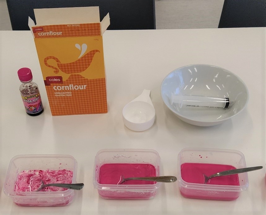
This activity introduces the concepts of lava viscosity and influence on volcanic cone shape. The download includes background information for teachers and an activity sheet for students. The activity involves making lava slime and racing this down a slope. Participants are asked to predict how lava viscosity might influence volcanic shape (a hypothesis) and then observe what does happen and relate this to the natural environment.
-
These videos are recordings of online secondary teacher professional learning sessions, delivered by Geoscience Australia’s Education Team. “Can I Fall Down the Cracks?” Plate Tectonic Misconceptions Part 1 This session focused on common misconceptions that are encountered when teaching plate tectonics. The student misconceptions addressed are: 1. We can’t see the tectonic plates (starting at 5:35) 2. The mantle is made of liquid rock (starting at 11:25) 3. The plates move by convection in the mantle (starting at 17:35) 4. When plates collide one always goes under the other (starting at 22:15) 57 minutes total duration, with Q&A with an expert scientist starting at 34 minutes. “Can I Fall Down the Cracks?” Plate Tectonic Misconceptions Part 2 This session focused on common misconceptions that are encountered when teaching hazards associated with plate tectonics. The student misconceptions addressed are: 1. Earthquakes are measured using the Richter scale (starting at 3:15) 2. The magnitude of an earthquake depends on how far away it is (starting at 7:20) 3. Earthquakes can be predicted (starting at 10:52) This section includes a description of Raspberry Shake equipment: low cost earthquake monitoring for the classroom 4. There are no volcanoes in Australia (starting at 18:25) 5. You can surf a tsunami (starting at 24:17) 51 minutes total duration, with Q&A with an expert scientist starting at 37 minutes.
-
How do some of the rocks in Minecraft form and behave in real life? This short video discusses bedrock, obsidian and redstone using real rock samples and references to the game.
-
This short video by the Geoscience Australia Education Team is targeted at upper primary students but is suitable for a wider audience. It introduces the concept of tectonic plates making use of a tectonic plates puzzle. Students are asked to predict the direction and speed of plate movement and consider where and why earthquakes happen on the Australian Plate. It is an introduction to major concepts of Earth science delivered in a light-hearted manner with an interactive presentation style.
-
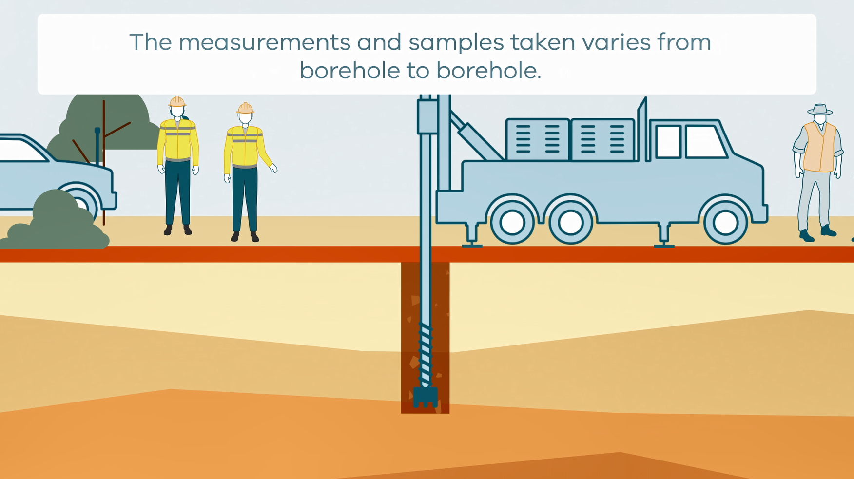
This animation shows how stratigraphic drilling is conducted. It is part of a series of Field Activity Technique Engagement Animations. The target audience are the communities that are impacted by GA's data acquisition activities. There is no sound or voice over. The 2D animation includes a simplified view of what stratigraphic drilling looks like, what measurements and samples are taken, and how scientists use the data.
-
Activity investigating the expansion rate of water to ice and how this related to weathering of rocks in the environment.
-
The Girls in STEM statement addresses Strategy 2028 impact area of ‘enabling an informed Australia’ by increasing earth science literacy and engagement while addressing issues of diversity and inclusion. The Statement articulates Geoscience Australia’s efforts to engage girls in STEM, particularly as it relates to our education program.
-
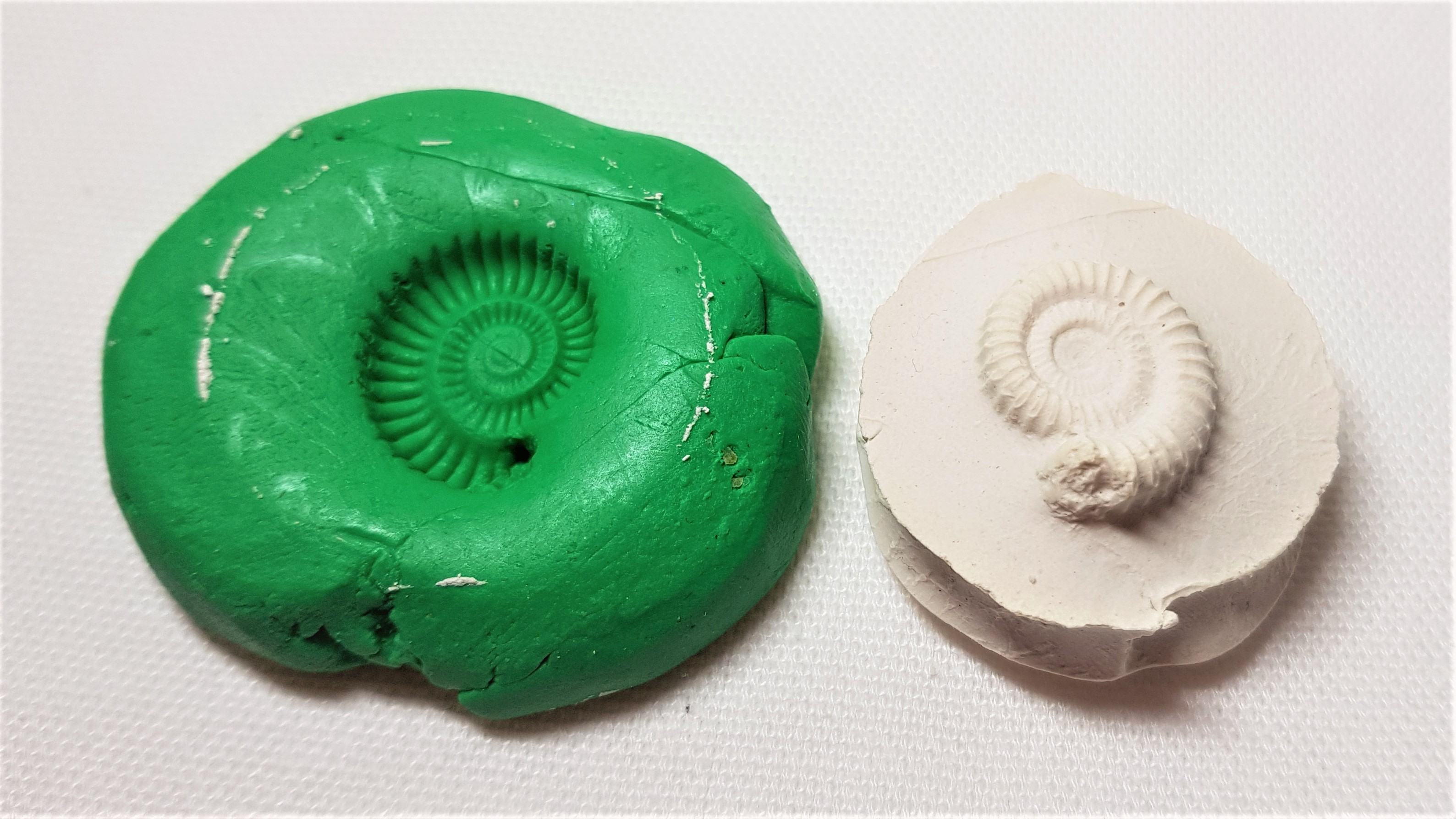
Educational resource and instructions to make your own fossil out of every day materials.
-
A two part Indigenous-led and produced Aboriginal cultural heritage awareness training video for Geoscience Australia staff. The video explores a number of topics from the perspective of Traditional Owners and Custodians. Topics covered include: What is Country, Lore and Kinship; the importance of listening, connecting to Country and the transference of knowledge; Aboriginal cultural heritage legislation and policy in Australia, native title and cultural heritage; the impact of past policies; and, working towards best practice. The video complements Geoscience Australia's Land Access and Cultural Heritage Policy, Procedures and Best Practice Standards.