Educational Product
Type of resources
Keywords
Publication year
Scale
Topics
-
<div>The A1 poster incorporates 4 images of Australia taken from space by Earth observing satellites. The accompanying text briefly introduces sensors and the bands within the electromagnetic spectrum. The images include examples of both true and false colour and the diverse range of applications of satellite images such as tracking visible changes to the Earth’s surface like crop growth, bushfires, coastal changes and floods. Scientists, land and emergency managers use satellite images to analyse vegetation, surface water or human activities as well as evaluate natural hazards.</div>
-
Australia - Evolution of a Continent: Palaeogeographic Atlas
-
This bulk set contains fifteen special double-sided 1:75 000 Mount Todd maps, with topography on one side and geology on the other side. Also included are fifteen 1: 75 000 transparent plastic map-reading cards. This area of the Northern Territory contains part of Nitmiluk National Park (Katherine Gorge) and includes sedimentary, igneous and metamorphic rock types and also interesting geological features such as faults, folds and granite intrusions. Suitable for use at secondary level Years 8-12.
-
The Tsunami teaching resource comprises; - 36 page booklet that includes definitions and causes of tsunamis, how danger increases as tsunamis approach land and their frequency of occurrence in Australia. Also gives vital information on recognising and surviving a tsunami. - 3 reproducible student activities - suggested answers to student activities Suitable for secondary level Years 7-10.
-
Six posters approximately A1 in size (31.5 x 25.59 inches) on prehistoric lifeforms. Each poster shows a sketch of the liveform, and a geological timescale showing the period during which the lifeform was found on Earth. Ideal for display in the classroom. Lifeforms are diprotodon, ammonite, glossopteris, conodont, brachiopod and a themed poster on the Devonian Pepiod.
-
Four posters approximately A1 in size (31.5 x 25.59 inches) on prehistoric creatures. Each creature is described with its name, diet, geological period, dimension, and interesting facts. Full-colour sketches are included on the posters. Creatures are Brachiosaurus, Trilobite, Stegosaurus, and Tyrannosaurus Rex.
-
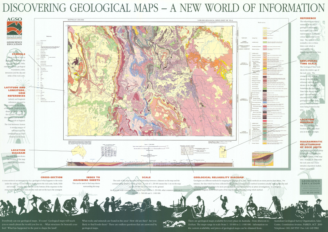
An educational product describing each of the elements on a geological map. Elements include symbols, grid references, cross-section, scale, geological reliability diagram and the geological time scale.
-
The Mt Todd map kit, suitable for Secondary level Years 8-12 contains; - 15 double-sided 1:75,000 scale Mt Todd geology/topography maps - 15 plastic map reading cards 1:75,000 scale - 86 page booklet (Record 1996/10) of full teaching notes including map projections, scale, latitude and longitude, direction, geological legends, rock types & ages, geological features eg. folds, faults, intrusions and dipping rocks, geological cross-sections, the link between geology and topography, economic geology and a glossary. - 11 reproducible student activities and exam - suggested answers to activities and exam
-
These Crystal Models are part of the Exploring Minerals and Crystals booklet and can be used to explore crystal shapes in high school and college geology. They can also be used independently to discuss three dimensional shapes in primary school mathematics.
-
The Tropical Cyclone Risk Model (TCRM) is a statistical-parametric model of tropical cyclone behaviour and effects. A statistical model is used to generate synthetic tropical cyclone events. This is then combined with a parametric wind field model to produce estimates of cyclonic wind hazard.


