Groundwater
Type of resources
Keywords
Publication year
Service types
Topics
-
This report presents key results from hydrogeological investigations at Alice Springs, completed as part of Exploring for the Future (EFTF)—an eight year, $225 million Australian Government funded geoscience data and information acquisition program focused on better understanding the potential mineral, energy and groundwater resources across Australia. The Southern Stuart Corridor (SSC) project area within the Northern Territory extends in a north–south corridor from Tennant Creek to Alice Springs, encompassing four water control districts and a number of remote communities. Water allocation planning and agricultural expansion in the SSC is currently limited by a paucity of data and information regarding the volume and extent of groundwater resources and groundwater systems more generally. This includes recharge rates, surface water –groundwater connectivity, and the dependency of ecosystems on groundwater. Outside the proposed agricultural areas, the project includes numerous remote communities where there is a need to secure water supplies. Geoscience Australia, in partnership with the Northern Territory Department of Environment and Natural Resources and the Power and Water Corporation, undertook an extensive program of hydrogeological investigations between 2017 and 2019. Data acquisition included helicopter airborne electromagnetic (AEM) and magnetic data, investigative groundwater bore drilling, ground-based and downhole geophysical data (including nuclear magnetic resonance for mapping water content and induction conductivity/gamma for defining geological formations), and hydrochemistry for characterising groundwater systems. This report investigates the hydrogeology across the Alice Springs focus area, which includes the Roe Creek and proposed Rocky Hill borefields, where five hydrostratigraphic units were mapped based on AEM interpretation and borehole geophysical information. The mapping supports the presence of a syncline, with a gentle parabolic fold axis that plunges westward, and demonstrates that the main Siluro-Devonian Mereenie Sandstone and Ordovician Pacoota Sandstone aquifers are continuous from Roe Creek borefield to the Rocky Hill area. Areas with the highest potential for recharge to the Paleozoic strata are where Roe Creek or the Todd River directly overlie shallow subcrop of the aquifer units. Three potential recharge areas are identified: (1) Roe Creek borefield, (2) a 3 km stretch of Roe Creek immediately west of the proposed Rocky Hill borefield, and (3) the viticulture block to the east of Rocky Hill. Analysis of groundwater chemistry and regional hydrology suggests that the rainfall threshold for recharge of the Paleozoic aquifers is ~125 mm/month, and groundwater isotope data indicate that recharge occurs rapidly. The groundwaters have similar major ion chemistry, reflecting similar geology and suggesting that all of the Paleozoic aquifers in the focus area are connected to some degree. Groundwater extraction at Roe Creek borefield since the 1960s has led to the development of a cone of depression and a groundwater divide, which has gradually moved eastward and is now east of the proposed Rocky Hill borefield. The majority of the groundwater within the focus area is of good quality, with <1000 mg/L total dissolved salts (TDS). The brackish water (7000 mg/L TDS) further to the east of the proposed Rocky Hill borefield warrants further investigation to determine the potential risk of it being captured by the cone of depression following the development of this borefield. This study provides new insight to the hydrogeological understanding of the Alice Springs focus area. Specifically, this investigation demonstrates that the Roe Creek and proposed Rocky Hill borefields, and a nearby viticulture area are all extracting from the same aquifer system. This finding will inform the future management and security of the Alice Springs community water supply. New groundwater resource estimates and a water level monitoring scheme can be developed to support the management of this vital groundwater resource.
-
This report presents groundwater levels results from the Howard East groundwater project in the Northern Territory (NT), conducted as part of Exploring for the Future (EFTF), an eight year, $225 million Australian Government funded geoscience data and information acquisition program focused on better understanding the potential mineral, energy and groundwater resources across Australia. The Howard East groundwater project is a collaborative study between Geoscience Australia and he Northern Territory Government’s Department of Environment and Natural Resources (DENR). It focuses on groundwater resources in the Howard East area, NT. This report describes a data release of groundwater levels and salinity information based on measurements collected in monitoring bores during the EFTF project. The full report includes: • A full description of how water levels in metres relative to Australian Height Datum (m AHD; where zero m AHD is an approximation of mean sea level) were calculated from manual dips and electronic data loggers for this project. • A series of tables in Appendix A containing sufficient information for each bore and datalogger file to reproduce the water levels reported in Appendix B and Appendix C. • A series of hydrographs in Appendix B showing how water levels (in m AHD) interpreted from manual dips and datalogger files varied during the EFTF project. • A series of electronic files in Appendix C that include - Data files from dataloggers in CSV file format that can be used with the information contained in this data release to regenerate the water levels shown on hydrographs in Appendix A. - Data files in CSV file format reporting the final water levels used to generate the hydrographs in Appendix B.
-
This report presents key results from the Howard East project conducted as part of Exploring for the Future (EFTF), an Australian Government funded geoscience data and information acquisition program. The four-year (2016–20) program focused on better understanding the potential mineral, energy and groundwater resources in northern Australia. Groundwater is an essential part of Darwin’s water supply and is sourced from the Koolpinyah Dolostone Aquifer (KDA) at the Howard East Borefield (HEB) and McMinns Borefield, which are ~25 km to 30 km southeast of Darwin. Previous work suggests that electrical conductivity anomalies observed in airborne electromagnetic (AEM) data within 5 km of HEB may be caused by saline groundwater within the KDA that is separated from HEB by dykes and other geological features that effectively compartmentalise the aquifer (Fell-Smith & Sumner, 2011; Tan et al., 2012). Nevertheless, concerns have grown that increased groundwater use may result in migration of saline groundwater toward HEB, which could compromise the groundwater resource. We collected groundwater chemistry including isotopes, time-series groundwater salinity, AEM, and induction and gamma data to better understand the complexities of the KDA. We show that groundwater in the KDA typically has a fresh Mg-Ca-HCO3 type composition, as is expected for a dolomitic aquifer. Highly saline Na-Cl type groundwater with a composition similar to seawater exists at some locations as well as groundwater with a mixed composition. These findings confirm previous interpretations for the area (e.g. Fell-Smith & Sumner, 2011). We sampled saline groundwater on the opposite side of two dolerite dykes to HEB to its northeast. Age dating results for this sample cannot be used to determine whether this saline groundwater represents relict seawater or whether groundwater at this site is in hydraulic connection with the modern ocean. Our groundwater chemistry results also show that saline intrusion is occurring northwest of HEB. AEM data were collected to better characterise geological and hydrogeological features in the area. Estimates of bulk conductivity of the subsurface were derived by inverting AEM data using both deterministic and stochastic methods. Using these AEM inversions and other hydrogeological information, we characterised high-conductivity anomalies within 5 km of HEB and the upper surface of unweathered dolerite in the two dykes northeast of HEB. We interpreted conductivity anomalies as pyritic shales, although drilling is required to investigate the salinity of groundwater in the KDA in this area. Where we were able to resolve the upper surface of unweathered material in the two dykes using the AEM, we found that it commonly occurs below sea level. Characterising the geometry of these dykes will aid in assessing their role in aquifer compartmentalisation. Our findings contribute to building a robust conceptual understanding of the KDA and will guide future investigations into the groundwater system. A number of other products exist for the EFTF Howard East project. The findings of this report are integrated with hydrodynamic analyses undertaken by Woltmann (in prep.) and reported in Haiblen et al. (2020). Hydrochemistry data presented here are contained in McGrath-Cohen et al. (2020), water level and salinity monitoring data can be found in Turner et al. (2020), AEM data are in Ray et al. (2020b), and induction and gamma data are in Tan et al. (2020).
-
This report presents a summary of the groundwater and surface water hydrochemistry data release from the Daly River project conducted as part of Exploring for the Future (EFTF)—an eight year, $225 million Australian Government funded geoscience data and information acquisition program focused on better understanding the potential mineral, energy and groundwater resources across Australia. This data release records the groundwater sample collection methods and hydrochemistry and isotope data from monitoring bores in the Daly River project area, Northern Territory (NT). The Daly River project is a collaborative study between Geoscience Australia and the NT Government. Hydrochemistry and isotope data were collected from existing bores in the Daly River area. The sampling methods, quality assurance/quality control procedures, analytical methods and results are included in this report and all hydrochemistry data are available for download from the link at right.
-
This report presents a summary of the groundwater and surface water hydrochemistry data release from the Howard East project conducted as part of Exploring for the Future (EFTF) —an eight year, $225 million Australian Government funded geoscience data and information acquisition program focused on better understanding the potential mineral, energy and groundwater resources across Australia. This data release records the groundwater and surface water sample collection methods and hydrochemistry and isotope data from monitoring bores in the Howard East project area, Northern Territory (NT). The Howard East project is a collaborative study between Geoscience Australia and the NT Government. Hydrochemistry and isotope data were collected from existing bores in the Howard East area. The sampling methods, quality assurance/quality control procedures, analytical methods and results are included in this report and all hydrochemistry data are available for download from the link at right.
-
This report provides an initial summary of the hydrogeochemistry of the McBride Basalt Province (MBP) and Nulla Basalt Province (NBP) of the Upper Burdekin Region of North Queensland, completed as part of Exploring for the Future (EFTF)—an eight year, $225 million Australian Government funded geoscience data and information acquisition program focused on better understanding the potential mineral, energy and groundwater resources across Australia. Groundwater hydrogeochemistry studies can improve system understanding by reflecting host formation compositions and groundwater processes. These studies also provide regional baseline groundwater datasets that can inform environmental monitoring, resource use and decision making. During 2017 and 2018 Geoscience Australia collected 38 groundwater samples and 80 surface water samples (including quality control samples) to evaluate groundwater system processes including potential flow paths, recharge and groundwater-surface water-interactions. These surveys were conducted across three months of fieldwork, sampling water for a comprehensive suite of hydrogeochemical parameters. The present report includes surface water and groundwater data and information on: 1) sampling sites; 2) field physicochemical parameters (EC, pH, Eh, DO and T); 3) field measurements of total alkalinity (HCO3-); 4) laboratory results of major anion and cation results; 5) laboratory results for isotopes of water (δ18O and δD), DIC (δ13C), and dissolved strontium (87Sr/86Sr); and 6) hydrogeochemical maps representing the spatial distribution of these parameters. Pending analyses include: CFCs, SF6 and radiogenic isotopes δ14C and δ36Cl. Analysis that were largely below detection limit include: trace element concentrations, dissolved sulfide (S2-), ferrous iron (Fe2+), and dissolved sulfate (affecting sampling of δ34S and δ18O). This study demonstrates that hydrogeochemistry surveys, with full suites of chemical parameters including isotopes, can reveal fundamental groundwater system processes such as groundwater flow paths, groundwater recharge and groundwater-surface water interactions. The chemical ‘fingerprints’ identified here indicate groundwater flow paths are largely restricted to within the MBP and NBP aquifers, which have little interaction with adjacent and underlying non-basaltic rocks. The results also indicate groundwater is largely recharged from rainfall in higher elevations of the basalt provinces, with variable rainfall inputs to groundwater from lower elevation and rivers along flow paths. Groundwater-surface water interactions show several chemical signatures linking groundwater to springs, tributary rivers and the Burdekin River. Results from the Upper Burdekin Hydrogeochemistry Survey for the MBP and NBP have been plotted and mapped with initial interpretations presented below. Further detailed interpretation of this hydrogeochemistry data will be the focus of future publications. This data release is part in a series of staged outputs from the EFTF program. Relevant data, information and images are available through the Geoscience Australia website.
-
This web service provides access to groundwater raster products for the Upper Burdekin region, including: inferred relative groundwater recharge potential derived from weightings assigned to qualitative estimates of relative permeability based on mapped soil type and surface geology; Normalised Difference Vegetation Index (NDVI) used to map vegetation with potential access to groundwater in the basalt provinces, and; base surfaces of basalt inferred from sparse available data.
-
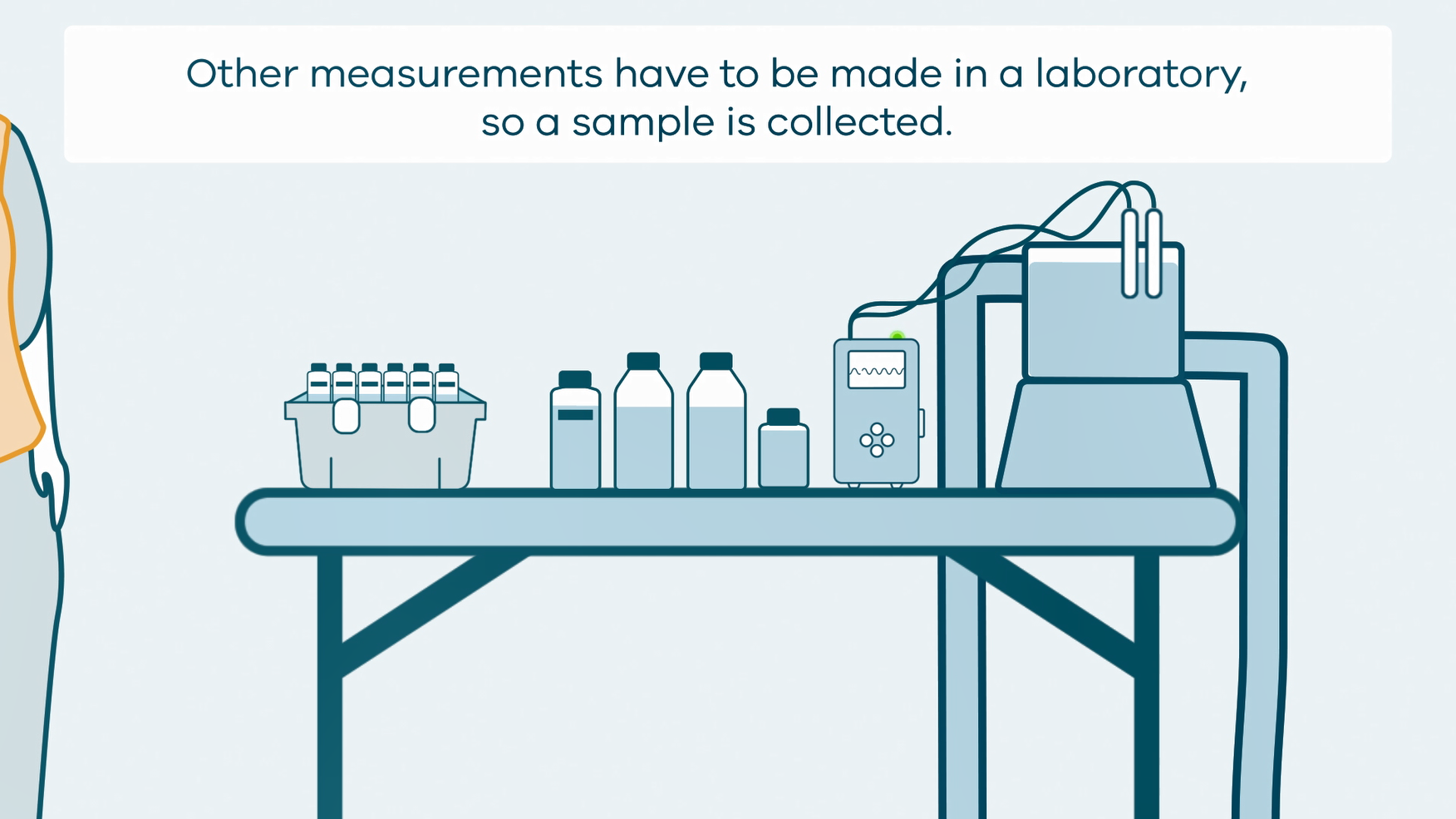
This animation shows how groundwater sampling is conducted. It is part of a series of Field Activity Technique Engagement Animations. The target audience are the communities that are impacted by GA's data acquisition activities. There is no sound or voice over. The 2D animation includes a simplified view of what groundwater sampling equipment looks like, what the equipment measures and how scientists use the data.