gas
Type of resources
Keywords
Publication year
Service types
Topics
-
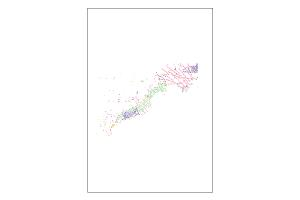
The Oil and Gas Pipelines Database contains known spatial locations of onshore and offshore pipelines or pipeline corridors used to transport natural gas, oil and other liquids within Australia’s mainland and territorial waters. This database contains data, as received, from GP INFO, Petrosys. Minimal effort was made to revise, value add and/or spatially improve the datasets.
-
Australia has significant gas resources capable of meeting the needs of domestic and international consumers for decades. Commercial viability of the resource depends on a number of factors such as geology, infrastructure, resource quality, and water depth. Further exploration is required to bring on Australia's lowest cost gas resources.
-
The Clarence-Moreton and the Surat basins in Queensland and northern New South Wales contain the coal-bearing sedimentary sequences of the Jurassic Walloon Coal Measures, composed of up to approximately 600 m of mudstone, siltstone, sandstone and coal. In recent years, the intensification of exploration for coal seam gas (CSG) resources within both basins has led to concerns that the depressurisation associated with future resource development may cause adverse impacts on water resources in adjacent aquifers. In order to identify the most suitable tracers to study groundwater recharge and flow patterns within the Walloon Coal Measures and their degree of connectivity with over- or underlying formations, samples were collected from the Walloon Coal Measures and adjacent aquifers in the northern Clarence-Moreton Basin and eastern Surat Basin, and analysed for a wide range of hydrochemical and isotopic parameters. Parameters that were analysed include major ion chemistry, -13C-DIC, -18O, 87Sr/86Sr, Rare Earth Elements (REE), 14C, -2H and -13C of CH4 as well as concentrations of dissolved gases (including methane). Dissolved methane concentrations range from below the reporting limit (10 µg/L) to approximately 50 mg/L in groundwaters of the Walloon Coal Measures. However, the high degree of spatial variability of methane concentrations highlights the general complexity of recharge and groundwater flow processes, especially in the Laidley Sub-Basin of the Clarence-Moreton Basin, where numerous volcanic cones penetrate the Walloon Coal Measures and may form pathways for preferential recharge to the Walloon Coal Measures. Interestingly, dissolved methane was also measured in other sedimentary bedrock units and in alluvial aquifers in areas where no previous CSG exploration or development has occurred, highlighting the natural presence of methane in different aquifers. Radiocarbon ages of Walloon Coal Measure groundwaters are also highly variable, ranging from approximately 2000 yrs BP to >40000 yrs BP. While groundwaters sampled in close proximity to the east and west of the Great Dividing Range are mostly young, suggesting that recharge to the Walloon Coal Measures through the basalts of the Great Dividing Range occurs here, there are otherwise no clearly discernable spatial patterns and no strong correlations with depth or distance along inferred flow paths in the Clarence-Moreton Basin. In contrast to this strong spatial variability of methane concentrations and groundwater ages, REE and 87Sr/86Sr isotope ratios of Walloon Coal Measures groundwaters appear to be very uniform and clearly distinct from groundwaters contained in other bedrock units. This difference is attributed to the different source material of the Walloon Coal Measures (mostly basalts in comparison to other bedrock units which are mostly composed of mineralogical more variable Paleozoic basement rocks of the New England Orogen). This study suggests that REE and 87Sr/86Sr ratios may be a suitable tracer to study hydraulic connectivity of the Walloon Coal Measures with over- or underlying aquifers. In addition, this study also highlights the need to conduct detailed water chemistry and isotope baseline studies prior to the development of coal seam gas resources in order to differentiate between natural background values of methane and potential impacts of coal seam gas development.
-
The National Onshore Gas Pipelines Dataset represents the spatial locations of pipelines for the transmission of natural gas within mainland Australia complimented with feature attribution.
-
From the beginning of petroleum exploration in the Perth Basin, the importance of the Early Triassic marine Kockatea Shale was recognised as the principal source for liquid petroleum in the onshore northern Perth Basin (Powell and McKirdy, 1976). Thomas and Barber (2004) constrained the effective source rock to a Early Triassic, middle Sapropelic Interval in the Hovea Member of the lower Kockatea Shale. In addition, Jurassic and Permian sourced-oils (Summons et al., 1995) demonstrate local effective non-Kockatea source rocks. However, evidence for multiple effective gas source rocks is limited. This study utilizes the molecular composition and carbon and hydrogen isotopic compositions of 34 natural gases from the Perth Basin, extending the previous study (Boreham et al., 2001) to the offshore and includes hydrogen isotopes and gases. It shows the existence of Jurassic to Permain gas systems in the Perth Basin.
-
Gas is a vital and growing part of the Australian and global energy mix. The gas industry is being transformed due to changes in markets and technology that are bringing new gas resources into play. This report builds on the Australian Energy Resource Assessment (AERA) was first published in March 2010 as a supporting document to the Energy White Paper process. The AERA (Geoscience Australia and ABARE, 2010) is a national prospectus for energy resources. It examined Australia's identified and potential energy resources ranging from fossil fuels and uranium to renewable sources. In the two years following the release of the AERA there have been significant changes in gas resources and within the gas market. This report provides an assessment of Australia's gas resources in 2012 and has been released to contribute to the final phase of the Energy White Paper process. The report documents the growth of gas resources and new projects that underpin an increasing role for gas both in Australia and internationally. For example coal seam gas (CSG) reserves have doubled since 2010 and three CSG/liquid natural gas (LNG) projects are now under construction, In addition, major new offshore conventional gas projects have been committed and commenced construction, including Ichthys in the Browse Basin and Prelude, the world's first floating LNG project. And Australia's third export LNG project, Pluto, has commenced operations.
-
Animation demonstrating how fraccing is used in Coal Seam Gas (CSG) extraction.
-
Following the drilling of a shallow natural CO<sub>2</sub> reservoir at the Qinghai research site, west of Haidong, China, it was discovered that CO<sub>2</sub> was continuously leaking from the wellbore due to well-failure. The site has become a useful research facility in China for studying CO<sub>2</sub> leakage and monitoring technologies for application to geological storage sites of CO<sub>2</sub>. During an eight day period in 2014, soil gas and soil flux surveys were conducted to characterise the distribution, magnitude and likely source of the leaking CO<sub>2</sub> . Two different sampling patterns were utilised during soil flux surveys. A regular sampling grid was used to spatially map out the two high-flux zones which were located 20–50 m away from the wellhead. An irregular sampling grid, with higher sampling density in the high-flux zones, allowed for more accurate mapping of the leak distribution and estimation of total field emission rate using cubic interpolation. The total CO<sub>2</sub> emission rate for the site was estimated at 649-1015 kgCO<sub>2</sub>/d and there appeared to be some degree of spatial correlation between observed CO<sub>2</sub> fluxes and elevated surface H<sub>2</sub>O fluxes. Sixteen soil gas wells were installed across the field to test the real-time application of Romanak et al.’s (2012) process-based approach for soil gas measurements (using ratios of major soil gas components to identify the CO<sub>2</sub> source) using a portable multi-gas analyser. Results clearly identified CO<sub>2</sub> as being derived from one exogenous source, and are consistent with gas samples collected for laboratory analysis. Carbon-13 isotopes in the centre of each leak zone (−0.21‰ and −0.22‰) indicate the underlying CO<sub>2</sub> is likely sourced from the thermal decomposition of marine carbonates. Surface soil mineralisation (predominantly calcite) can be used to infer prior distribution of the CO<sub>2</sub> hotspots and as a consequence highlighted plume migration of 20m in 11 years. The broadening of the affected area beyond the wellbore at the Qinghai research site markedly increases the area that needs surveying at sufficient density to detect a leak. This challenges the role of soil gas and soil flux in a CCS monitoring and verification program for leak detection, suggesting that these techniques may be better applied for characterising the source and emission rate of a CO<sub>2</sub> leak, respectively. <b>Citation:</b> I.F. Schroder, H. Zhang, C. Zhang, A.J. Feitz, The role of soil flux and soil gas monitoring in the characterisation of a CO2 surface leak: A case study in Qinghai, China, International Journal of Greenhouse Gas Control, Volume 54, Part 1, 2016, Pages 84-95, ISSN 1750-5836, https://doi.org/10.1016/j.ijggc.2016.07.030.
-
The Energy component of Geoscience Australia’s Exploring for the Future (EFTF) program is aimed at improving our understanding of the petroleum resource potential of northern Australia, including the Lawn Hill Platform region of the Isa Superbasin. The Paleoproterozoic Isa Superbasin in northwestern Queensland contains organic rich sedimentary units with the potential to host both conventional and unconventional petroleum systems (Gorton & Troup, 2018). On the Lawn Hill Platform, the River and Lawn supersequences of the Isa Superbasin host the recently discovered Egilabria shale gas play and are considered highly prospective shale gas targets. However, the lateral extent of these plays is currently unknown due to the limited well and associated geochemical data. To aid in the identification of new areas with the potential to host active petroleum systems, this work assesses the burial and thermal history of the Lawn Hill Platform (Figure 1) by using organic richness, quality and thermal maturity of source rocks of the Isa Superbasin. This assessment is based on a compilation of updated and quality controlled publicly available total organic carbon (TOC), Rock-Eval pyrolysis and organic matter reflectance data, and combines revised assessments of the depth structure and isopach mapping by Bradshaw et al., (2018, in press). Burial-thermal relationships in the basin have been difficult to determine in the past, usually attributed to multiple hydrothermal events which has resulted in erratic, and occasionally inverted, maturity reflectance profiles (Gorton and Troup, 2018; Glikson, 1993). Additional difficulties that contribute large uncertainties to our understanding are estimating the burial history across the basin, especially the maximum depth of burial and hence the estimated amount of erosion. Initial modelling suggests erosion amounts could range anywhere from several hundreds of meters to several thousands of meters across the Lawn Hill Platform region (Figure 2). Burial and thermal history modelling is calibrated using paleo-maturity data (reflectance profiles as mentioned above, Figure 2), which is poorly constrained. Because of the age (Paleoproterozoic) of the organic matter, reflectance values of alginite and bitumen were used, which are not always comparable to the standard vitrinite reflectance profiles that are typically used for burial and thermal history modelling calibration. In this study other options of burial-thermal model calibrations were assessed to aid in characterising the petroleum potential of this region, including; bottom hole temperature, developing an improved Tmax conversion equation specific to the Isa Superbasin region, using published conversion equations to convert alginite and bitumen reflectance to vitrinite equivalent reflectance, using HI as an indicator of thermal history, oxygen isotopes (δ18O), and fluid inclusion geothermometry. Abstract and poster for presentation at the Australian Organic Geochemistry Conference 2018
-
This is the Acreage Release Marine Environmental Data compiled web service to be updated each year with acreage release. It contains the following publicly available datasets, for the 2016 Acreage Release - Marine Survey Towed-video Transects, Marine Sediments Database Samples, Australian Seascapes, Seabed Mud Content on the Northwest Shelf, Seabed Sand Content of the Northwest Shelf and Seabed Gravel Content of the Northwest Shelf.