pixel images
Type of resources
Keywords
Publication year
Scale
Topics
-
No abstract available
-
Colour total magnetic intensity (reduced to the pole) pixel image map covering the Andamooka, Copley, Parachilna, Orroroo and part of the Port Augusta 1:250,000 map Sheet areas.
-
Colour ternary (K-U-TH R-G-B) gamma-ray spectrometry pixel image digital BIL file covering the Andamooka, Copley, Parachilna, Orroroo and part of the Port Augusta 1:250,000 map Sheet areas.
-
Total magnetic intensity stitch of all open file airborne geophysical surveys at 250 m cellsize for Western Australia. To be released at ASEG, Perth, March 2000.
-
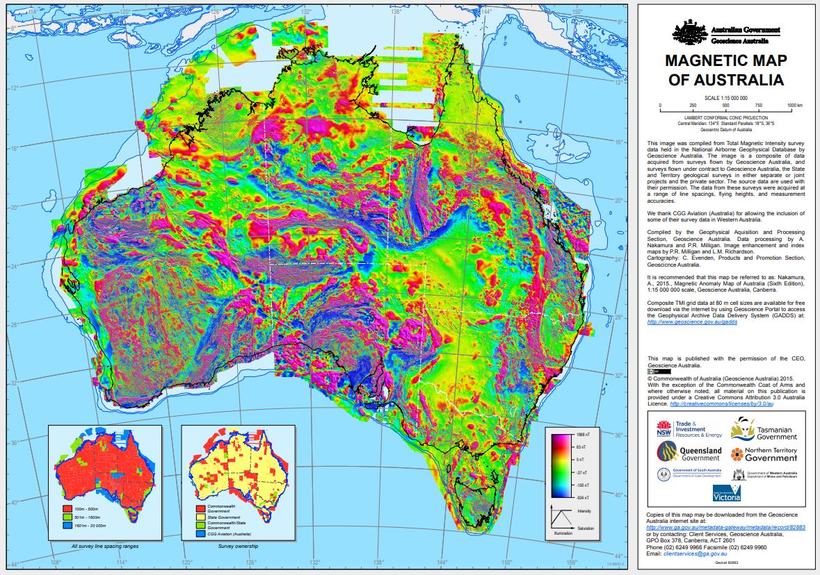
Total Magnetic Intensity colour composite image 2015 The image was created from the Total Magnetic Intensity Grid 2015 - sixth edition. This image has a cell size of ~3 seconds of arc (approximately 80 m) and has been image enhanced for optimal display in Hue-Saturation-Intensity (HSI). This image only includes airborne-derived TMI data for onshore and near-offshore continental areas. Since the fifth edition was released in 2010 data from 41 new surveys have been added to the database, acquired mainly by the State and Territory Geological Surveys. It is estimated that 31 500 000 line-kilometres of survey data were acquired to produce the grid data, 4 500 000 line-kilometres more than for the previous edition.
-
No abstract available
-
This edition of the Magnetic Anomaly Map of Australia results from a completely new compilation of Total Magnetic Intensity (TMI) grid data. It has been produced using a new method of matching the individual survey grids and the use of independent data to help constrain long wavelengths. 680 individual grids have been matched and merged into the composite used to produce this image, with the resolution of each grid optimal for the specifications of the source survey line data. Since the Third Edition (Milligan and Tarlowski, 1999), data from many new surveys have been added, acquired mainly by the state and territory geological surveys. It is estimated that 19 million line-kilometres of survey data were acquired to produce the grid data, 10 million line-kilometres more than for the Third Edition.
-
Offshore and onshore parts of Gippsland Basin, Victoria, survey covers the entire 1:250 000 sheets of Sale and SJ55-12 as well as part of the Bairnsdale, Mallacoota, SJ55-14 and SJ55-15 map sheets.
-
No abstract available
-
No abstract available

