dating
Type of resources
Keywords
Publication year
Topics
-
Bonaparte Basin biostratigraphic chart
-
Northern Carnarvon Basin Biozonation and Stratrigraphy, 2008, Chart 34
-
The contemporary crustal stress regime in south-eastern Australia can be traced back to the terminal Miocene. Increased coupling of the Australian and Pacific Plate boundary at this time resulted in regional-scale tilting, local uplift and erosion, and in the formation of unconformities in southern Australian basins. In the onshore Gippsland Basin the unconformity surface is overlain by an extensive sheet of fluvial sediment known as the Haunted Hill Formation (HHF). Open folds and flexures developed within the HHF over blind reverse and reverse oblique faults provide a record of deformation spanning much of the neotectonic period. The predominance of flexures and folds rather than discrete faulting at the surface complicates the assessment of slip rates over the last few seismic cycles. However, ages from an undeformed fill terrace bordering the Morwell River and crossing the Morwell Monocline suggest that it has been a minimum of 70 ka since the last deformation event on at least this structure. Stream profiles crossing the Snake Ridge, Yallourn and Rosedale Monoclines similarly reveal no evidence for recent tectonic displacement. Cosmogenic radionuclide (10Be and 26Al) burial ages of siliceous sediments sampled from tectonically uplifted HHF on the Yallourn, Morwell and Snake Ridge Monoclines provide constraint on the long-term evolution of these structures. Combined with stratigraphic and tectonic records from the offshore Gippsland Basin, these data provide a basis for informed seismic hazard assessment.
-
Widespread reductions in the thickness and extent of Antarctic ice shelves are triggering retreat, acceleration and increased discharge of marine-terminating glaciers. However, while the impacts of recent ice-shelf changes are now well documented, their role in modulating past ice sheet dynamics – especially at a resolution required to identify drivers of change and test ice sheet models - remains poorly constrained. This reflects two persistent issues: (i) the effective discrimination between sediments and landforms deposited in a sub-ice-shelf setting from other glacimarine environments, and (ii) challenges associated with dating these records. Here we summarise recent progress in deciphering the ‘geological imprint’ of Antarctic ice shelves, including important advances in dating methods and the proxies required to reconstruct the drivers of change. Despite this improved ‘toolbox’ for establishing ice shelf presence and absence, we recognise several challenges that need to be overcome if we are to fully exploit the palaeo record. <b>Citation:</b> Smith, J.A., Graham, A.G.C., Post, A.L. et al. The marine geological imprint of Antarctic ice shelves. <i>Nat Commun</i> <b>10</b>, 5635 (2019). https://doi.org/10.1038/s41467-019-13496-5
-
Browse Basin Biozonation and Stratigraphy, 2008, revised February 2008
-
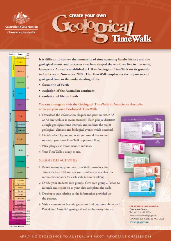
This teaching aid includes instructions and layout calculations for creating a Geological TimeWalk of your own. A set of information plaques marking each geological time interval is also available to download and use with the TimeWalk.
-
Canning Basin Biozonation and Stratigraphy updated in February 2008
-
The Lower Darling Valley (LDV) contains Cenozoic shallow marine, fluvial, lacustrine and aeolian sediments capped by a number of Quaternary fluvial units associated with the Darling River and its anabranches, which were poorly dated prior to this study. Recent investigations in the LDV area have used an Airborne Electromagnetic (AEM) survey, a new high-resolution LiDAR survey, sonic drilling, shallow hand-augering, examination of tractor-dug pits, sediment sample analyses, landform mapping, and river bottom profiling in combination with OSL and radiocarbon dating to provide new insights into the nature and chronology of Quaternary fluvial landscape evolution. The Quaternary sequence in the LDV consists of scroll-plain tracts of different ages incised into higher, older and more featureless floodplain sediments. Samples for OSL and radiocarbon dating were taken in tractor-excavated pits, from sonic cores and from hand-auger holes from a number of scroll-plain and older floodplain sediments. The youngest, now inactive, scroll-plain phase associated with the modern Darling River, was active in the period 5-2 ka. A previous anabranch scroll-plain phase has Last Glacial Maximum dates around 20 ka. Less distinct scroll-plain tracts, older than the anabranch system, have ages around 30ka. A poorly preserved scroll-plain phase with very indistinct scroll and channel traces is associated with the Darling River tract and has ages around 45-50 ka. Older dates of 85 ka and >150 ka have been obtained beneath the higher floodplain from lateral-migration sediments that lack visible scroll-plain traces. This chronologic sequence suggests regular recurrence of approximately 5 ka lateral-migration episodes separated by approximately 10 ka periods of quiescence. There is a lack of coincidence with the glacial-interglacial climate cycles. This suggests that the onset and termination of lateral-migration phases is probably a combination of changes in discharge and sediment regimes r
-
The Gawler Craton, South Australia, preserves extensive sedimentary sequences and associated magmatic rocks that span the interval covering the Archaean-Palaeoproterozoic transition, with bimodal calc-alkaline volcanism and associated sedimentation occurring over the interval ~2560-2480 Ma. The pervasive high geothermal gradient metamorphism in the earliest Palaeoproterozoic, ~2470-2420 Ma (Fanning et al., 2007; Jagodzinski et al., 2009) within the Gawler Craton suggests the Gawler Craton is potentially more likely a correlative of the Dhawaar Craton, Sask Craton and other similar terranes, in terms of timing of magmatic and orogenic events (Payne et al., 2009). We report new zircon U-Pb ion probe data collected from Neoarchaean to Earliest Palaeoproterozoic metasedimentary and meta-igneous rocks of the Gawler Craton, South Australia, an important time interval for the development of the Gawler Craton itself that has been investigated by relatively few geochronological studies. The new data show that the interval ~2560-2480 Ma was characterised by deposition and associated magmatism. This was terminated by contractional deformation and high geothermal gradient metamorphism over the interval ~2470-2410 Ma.
-
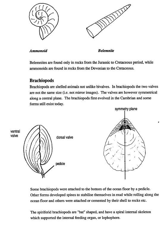
This black and white education resource is a 58 page booklet which contains information on geological time, fossilisation, characteristics of major groups of vertebrate and invertebrates, micropaleontology (e.g.. spores and pollen), trace fossils and the uses of fossils. It includes student activities. Suitable for secondary Years 7-10