offshore
Type of resources
Keywords
Publication year
Service types
Topics
-
<div>As a resource to enhance exploration in the offshore Otway Basin, Geoscience Australia (GA) has produced a new well folio that extends the scope of a previous release by including 32 key wells from the central and southeast regions. This folio covers the areas from Normanby 1 on the Normanby Terrace, through the Shipwreck Trough and Nelson Sub-basin, to Whelk 1 in the south. The previous well composites included wireline logs for petrophysical analysis, interpreted lithology, organic geochemistry and organic petrology data, and well markers. This folio includes all of these attributes with the addition of core-based depositional environment (DE) and gross depositional environment (GDE) interval interpretations which were subsequently used to constrain wireline interpretation away from core control. The core/wireline lithological interpretation along with further seismic and biostratigraphic data informed well marker locations and enabled a better regional correlation across the basin. The folio provides the complementary datasets used to construct each well composite. Presented at the Australian Energy Producers (AEP) Conference & Exhibition (https://energyproducersconference.au/conference/)
-
In 2017, 21 new offshore petroleum exploration areas have been released. The majority of the areas are located along the North West Shelf spanning the Westralian Superbasin from the Bonaparte Basin in the north-east to the Northern Carnarvon Basin in the south-west. New areas have been released in offshore south-eastern Australia with new opportunities provided in the Otway, Bass and Gippsland basins. Two large areas in the northern Perth Basin, an offshore frontier, complete the 2017 Acreage Release. All Release Areas are supported by industry nominations and one new cash bid area has been offered in the Dampier Sub-basin. Geoscience Australia continues to support industry activities by acquiring, interpreting and integrating pre-competitive datasets that are made freely available as part of the agency’s regional petroleum geological studies. A new regional 2D seismic survey was acquired in the Houtman Sub-basin of the Perth Basin, forming the basis of the latest prospectivity study carried out by Geoscience Australia. The results of the study are presented in the technical program of the 2017 APPEA conference. A wealth of seismic and well data, submitted under the Offshore Petroleum and Greenhouse Gas Storage Act 2006 (OPGSSA) are made available through the National Offshore Petroleum Information Management System (NOPIMS). Additional datasets are accessible through Geoscience Australia’s data repository. Presented at the 2017 Australian Petroleum Production & Exploration Association (APPEA) Conference.
-
<div>Gas production from the Inner Otway Basin commenced in the early 2000s but the deep-water part of this basin remains an exploration frontier. Ground-truthing of depositional environments (DE) and gross depositional environments (GDE) is an important contribution to play-based exploration in the Otway Basin. This digital dataset consists of core logs and core photographs of approximately 700 m of core from 19 wells across the entire offshore basin. Observations recorded in the logs include lithology, modal grain size, stacking patterns, carbonate mud percentage, bioturbation index, and DE/GDE intervals. Cubitt et al. 2023 describes how core-based DE/GDE interpretations were applied to wireline log signatures with interpretations made from TD to the base Cenozoic in 38 wells across the basin. DE and DE tracks are included in the well composite logs compiled by Nguyen et al (2024).</div>
-

This is the Acreage Release Marine Environmental Data compiled web service to be updated each year with acreage release. It contains the following publicly available datasets, for the 2016 Acreage Release - Marine Survey Towed-video Transects, Marine Sediments Database Samples, Australian Seascapes, Seabed Mud Content on the Northwest Shelf, Seabed Sand Content of the Northwest Shelf and Seabed Gravel Content of the Northwest Shelf.
-
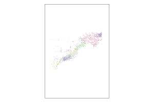
Gravity data measures small changes in gravity due to changes in the density of rocks beneath the Earth's surface. The data collected are processed via standard methods to ensure the response recorded is that due only to the rocks in the ground. The results produce datasets that can be interpreted to reveal the geological structure of the sub-surface. The processed data is checked for quality by GA geophysicists to ensure that the final data released by GA are fit-for-purpose. These line dataset from the GA302 Capel and Faust Basins MSS survey were acquired in 2006 for Geoscience Australia. This survey acquired a range of pre-competitive geological and geophysical data that included seismic reflection, gravity, magnetic and swath bathymetry measurements, as well as seafloor dredge samples.
-
This is the Acreage Release Marine Environmental Data compiled web service to be updated each year with acreage release. It contains the following publicly available datasets, for the 2016 Acreage Release - Marine Survey Towed-video Transects, Marine Sediments Database Samples, Australian Seascapes, Seabed Mud Content on the Northwest Shelf, Seabed Sand Content of the Northwest Shelf and Seabed Gravel Content of the Northwest Shelf.
-
The offshore seismic data consists of field, processed, and seismic navigation data. Reports of the acquisition, processing and interpretation reports plus reprocessed seismic data and reports are also held. The collection is derived from the submission of seismic data under the Offshore Petroleum and Greenhouse Gas Storage Act and previous legislation. The Petroleum (Submerged Lands), the Offshore Petroleum, and the Offshore Petroleum and Greenhouse Gas Storage Act 2006 (OPGGSA) requires petroleum data to be submitted to the State Designated Authority (DA). The Act(s) also require the DAs to make copies of the data available to the Commonwealth Minister through the Joint Authority.
-
<div>Ideally when combining different 3D seismic surveys differences in acquisition parameters warrant full pre-stack reprocessing from field data. However, there are occasions where this is not possible due to time, financial or data access constraints; a valuable alternative is post-stack merging and enhancement of existing migrations. The offshore Otway Basin was the subject of such a project, the objective of which was to produce a regularised and seamless 3D dataset of the highest possible quality, within a two-month turnaround time. The input migrated volumes varied by data extent, migration methodology, angle range and grid orientation. 14 input volumes totalling 8,092 km2 were post-stack merged and processed to produce a continuous and consistent volume, enabling more efficient and effective interpretation of the region. The surveys were regularised onto a common grid, optimised for structural trend, prior to survey matching. DUG’s mis-tie analysis algorithm, applied over a time window optimised for interpretation of key</div><div>events, was used to derive corrections for timing, phase and amplitude, using the Investigator North survey as a reference. This was followed by time-variant spectral and amplitude matching, with gain corrections applied, to improve continuity between volumes. Additional enhancements including noise removal and lateral amplitude scaling were also applied. The final merged volume offers significant uplift over the inputs providing better imaging of structure and event and dramatically improving the efficiency and quality of interpretation. This enables rapid reconnaissance of the area by explorers. Presented at the Australian Energy Producers (AEP) Conference & Exhibition
-
The Marine Survey Geomorphology Web Map Service contains the local scale (1:10 000) interpreted geomorphology maps available for download on Geoscience Australia's website. These interpreted geomorphology maps have been produced for numerous marine survey programs conducted in Australian mainland and Antarctic waters by both Geoscience Australia and our collaborators. Layers are grouped by survey or region and where available include both the Geoscience Australia and vessel survey identification numbers that contributed to each dataset.