transport
Type of resources
Keywords
Publication year
Service types
Scale
Topics
-
Road network extracted from Digital Chart of the World (DCW) Transport dataset (dataset derived from the Digital Chart of the World). Generic information on DCW data sets The primary source for DCW is the US Defense Mapping Agency (DMA) Operational Navigation Chart (ONC) series produced by the United States, Australia, Canada, and the United Kingdom. The ONCs have a scale of 1:1,000,000, where 1 inch equals approximately 16 miles.The charts were designed to meet the needs of pilots and air crews in medium and low altitude en route navigation and to support military operational planning, intelligence briefings, and other needs. Therefore, the selection of ground features is based on the requirement for rapid visual recognition of significant details seen from a low perspective angle. The DCW database was originally published in 1992. Data currency varies from place to place depending on the currency of the ONC charts. Chart currency ranges from the mid 1960s to the early 1990s. Compilation dates for every ONC chart are included in the database. For more information on the Digital Chart of the world please browse the DCW website where you can download these data in VPF format. GA has converted these VPF format files to common GIS formats Arcview and Mapinfo. Available datasets include drainage, roads and railway networks, political areas and boundaries and population centres. Available for free download.
-
This point dataset contains the major airport fuel storage and supply facilities in Australia.
-
This service has been created specifically for display in the National Map and the chosen symbology may not suit other mapping applications. The Australian Topographic web map service is seamless national dataset coverage for the whole of Australia. These data are best suited to graphical applications. These data may vary greatly in quality depending on the method of capture and digitising specifications in place at the time of capture. The web map service portrays detailed graphic representation of features that appear on the Earth's surface. These features include aviation, physiography, road transport and rail transport themes from the Geoscience Australia 250K Topographic Data. The service contains layer scale dependencies.
-
This point dataset contains the major airport hangar facilities in Australia.
-
Animated slide show. Showing Australia's transport infrastructure for Uranium, using maps and including dot points.
-
Matching of CO2 emission sources with storage opportunities or source/sink matching (SSM), involves the integration of a number of technical, social and economic issues. It requires identification of the optimal locations for both the emission source and storage site for CO2 emissions. The choice of optimal sites is a complex process and will not rest solely on the best technical site for storage, but will require a detailed assessment of source issues, transport links and integration with economic and environmental factors. Transport is one of the major costs in CO2 sequestration and in many instances it will strongly influence how locations are chosen, but itself will be dependent on what type of facilities are to be built, be they either onshore or offshore or a combination of both. Comparison of theoretical studies, and the numerous criteria they utilise in their assessments, with current or planned commercial operations indicates that it is only a few of the major criteria that determine site locations.
-
The dataset contains the spatial locations, in point format, of Australia's major international, domestic and regional airport terminals.
-
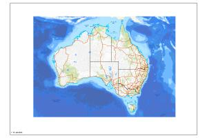
The railways that link urban and regional Australia have played a significant role in the development of our nation. Rail transport contributes many billions of dollars every year to Australia`s economy. Many of the products we use every day have travelled by rail at some stage in their journey. From home to work or across the country, passenger trains carry more than 500 million people each year - that`s around 25 times Australia`s population! With the opening of the Alice Springs to Darwin line in February 2004, all mainland capital cities and their ports are now connected by a 9420 kilometre network of standard gauge track, known as the Interstate Rail Network. The Railways of Australia thematic map reflects Australia`s impressive rail network. Whether it is used as a functional reference map or simply an outstanding wall-piece, Railways of Australia is a must for all rail enthusiasts and industries that rely on the nation`s rail network. Railways of Australia shows major passenger and freight lines, selected tourist railways, and metropolitan rail networks. Travelling times and distances, length of track, passenger loads, freight tonnage, and fabulous facts about Australia`s rail network are also included. This map was produced with the help of the Australasian Railway Association and Railpage. Product Specifications Coverage: Australia Scale: 1:5,000,000 (1 cm on the map measures 50km) Currency: November 2003 Coordinates: Geographical Datum: GDA94 Projection: Simple Conic on two standard parallels 18S and 36S Medium: Printed map - flat or folded Forward Program: Map will be updated as required
-
The Australian Topographic base map service is seamless national dataset coverage for the whole of Australia. The map is a representation of the Geoscience Australia 250k topographic specification and portrays a detailed graphic representation of features that appear on the Earth's surface. These features include cultural, hydrography and relief themes. The service contains layer scale dependencies.
-
This web service delivers data from an aggregation of sources, including several Geoscience Australia databases (provinces (PROVS), mineral resources (OZMIN), energy systems (AERA, ENERGY_SYSTEMS) and water (HYDROGEOLOGY). Information is grouped based on a modified version of the Australian Bureau of Statistics (ABS) 2021 Indigenous Regions (IREG). Data covers population centres, top industries, a regional summary, groundwater resources and uses, energy production and potential across six sources and two energy storage options. Mineral production and potential covers 36 commodities that are grouped into 13 groups.