WMS
Type of resources
Keywords
Publication year
Distribution Formats
Service types
Scale
Topics
-
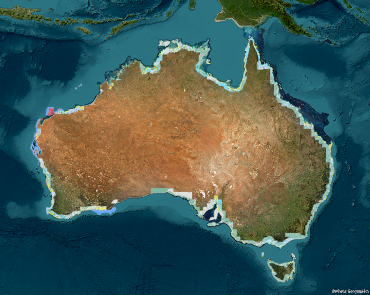
This service represents a combination of two data products, the DEM_SRTM_1Second dataset and the Australian_Bathymetry_Topography dataset. This service was created to support the CO2SAP (Co2 Storage application) Project to create a transect elevation graph within the application. This data is not available as a dataset for download as a Geoscience Australia product. The DEM_SRTM_1Second service represents the National Digital Elevation Model (DEM) 1 Second product derived from the National DEM SRTM 1 Second. The DEM represents ground surface topography, with vegetation features removed using an automatic process supported by several vegetation maps. eCat record 72759. The Australian_Bathymetry_Topography service describes the bathymetry dataset of the Australian Exclusive Economic Zone and beyond. Bathymetry data was compiled by Geoscience Australia from multibeam and single beam data (derived from multiple sources), Australian Hydrographic Service (AHS) Laser Airborne Depth Sounding (LADS) data, Royal Australian Navy (RAN) fairsheets, the General Bathymetric Chart of the Oceans (GEBCO) bathymetric model, the 2 arc minute ETOPO (Smith and Sandwell, 1997) and 1 arc minute ETOPO satellite derived bathymetry (Amante and Eakins, 2008). Topographic data (onshore data) is based on the revised Australian 0.0025dd topography grid (Geoscience Australia, 2008), the 0.0025dd New Zealand topography grid (Geographx, 2008) and the 90m SRTM DEM (Jarvis et al, 2008). eCat record 67703. IMPORTANT INFORMATION For data within this service that lays out of the Australian boundary the following needs to be considered. This grid is not suitable for use as an aid to navigation, or to replace any products produced by the Australian Hydrographic Service. Geoscience Australia produces the 0.0025dd bathymetric grid of Australia specifically to provide regional and local broad scale context for scientific and industry projects, and public education. The 0.0025dd grid size is, in many regions of this grid, far in excess of the optimal grid size for some of the input data used. On parts of the continental shelf it may be possible to produce grids at higher resolution, especially where LADS or multibeam surveys exist. However these surveys typically only cover small areas and hence do not warrant the production of a regional scale grid at less than 0.0025dd. There are a number of bathymetric datasets that have not been included in this grid for various reasons.
-
The Vlaming Sub-Basin CO2 Storage Potential Study web service includes the datasets associated with the study in the Vlaming Sub-basin, located within the southern Perth Basin about 30 km west of Perth. The data in this web service supports the results of the Geoscience Australia Record 2015/009 and appendices. The study provides an evaluation of the CO2 geological storage potential of the Vlaming Sub-basin and was part of the Australian Government's National Low Emission Coal Initiative.
-
This web map service provides visualisations of datasets used as inputs into the analysis of prospective hydrogen production regions of Australia. The service has been developed using datasets sourced from the Department of Environment and Energy, PSMA Australia, Garrad Hassan Pacific Pty. Ltd., Australian Bureau of Meteorology, Department of Resources Energy and Tourism, Queensland Department of Employment, Economic Development and Innovation, NSW Department of Planning, Industry and Environment, and Geoscience Australia
-
This OGC conformant web service delivers data from Geoscience Australia's Reservoir, Facies and Hydrocarbon Shows (RESFACS) Database. RESFACS is an interpretative reservoir/facies database containing depth-based information regarding permeability, porosity, shows, depositional environment and biostratigraphy of petroleum wells.
-
This service is the processing inputs that are used within the Criteria Assessment geoprocessing service. This service is specifically for use within the Carbon Capture and Storage application.
-
The Australian Geological Provinces Database contains descriptions and spatial extents of the fundamental geological elements of the Australian continent and offshore surrounds. Province types include sedimentary basins, tectonic provinces such as cratons and orogens, igneous provinces, and metallogenic provinces. Spatial data has been captured largely at approximately 1:1M scale for intended use between 1:2M and 1:5M scale.
-
This web service provides access to gridded data produced by Geoscience Australia from studies of Australian groundwater and hydrogeological systems.
-
This web service provides access to the National Local Government Area Council Offices dataset and presents the spatial locations of all known Local Government Area council office facilities within Australia, all complemented with feature attribution.
-
The service contains the Australian Coastal Geomorphology Landform Type Classifications, used to support a national coastal risk assessment. It describes the location and extent of landform types identifiable at scales between 1:250,000 and 1:25,000. It describes the landform types present in either erosional or dispositional environments.
-
Publicly available geology data are compiled to provide a common information base for resource development and regulatory decisions in the Adavale Basin region. This web service summarises the geology of the Adavale Basin.