education
Type of resources
Keywords
Publication year
Topics
-
Learn about earthquake monitoring in Australia through a visit to the National Earthquake Alerts Centre. Earthquakes are geological events that are detected by a network of seismometers; each 'station' sends seismic information for analysis and checking by seismologists who are on duty 24/7. We learn about the types of wave forms (primary, secondary and surface) and the sequence of events in the Centre when an earthquake is detected; the measurements made such as magnitude are then published on the earthquakes@GA webpage.
-
Have you ever wondered what lava looks like when it cools down? This short video introduces rocks from volcanoes and their features using some of the samples in the Geoscience Australia Education Centre. Viewers are shown different types of lava rock, bombs, obsidian and pumice. The video is suitable for middle primary and older students as well as a general audience; it introduces some technical terms and uses samples available for school students to handle during visits to the Centre.
-
Australia is a unique continent. This short video introduces the physical geography of Australia using a colourful topographic map. Viewers are shown the three major physical regions of the continent, the lack of large mountains and consider why relatively few people live in Australia given its size.
-
Many people fondly remember assembling their first rock collection or exploding a baking soda volcano as a child. These experiences can be a great gateway into the Earth sciences, but a more tailored and modern approach will ensure future generations are geoscience-literate and eventually able to contribute to the workforce. In this presentation, we 1. Use the Geoscience Australia Education Program as a case study of changing approaches to Earth science education and engagement, particularly after the global pandemic; 2. Discuss four key challenges facing geoscience education and engagement; and 3. Apply these challenges to efforts to promote Earth science to students in later high school, including summarising some of the broader data surrounding the attitudes and priorities of this demographic. We hope that this presentation will help guide the discussion on how we can most effectively ignite the interest of the next generation in pursuing Earth Science.
-
Flyer for year 9 students promoting careers in geoscience
-
Fossil shells can tell us about past environments. This video presents examples of shell fossils that help us to understand where oceans were located in Australia millions of years ago. The shells lived in shallow marine environments before they died and became part of the rocks formed from sand and silt at the bottom of the water. Brachiopods from Woolshed Creek in Canberra and a large spiral shell from the Nullarbor Plain are showcased along with an elevation map of Australia.
-
Learn about studying fossils (palaeontology) in this behind-the-scenes visit to the Commonwealth Palaeontological Collection. The formation of fossils is explained and different types of fossils are shown. The collection contains thousands of specimens including microscopic organisms called Foraminifera. Viewers learn that there are many scientific uses of fossils and this collection is a resource that scientists continue to study today.
-
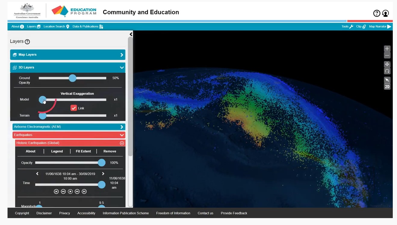
A series of short video clips illustrating how to use the Community and Education Data Portal (https://portal.ga.gov.au/persona/education). The Community and Education data portal is one of many data delivery portals available from Geoscience Australia, giving users access to a wealth of useful data and tools. It has been designed specifically for non-technical users, so that general community members, including educators, can access themed surface and subsurface datasets or images with enhanced capabilities including 3D visualisation, and online analysis tools. The User Guide Video complements the help menu in the portal. The User guide is broken into a series of topics 1. Introduction 2. Toolbar 3. Map layers 4. Multiple Layers 5. Background Layers and Sharing 6. 3D Layers 7. Tools 8. Custom Layers The step by step guides were produced by James Cropper.