Geomorphology
Type of resources
Keywords
Publication year
Service types
Topics
-
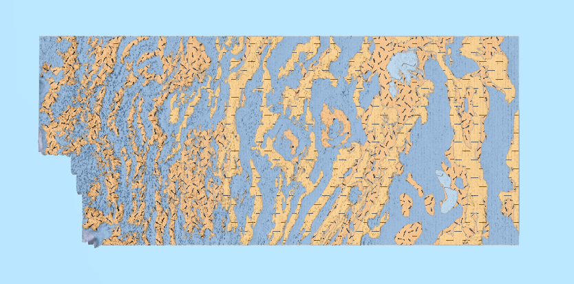
A high-resolution multibeam echosounder (MBES) dataset covering over 279,000 km2 was acquired in the southeastern Indian Ocean to assist the search for Malaysia Airlines Flight 370 (MH370) that disappeared on 8 March 2014. The data provided an essential geospatial framework for the search and is the first large-scale coverage of MBES data in this region. Here we report on geomorphic analyses of the new MBES data, including a comparison with the Global Seafloor Geomorphic Features Map (GSFM) that is based on coarser resolution satellite altimetry data, and the insights the new data provide into geological processes that have formed and are currently shaping this remote deepsea area. Our comparison between the new MBES bathymetric model and the latest global topographic/bathymetric model (SRTM15_plus) reveals that 62% of the satellite-derived data points for the study area are comparable with MBES measurements within the estimated vertical uncertainty of the SRTM15_plus model (± 100 m). However, > 38% of the SRTM15_plus depth estimates disagree with the MBES data by > 100 m, in places by up to 1900 m. The new MBES data show that abyssal plains and basins in the study area are significantly more rugged than their representation in the GSFM, with a 20% increase in the extent of hills and mountains. The new model also reveals four times more seamounts than presented in the GSFM, suggesting more of these features than previously estimated for the broader region. This is important considering the ecological significance of high-relief structures on the seabed, such as hosting high levels of biodiversity. Analyses of the new data also enabled sea knolls, fans, valleys, canyons, troughs, and holes to be identified, doubling the number of discrete features mapped. Importantly, mapping the study area using MBES data improves our understanding of the geological evolution of the region and reveals a range of modern sedimentary processes. For example, a large series of ridges extending over approximately 20% of the mapped area, in places capped by sea knolls, highlight the preserved seafloor spreading fabric and provide valuable insights into Southeast Indian Ridge seafloor spreading processes, especially volcanism. Rifting is also recorded along the Broken Ridge – Diamantina Escarpment, with rift blocks and well-bedded sedimentary bedrock outcrops discernible down to 2400 m water depth. Modern ocean floor sedimentary processes are documented by sediment mass transport features, especially along the northern margin of Broken Ridge, and in pockmarks (the finest-scale features mapped), which are numerous south of Diamantina Trench and appear to record gas and/or fluid discharge from underlying marine sediments. The new MBES data highlight the complexity of the search area and serve to demonstrate how little we know about the vast areas of the ocean that have not been mapped with MBES. The availability of high-resolution and accurate maps of the ocean floor can clearly provide new insights into the Earth's geological evolution, modern ocean floor processes, and the location of sites that are likely to have relatively high biodiversity. <b>Citation:</b> Kim Picard, Brendan P. Brooke, Peter T. Harris, Paulus J.W. Siwabessy, Millard F. Coffin, Maggie Tran, Michele Spinoccia, Jonathan Weales, Miles Macmillan-Lawler, Jonah Sullivan, Malaysia Airlines flight MH370 search data reveal geomorphology and seafloor processes in the remote southeast Indian Ocean, <i>Marine Geology</i>, Volume 395, 2018, Pages 301-319, ISSN 0025-3227, https://doi.org/10.1016/j.margeo.2017.10.014.
-
The deep waters within the Gascoyne Marine Park have been largely unexplored for their seafloor biodiversity. Survey FK200308 on the RV Falkor targeted two canyons within the Gascoyne Marine Park to understand and map the distribution and diversity of marine habitats and biota within the Cape Range and Cloates Canyons. These canyons were targeted to better understand their ecological significance as a conduit between shelf environments adjacent to the Ningaloo Reef and the abyssal plain. They occur within the habitat protection and multiple use zones of the Gascoyne Marine Park off north-western Australia. Survey FK200308 was led by researchers at the Western Australian Museum, and included scientists from Geoscience Australia, Curtin University, Macquarie University and Scripps Institute of Oceanography. Multibeam sonar was used to map parts of the marine park, while a Remotely Operated Vehicle (ROV) was deployed to undertake a comprehensive taxon inventory of the North-West canyon fauna based on underwater imagery and sampling. Additional biological samples were collected via plankton sampling, as well as fish and crustacean traps on a lander, and stand-alone fish trap deployments. Autonomous Reef Monitoring Structures (ARMS) were deployed at select sites to capture cryptic benthic organisms over several years. DNA samples from the water column (eDNA) were collected to enable a broader understanding of the biodiversity of the region, and to provide a methodological comparison to the organisms present at the time of sampling. The key drivers for this survey were to collect Information to enhance our understanding of the Gascoyne Marine Park and deep-sea environments throughout Western Australia, and to facilitate comparisons between the north-west and eastern and southern Australian deep-sea waters. This information can be applied to inform management plans, scientific research and industry activities for the North-West. Specifically, this survey provided: • A faunal inventory as a baseline information for monitoring deep water WA environments. A total of 2570 seafloor images were annotated from quantitative transects, more than 1000 specimens were collected and up to 30 new species discovered. • High resolution mapping of the seafloor across an area of 11,250 km2 revealed a detailed understanding of seabed habitats and environments in the Gascoyne Marine Park, and a regional context in which to interpret the faunal inventory. • Repeat multibeam mapping of the Cape Range and Cloates Canyons informed our understanding of seabed stability in the canyons of the Gascoyne Marine park, illustrating a rare case of true monitoring using multibeam in Australian waters. • The use of a state-of-the-art ROV across 20 deployments helped inform a new ROV field manual (Monk et al. 2020), adding to the existing suite of standard operating procedures supported by Parks Australia (https://marine-sampling-field-manual.github.io/). This survey confirmed that canyons within the Gascoyne Marine Park are important ecological systems, supporting numerous deep-sea species, many of which were discovered to be new to science. The advanced capabilities of the ROV SuBastian to navigate and image complex near vertical walls and overhangs within the canyons revealed patterns in the distribution of the seafloor taxa consistent with small-scale environmental variability. Repeat multibeam mapping revealed a dynamic canyon system that continues to be shaped by turbidity events. The occurrence of reworked seagrass blades within the canyons provided new understanding of these canyon systems as an active conduit between shallow shelf and abyssal environments. The distribution of the seabed biota revealed through quantitative ROV transects emphasised the importance of disturbance patterns in shaping the canyon ecosystems.
-
This flythrough shows the seafloor bathymetry, cores and canyon names for the Sabrina slope region of East Antarctica. Indigenous names for canyons were proposed following consultation with the Noongar people in Western Australia, the region of Western Australia that was formerly conjugate to the Sabrina margin. Canyon names are as follows: 1. Boongorang Canyon (Blowing in the wind) 2. Manang Canyon (Pool of Water Canyon) 3. Maadjit Canyon (Water Serpent Canyon) 4. Jeffrey Canyon (after Shirley Jeffrey, diatom researcher) 5. Morka Canyon (Winter Canyon) 6. Minang-a Canyon (Whale Canyon)
-
This OGC Web Feature Service (WFS) contains geospatial seabed morphology and geomorphology information for Cairns Seamount within the Coral Sea Marine Park and are intended for use by marine park managers, regulators, the general public and other stakeholders. This web service uses the data product published in McNeil et al. (2023); eCat Record 147998.
-
The service contains the Australian Coastal Geomorphology Smartline, used to support a national coastal risk assessment. The 'Smartline' is a representation of the geomorphic features located within 500m of the shoreline, denoted by the high water mark. The service includes geomorphology themes and stability classes.
-
This OGC Web Map Service (WMS) contains seabed morphology and geomorphology information for a subset area of Zeehan Marine Park (South-east Marine Parks Network) and is intended for use by marine park managers, regulators and other stakeholders. This web service uses the data product published in McNeil et al. (2023); eCat Record 148620.
-
<div>This data product contains geospatial seabed morphology and geomorphology information for the Beagle Marine Park and is intended for use by marine park managers, regulators, the general public and other stakeholders. A nationally consistent two-part (two-step) seabed geomorphology classification system was used to map and classify the distribution of key seabed features. </div><div><br></div><div>In step 1, semi-automated GIS mapping tools (GA-SaMMT; Huang et al., 2022; eCat Record 146832) were applied to bathymetry digital elevation models (DEM) in a GIS environment (ESRI ArcGIS Pro) to map polygon extents (topographic high, low, and planar) and quantitatively characterise their geometries. The geometric attributes were then used to classify each shape into discrete Morphology Feature types (Part 1: Dove et al., 2020; eCat Record 144305). In step 2, the seabed geomorphology was interpreted by applying additional datasets and domain knowledge to inform their geomorphic characterisation (Part 2: Nanson et al., 2023; eCat Record 147818). Where available, backscatter intensity, seabed imagery, seabed sediment samples and sub-bottom profiles supplemented the bathymetry DEM and morphology classifications to inform the geomorphic interpretations.</div><div><br></div><div>The Beagle Marine Park seabed morphology and geomorphology features were informed by a post survey report (Barrett et al., 2021). Seabed units were classified at multiple resolutions that were informed by the underlying bathymetry: </div><div><br></div><div>· A broad scale layer represents features that were derived from a 30 m horizontal resolution compilation DEM (Beaman et al 2022; eCat Record 147043). </div><div>· A series of medium and fine scale feature layers were derived from individual 1 m horizontal resolution DEMs (Nichol et al., 2019; eCat Record 130301). </div><div><br></div><div>The data product and application schema are fully described in the accompanying Data Product Specification. </div><div><br></div><div><em>Barrett, N, Monk, J., Nichol, S., Falster, G., Carroll, A., Siwabessy, J., Deane, A., Nanson, R., Picard, K., Dando, N., Hulls, J., and Evans, H. (2021). Beagle Marine Park Post Survey Report: South-east Marine Parks Network. Report to the National Environmental Science Program, Marine Biodiversity Hub. University of Tasmania.</em></div><div><br></div><div><em>Beaman, R.J. (2022). High-resolution depth model for the Bass Strait -30 m. <a href=https://dx.doi.org/10.26186/147043>https://dx.doi.org/10.26186/147043</a>, GA eCat Record 147043. </em></div><div><br></div><div><em>Dove, D., Nanson, R., Bjarnadóttir, L. R., Guinan, J., Gafeira, J., Post, A., Dolan, Margaret F.J., Stewart, H., Arosio, R., Scott, G. (2020). A two-part seabed geomorphology classification scheme (v.2); Part 1: morphology features glossary. Zenodo. <a href=https://doi.org/10.5281/zenodo.40752483>https://doi.org/10.5281/zenodo.4075248</a>; GA eCat Record 144305 </em></div><div><br></div><div><em>Huang, Z., Nanson, R. and Nichol, S. (2022). Geoscience Australia's Semi-automated Morphological Mapping Tools (GA-SaMMT) for Seabed Characterisation. Geoscience Australia, Canberra. <a href=https://dx.doi.org/10.26186/146832>https://dx.doi.org/10.26186/146832</a>; GA eCat Record 146832 </em></div><div><em> </em></div><div><em>Nanson, R., Arosio, R., Gafeira, J., McNeil, M., Dove, D., Bjarnadóttir, L., Dolan, M., Guinan, J., Post, A., Webb, J., Nichol, S. (2023). A two-part seabed geomorphology classification scheme; Part 2: Geomorphology classification framework and glossary (Version 1.0) (1.0). Zenodo.<a href=https://doi.org/10.5281/zenodo.7804019>https://doi.org/10.5281/zenodo.7804019</a>; GA eCat Record 147818 </em></div>
-
This OGC Web Map Service (WMS) contains geospatial seabed morphology and geomorphology information for Cairns Seamount within the Coral Sea Marine Park and are intended for use by marine park managers, regulators, the general public and other stakeholders. This web service uses the data product published in McNeil et al. (2023); eCat Record 147998.
-
This ESRI map (web) service contains seabed morphology and geomorphology information for a subset area of Zeehan Marine Park (South-east Marine Parks Network) and is intended for use by marine park managers, regulators and other stakeholders. This web service uses the data product published in McNeil et al. (2023); eCat Record 148620.
-
This data product contains seabed morphology and geomorphology information for a subset area of Zeehan Marine Park. A nationally consistent seabed geomorphology classification scheme was used to map and classify the distribution of key seabed features. The Zeehan Marine Park seabed morphology and geomorphology maps were derived from a 2 m horizontal resolution bathymetry DEM compiled from a multibeam survey undertaken for Parks Australia by the University of Tasmania. Semi-automated GIS mapping tools (GA-SaMMT); (Huang et. al., 2022; eCat Record 146832) were applied to a bathymetry digital elevation model (DEM) in a GIS environment (ESRI ArcGIS Pro) to map polygon extents (topographic high, low, and planar) and to quantitatively characterise polygon geometries. Geometric attributes were then used to classify each shape into discrete Morphology Feature types (Dove et. al., 2020; eCat Record 144305). Seabed geomorphology features were interpreted by applying additional datasets and domain knowledge to inform their geomorphic characterisation (Nanson et. al., 2023; eCat Record 147818). Where available, backscatter intensity, seabed imagery, and survey reports supplemented the bathymetry DEM and morphology classifications to inform the geomorphic interpretations. The data product and classification schema are fully described in the accompanying Data Product Specification. Dove, D., Nanson, R., Bjarnadóttir, L. R., Guinan, J., Gafeira, J., Post, A., Dolan, Margaret F.J., Stewart, H., Arosio, R., Scott, G. (2020). A two-part seabed geomorphology classification scheme (v.2); Part 1: morphology features glossary. Zenodo. https://doi.org/10.5281/zenodo.4075248; Huang, Z., Nanson, R., Nichol, S. 2022. Geoscience Australia's Semi-automated Morphological Mapping Tools (GA-SaMMT) for Seabed Characterisation. Geoscience Australia, Canberra. https://dx.doi.org/10.26186/146832 Nanson, R., Arosio, R., Gafeira, J., McNeil, M., Dove, D., Bjarnadóttir, L., Dolan, M., Guinan, J., Post, A., Webb, J., Nichol, S. (2023). A two-part seabed geomorphology classification scheme; Part 2: Geomorphology classification framework and glossary (Version 1.0) (1.0). Zenodo. https://doi.org/10.5281/zenodo.7804019