ENVIRONMENTAL SCIENCES
Type of resources
Keywords
Publication year
Topics
-
This report describes the results of an extended national field spectroscopy campaign designed to validate the Landsat 8 and Sentinel 2 Analysis Ready Data (ARD) surface reflectance (SR) products generated by Digital Earth Australia. Field spectral data from 55 overpass coincident field campaigns have been processed to match the ARD surface reflectances. The results suggest the Landsat 8 SR is validated to within 10%, the Sentinel 2A SR is validated to within 6.5% and Sentinel 2B is validated to within 6.8% . Overall combined Sentinel 2A and 2B are validated within 6.6% and the SR for all three ARD products are validated to within 7.7%.
-
The values and distribution patterns of the strontium (Sr) isotope ratio 87Sr/86Sr in Earth surface materials is of use in the geological, environmental and social sciences. Ultimately, the 87Sr/86Sr ratio of any mineral or biological material reflects its value in the rock that is the parent material to the local soil and everything that lives in and on it. In Australia, there are few large-scale surveys of 87Sr/86Sr available, and here we report on a new, low-density dataset using 112 catchment outlet (floodplain) sediment samples covering 529,000 km2 of inland southeastern Australia (South Australia, New South Wales, Victoria). The coarse (<2 mm) fraction of bottom sediment samples (depth ~0.6-0.8 m) from the National Geochemical Survey of Australia were fully digested before Sr separation by chromatography and 87Sr/86Sr determination by multicollector-inductively coupled plasma-mass spectrometry. The results show a wide range of 87Sr/86Sr values from a minimum of 0.7089 to a maximum of 0.7511 (range 0.0422). The median 87Sr/86Sr (± robust standard deviation) is 0.7199 (± 0.0112), and the mean (± standard deviation) is 0.7220 (± 0.0106). The spatial patterns of the Sr isoscape observed are described and attributed to various geological sources and processes. Of note are the elevated (radiogenic) values (≥~0.7270; top quartile) contributed by (1) the Palaeozoic sedimentary country rock and (mostly felsic) igneous intrusions of the Lachlan geological region to the east of the study area; (2) the Palaeoproterozoic metamorphic rocks of the central Broken Hill region; both these sources contribute fluvial sediments into the study area; and (3) the Proterozoic to Palaeozoic rocks of the Kanmantoo, Adelaide, Gawler and Painter geological regions to the west of the area; these sources contribute radiogenic material to the region mostly by aeolian processes. Regions of low 87Sr/86Sr (≤~0.7130; bottom quartile) belong mainly to (1) a few central Murray Basin catchments; (2) some Darling Basin catchments in the northeast; and (3) a few Eromanga geological region-influenced catchments in the northwest of the study area. The new spatial dataset is publicly available through the Geoscience Australia portal (https://portal.ga.gov.au/restore/cd686f2d-c87b-41b8-8c4b-ca8af531ae7e).
-
The Australian Capital Territory Geochemical Urban Mapping (ACTGUM) project, a collaboration between the National Centre for Forensic Studies at the University of Canberra, Geoscience Australia (GA) and the Australian Federal Police, aims to enable high-quality research investigating the provenancing of topsoil in a law enforcement/intelligence context. Although many geochemical soil surveys already exist, these are typically developed primarily for exploration and related earth sciences, limiting their use for forensic applications that have specific, and often differing requirements (e.g. sampling density, sampling medium and depth, and data treatment). An important part of the project is the development of a high quality, internally consistent, geochemical dataset of topsoil, covering a model area of interest at a relatively high sampling density. Initiated in 2017, a soil geochemical survey has been completed, covering the urban and surrounding suburban areas of Canberra, Australian Capital Territory (ACT), in inland southeastern Australia. At present, a total of 823 topsoil samples (including field replicate samples at 65 sites) have been collected from 686 sites, including 6 resampled sites, which together cover over 650 km2 at the average sample density of 1 site per 1 km2. Samples were collected from urban and suburban public parks, nature reserves, roadside verges, nature strips, and private agricultural land. Obvious areas of anthropogenically introduced, modified or contaminated soils were avoided. At each site, a 1 – 2 kg composite of five subsamples taken from the corners and centre of a 1m x 1m area at a depth interval of 0 – 5 cm was collected, after removal of surface vegetation. All composite samples were subsequently air dried, homogenised and split into two halves. One half was set aside for archiving. The remainder was dry sieved to <75 μm, consistent with existing geochemical surveys in Australia, including the GA National Geochemical Survey of Australia and GA Northern Australian Geochemical Survey. Any excess sample/fraction was kept for potential future use. All subsequent analytical protocols were applied to the <75 μm fraction, and those performed at the GA inorganic laboratory include: (1) X-ray fluorescence (XRF) analysis of fused beads and loss on ignition (LOI) (total geochemistry); and (2) Inductively coupled plasma – mass spectrometry (ICP-MS) analysis of total digestions of fused bead fragments (total geochemistry). Additional and complimentary measurements have been completed elsewhere, including magnetic susceptibility, ICP-MS analysis of aqua regia digests, Munsell soil colour, and X-ray diffraction (XRD) analysis. These measurements have been discussed elsewhere and/or will be published separately. In the present project manual, we describe the: (1) The synopsis underpinning the broader project and determination of sampling sites; and (2) Detailed protocols for sample collection, preparation and analysis of total element content. Release and interpretation of the project dataset, quality assessments and geochemical maps will be published separately.
-
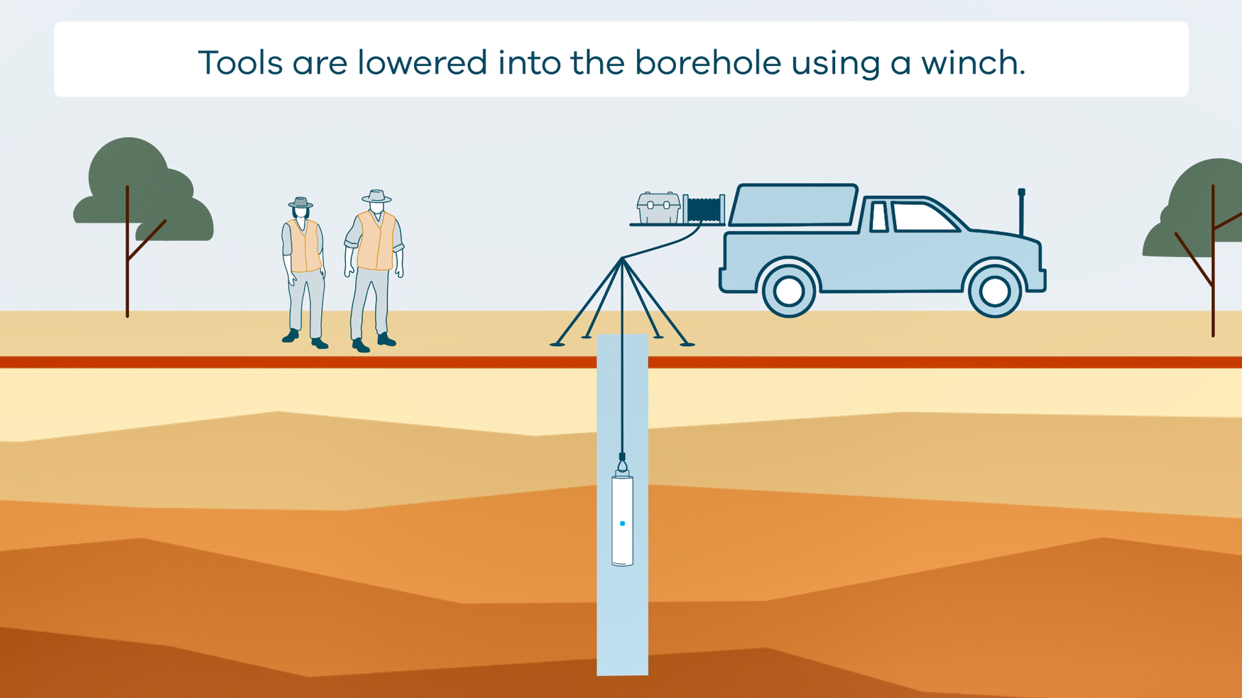
This animation shows how borehole geophysical surveys are conducted. It is part of a series of Field Activity Technique Engagement Animations. The target audience are the communities that are impacted by GA's data acquisition activities. There is no sound or voice over. The 2D animation includes a simplified view of what borehole geophysics equipment looks like, what the equipment measures and how scientists use the data.
-
This brief report updates the ‘Two-part Seabed Geomorphology classification scheme’ of Dove et al. (2016) and presents a new glossary (Part 1) of Seabed Morphology features. This Morphology glossary is intended to provide marine scientists with an accurate and robust way to characterise the seabed. Each glossary entry includes a feature definition and a representative schematic diagram to support clear and consistent classification. Feature terms and definitions are primarily drawn from the IHO guide for undersea feature names, which are herein modified and augmented with additional terms to ensure the final feature catalogue and glossary encompasses the diversity of morphologies observed at the seabed, while also minimising duplication and/or ambiguity. This updated classification system and new glossary are the result of a collaboration between marine geoscientists from marine mapping programmes/networks in Norway (MAREANO), Ireland (INFOMAR), UK (MAREMAP), and Australia (Geoscience Australia) (MIM-GA). A subsequent report will present the (Part 2) Geomorphology feature glossary. <b>Citation:</b> Dove, Dayton, Nanson, Rachel, Bjarnadóttir, Lilja R., Guinan, Janine, Gafeira, Joana, Post, Alix, Dolan, Margaret F.J., Stewart, Heather, Arosio, Riccardo, & Scott, Gill. (2020). <i>A two-part Seabed Geomorphology classification scheme (v.2); Part 1: Morphology Features Glossary.</i> Zenodo. https://doi.org/10.5281/zenodo.4071939
-
This Daly Basin dataset contains descriptive attribute information for the areas bounded by the relevant spatial groundwater feature in the associated Hydrogeology Index map. Descriptive topics are grouped into the following themes: Location and administration; Demographics; Physical geography; Surface water; Geology; Hydrogeology; Groundwater; Groundwater management and use; Environment; Land use and industry types; and Scientific stimulus. The Daly Basin is a geological formation consisting of Cambrian to Ordovician carbonate and siliciclastic rocks, formed approximately 541 million to 470 million years ago. The basin stretches about 170 km in length and 30 km in width, shaped as a northwest elongated synform with gentle dips of less than 1 degree, likely due to prolonged sedimentary deposition in the shallow seas of the Centralian Superbasin, possibly along basin-scale faults. The primary groundwater reservoir within the Daly Basin is found in the Cambrian Daly River Group. This group comprises three units: the Tindall Limestone, Jinduckin Formation, and Oolloo Dolostone. The Tindall Limestone, which lies at the base, consists of grey, mottled limestone with some maroon-green siltstone or dark grey mudstone. The transition from the Tindall Limestone to the overlying Jinduckin Formation is marked by a shift from limestone to more siliciclastic rocks, indicating a change from open-shelf marine to peri-tidal environments. The Jinduckin Formation, situated above the Tindall Limestone, is composed of maroon-green dolomitic-siliciclastic siltstone with interbeds of dolomitic sandstone-siltstone, as well as dolostone and dolomitic quartz sandstone lenses. It gradually transitions into the carbonate-rich Oolloo Dolostone, with the highest finely laminated dolomitic sandstone-siltstone interbeds at the top of the Jinduckin Formation. The Oolloo Dolostone, the uppermost unit of the Daly River Group, comprises two members: the well-bedded lower Briggs Member, consisting of fine- to medium-grained crystalline dolostone and dolomitic quartz sandstone, and the massive upper King Member. Overlying the Daly River Group is the Ordovician Florina Formation, consisting of three carbonate intervals separated by two fine-grained, glauconite-bearing quartz sandstone units. The Florina Formation and the Daly River Group are covered unconformably by Cretaceous claystone and sandstone of the Carpentaria Basin, which extends over a significant portion of the Daly Basin.
-
The continental slope seaward of the Totten Glacier and Sabrina Coast displays a suite of submarine canyons separated by ridges. The ridges show a range of morphological features that indicate they form by accretion of pelagic and hemipelagic sediment which can be remobilised by mass movement. The study area can be divided into two areas with distinct geomorphological features. Canyons in the eastern part of the study area have concave thalwegs and are linked to the shelf edge and upper slope and show signs of erosion and deposition along their beds suggesting cycles of activity controlled by climate cycles. The major canyon in the western part of the area has a convex thalweg. It is likely fed predominantly by mass movement from the flanks of the adjacent ridges with less input sediment from the shelf edge. The ridges between canyons in the Eastern part of the study area are asymmetric with crests close to the west bank of adjacent canyons and are mostly formed by westward advection of fine sediment lofted from turbidity currents and deposition of pelagic sediment. The ridges in the western part of the study area are more likely fully contourites, formed by accretion of suspended sediment with their associated canyons fed by flows derived predominantly from slumping on the adjacent ridge flanks. Canyons and ridges in the eastern part of the study area lie to the east of the Totten Glacier and are seaward of small ice drainage basins feeding the Moscow University Ice Shelf. Ridges and canyons in the western part of area formed from sediment transported along the margin and from detritus originating from the Totten Glacier. Higher sediment supply produced larger, shallower ridges that interact with ocean currents and coincide with a long-lived depocenter. The overall geomorphology of the Sabrina Coast slope is part of a continuum of mixed contourite-turbidite systems identified on the Antarctic margin. These ridges are thus prime locations to sample for sedimentary records of the Totten Glacier’s interaction with the adjacent ocean. <b>Citation:</b> E. O'Brien, A.L. Post, S. Edwards, T. Martin, A. Caburlotto, F. Donda, G. Leitchenkov, R. Romeo, M. Duffy, D. Evangelinos, L. Holder, A. Leventer, A. López-Quirós, B.N. Opdyke, L.K. Armand, Continental slope and rise geomorphology seaward of the Totten Glacier, East Antarctica (112°E-122°E), <i>Marine Geology</i>, Volume 427, 2020, 106221, ISSN 0025-3227, https://doi.org/10.1016/j.margeo.2020.1062
-
This collection includes information regarding the location and design of Australian onshore and offshore boreholes, where boreholes are defined as the generalized term for any narrow shaft drilled in the ground, either vertically or horizontally. In this context, boreholes include: Mineral Drillholes, Petroleum Wells and Water Bores along with a variety of others types, but does not include Costean, Trench or Pit. <b>Value: </b> Information related to the boreholes described in this collection have the potential to support geological investigations and assessment of a variety of resources. <b>Scope: </b>Selected open file boreholes Australian boreholes located onshore and offshore
-
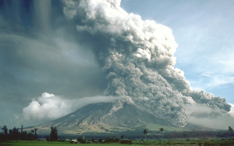
Activity for secondary and senior secondary students examining a hypothetical city and its vulnerability to volcanic hazard risk. Includes background information for teachers, PowerPoint presentation, student activity sheet and worked answers.
-
The discovery of strategically located salt structures, which meet the requirements for geological storage of hydrogen, is crucial to meeting Australia’s ambitions to become a major hydrogen producer, user and exporter. The use of the AusAEM airborne electromagnetic (AEM) survey’s conductivity sections, integrated with multidisciplinary geoscientific datasets, provides an excellent tool for investigating the near-surface effects of salt-related structures, and contributes to assessment of their potential for underground geological hydrogen storage. Currently known salt in the Canning Basin includes the Mallowa and Minjoo salt units. The Mallowa Salt is 600-800 m thick over an area of 150 × 200 km, where it lies within the depth range prospective for hydrogen storage (500-1800 m below surface), whereas the underlying Minjoo Salt is generally less than 100 m thick within its much smaller prospective depth zone. The modelled AEM sections penetrate to ~500 m from the surface, however, the salt rarely reaches this level. We therefore investigate the shallow stratigraphy of the AEM sections for evidence of the presence of underlying salt or for the influence of salt movement evident by disruption of near-surface electrically conductive horizons. These horizons occur in several stratigraphic units, mainly of Carboniferous to Cretaceous age. Only a few examples of localised folding/faulting have been noted in the shallow conductive stratigraphy that have potentially formed above isolated salt domes. Distinct zones of disruption within the shallow conductive stratigraphy generally occur along the margins of the present-day salt depocentre, resulting from dissolution and movement of salt during several stages. This study demonstrates the potential AEM has to assist in mapping salt-related structures, with implications for geological storage of hydrogen. In addition, this study produces a regional near-surface multilayered chronostratigraphic interpretation, which contributes to constructing a 3D national geological architecture, in support of environmental management, hazard mapping and resource exploration. <b>Citation: </b>Connors K. A., Wong S. C. T., Vilhena J. F. M., Rees S. W. & Feitz A. J., 2022. Canning Basin AusAEM interpretation: multilayered chronostratigraphic mapping and investigating hydrogen storage potential. In: Czarnota, K (ed.) Exploring for the Future: Extended Abstracts, Geoscience Australia, Canberra, https://dx.doi.org/10.26186/146376