acreage release
Type of resources
Keywords
Publication year
Service types
Topics
-
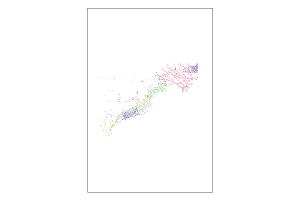
This is the Acreage Release Marine Environmental Data compiled web service to be updated each year with acreage release. It contains the following publicly available datasets, for the 2016 Acreage Release - Marine Survey Towed-video Transects, Marine Sediments Database Samples, Australian Seascapes, Seabed Mud Content on the Northwest Shelf, Seabed Sand Content of the Northwest Shelf and Seabed Gravel Content of the Northwest Shelf.
-
In 2017, 21 new offshore petroleum exploration areas have been released. The majority of the areas are located along the North West Shelf spanning the Westralian Superbasin from the Bonaparte Basin in the north-east to the Northern Carnarvon Basin in the south-west. New areas have been released in offshore south-eastern Australia with new opportunities provided in the Otway, Bass and Gippsland basins. Two large areas in the northern Perth Basin, an offshore frontier, complete the 2017 Acreage Release. All Release Areas are supported by industry nominations and one new cash bid area has been offered in the Dampier Sub-basin. Geoscience Australia continues to support industry activities by acquiring, interpreting and integrating pre-competitive datasets that are made freely available as part of the agency’s regional petroleum geological studies. A new regional 2D seismic survey was acquired in the Houtman Sub-basin of the Perth Basin, forming the basis of the latest prospectivity study carried out by Geoscience Australia. The results of the study are presented in the technical program of the 2017 APPEA conference. A wealth of seismic and well data, submitted under the Offshore Petroleum and Greenhouse Gas Storage Act 2006 (OPGSSA) are made available through the National Offshore Petroleum Information Management System (NOPIMS). Additional datasets are accessible through Geoscience Australia’s data repository. Presented at the 2017 Australian Petroleum Production & Exploration Association (APPEA) Conference.