maps
Type of resources
Keywords
Publication year
Topics
-
Total magnetic intensity data measures variations in the intensity of the Earth's magnetic field caused by the contrasting content of rock-forming minerals in the Earth's crust. The data are collected on airborne geophysical surveys conducted by Commonwealth, State & NT Governments and the private sector.
-
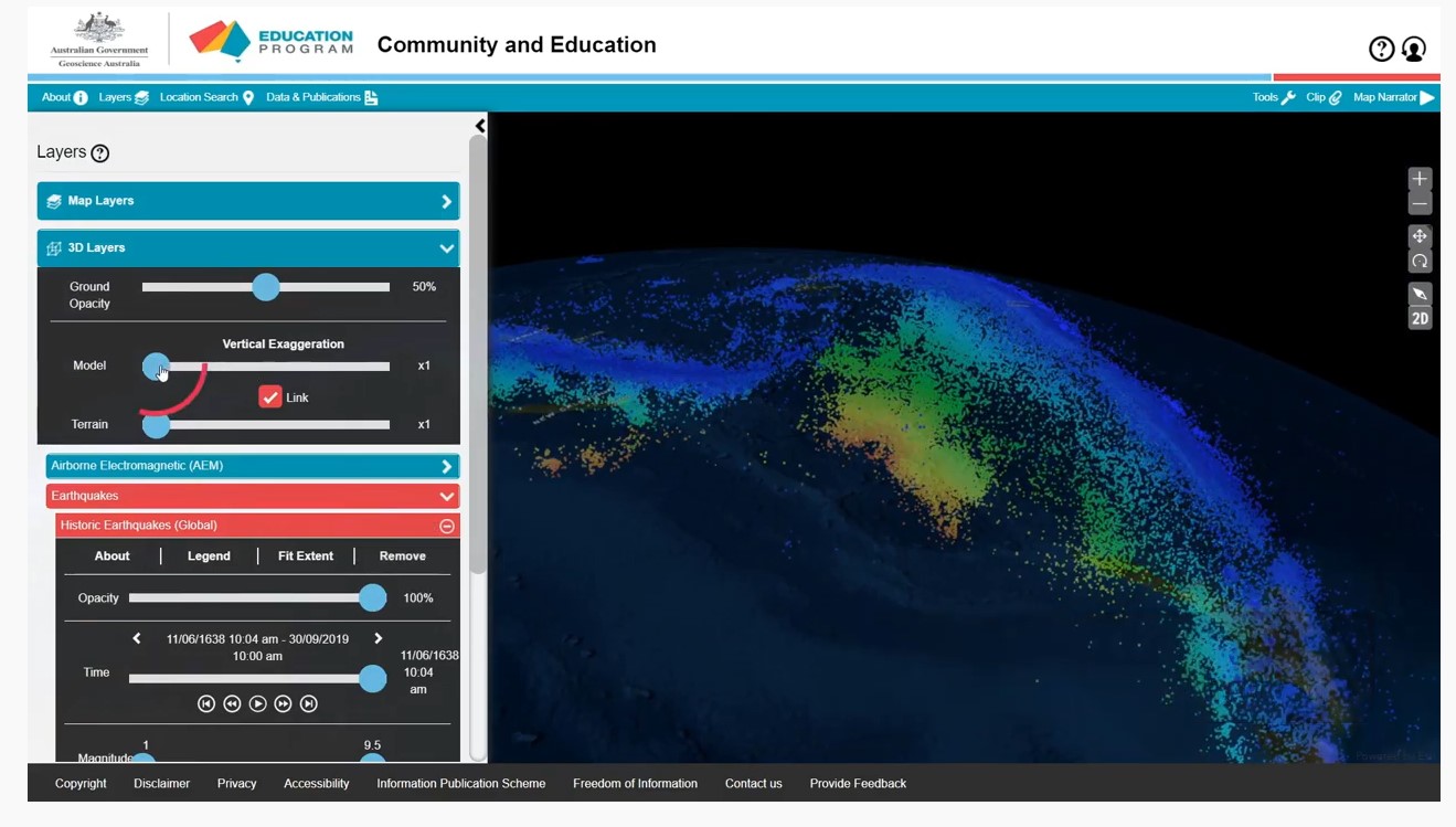
A series of short video clips illustrating how to use the Community and Education Data Portal (https://portal.ga.gov.au/persona/education). The Community and Education data portal is one of many data delivery portals available from Geoscience Australia, giving users access to a wealth of useful data and tools. It has been designed specifically for non-technical users, so that general community members, including educators, can access themed surface and subsurface datasets or images with enhanced capabilities including 3D visualisation, and online analysis tools. The User Guide Video complements the help menu in the portal. The User guide is broken into a series of topics 1. Introduction 2. Toolbar 3. Map layers 4. Multiple Layers 5. Background Layers and Sharing 6. 3D Layers 7. Tools 8. Custom Layers The step by step guides were produced by James Cropper.
-
Legacy product - this record contains specifications and schema followed in the creation of topographic maps (published by Geoscience Australia between 1995-2012).