Classroom
Type of resources
Keywords
Publication year
Topics
-
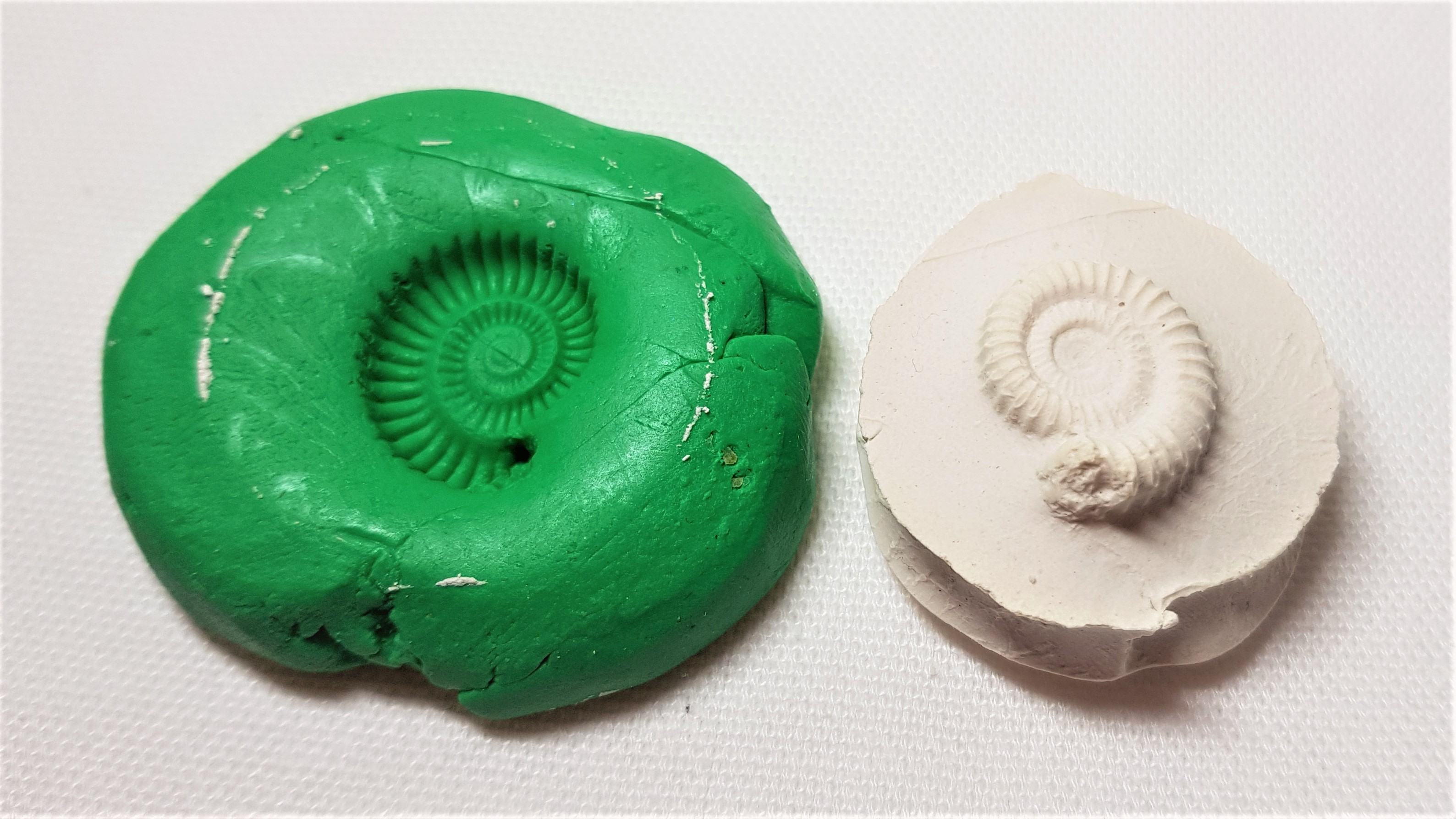
Educational resource and instructions to make your own fossil out of every day materials.
-
Explore important concepts about groundwater using this comprehensive teaching resource. This mini unit includes case studies of Australian groundwater topics, First Nations Australian perspectives about water use and groundwater are also included. This mini unit included four files - the guide, 2 x student activities and a kml file. The guide includes educator tips as well as answers to the student activities. Suitable for upper primary to lower secondary students.
-
Geoscience Australia produces a range of educational resources (ga.gov.au/education), including webinars on various geoscientific topics for school children. These webinars are designed to be used for classroom or home learning. They are standalone products that do not require preparation or follow-up by teachers, although this is encouraged. The webinar 'Australia's Seafloor: What's on it, who cares and how do we map it' is designed for upper primary students (Years 4-6). It is delivered by marine scientist Rachel Przeslawski and introduces the techniques and uses of seabed mapping, with a focus on Australia, as well as some of the fascinating marine animals found on the seafloor. Length: 23 minutes.
-
<div>This document steps teachers and students through accessing and using satellite data on the Digital Earth Australia (DEA) Portal, with a particular focus on bushfires and flood events. The document is intended to be followed with the DEA portal open so teachers and students can explore the data using the links provided in the guide. The document also provides brief background information on how spectral satellites operate and how various bands of the electromagnetic spectrum can deliver useful data.</div>
-
This 12-page teacher guide is intended for upper primary teachers but may also be useful in secondary classrooms as well. The guide explains how to set up a micro:bit (tiny inexpensive computer) as a mini seismometer that will detect shaking, and how to collect and display the data. The guide also includes classroom-ready activities on how to introduce and explore vibrations and earthquake monitoring.