Educational Product
Type of resources
Keywords
Publication year
Scale
Topics
-
<div>The A1 poster incorporates 4 images of Australia taken from space by Earth observing satellites. The accompanying text briefly introduces sensors and the bands within the electromagnetic spectrum. The images include examples of both true and false colour and the diverse range of applications of satellite images such as tracking visible changes to the Earth’s surface like crop growth, bushfires, coastal changes and floods. Scientists, land and emergency managers use satellite images to analyse vegetation, surface water or human activities as well as evaluate natural hazards.</div>
-
This booklet focuses on volcanoes, their formation process, types, shapes, locations and effects on their surroundings. Significant volcano events around the world are covered, and special emphasis is placed on the Australian volcanic landscape. Student activities included. Recommended for Years 6 and 9.
-
Handout about the SHRIMP instrument for visitors to GA SHRIMP Lab.
-
This set of 15 Australian landslide images on CD-ROM with accompanying explanatory text illustrates the causes of landslides and other earth movements. Learn how people contribute to creating and mitigating such events. Landslide images include Thredbo, NSW, Sorrento Vic., Gracetown WA and Tasmania. Suitable for secondary level Years 7-12.
-
The Gold Rush Technology image set comprises 15 images and accompanying text that includes background information and descriptions of each image. The images depict methods used by Gold Rush miners, from simple alluvial panning to underground mining. The resource also includes modern gold exploration methods using geology and geophysics techniques. Possible student question/s for each slide are provided. Suitable for primary levels Years 5-6 and secondary levels Years 7-8
-
This is a mixture of maps and text explaining the area in fairly straightforward language.
-
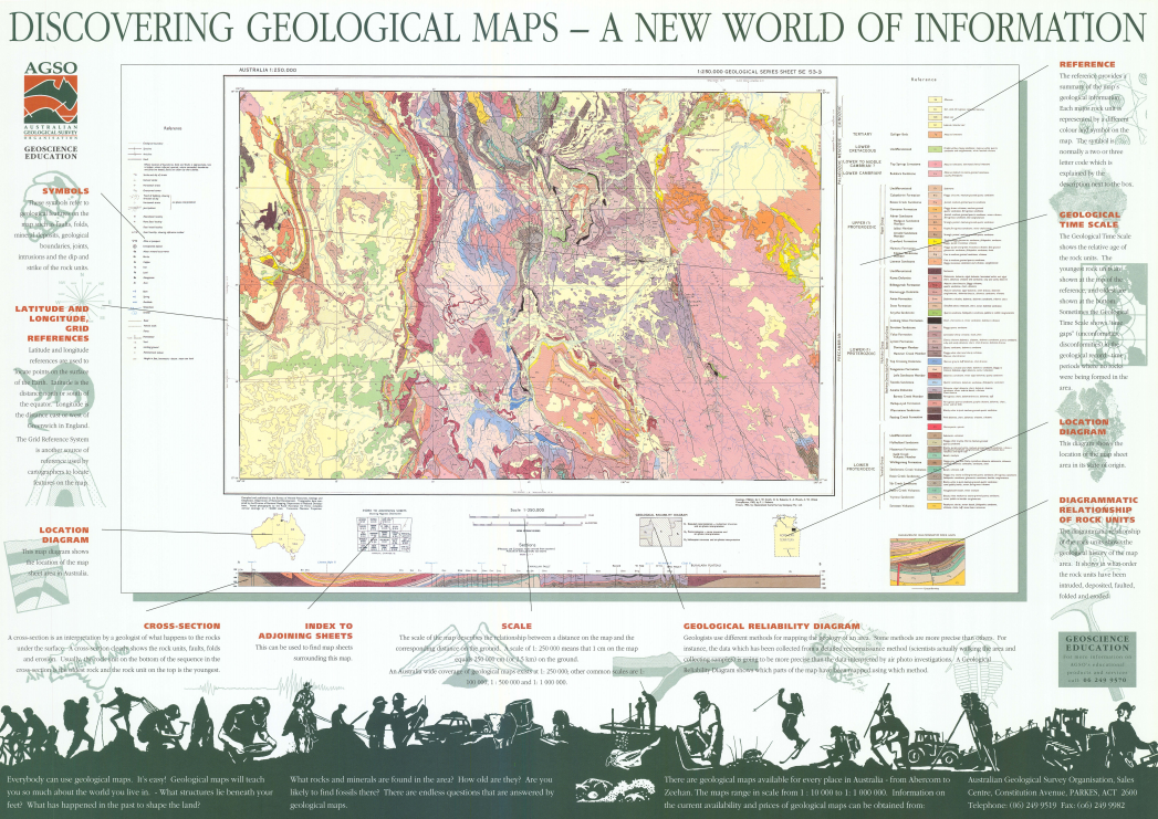
An educational product describing each of the elements on a geological map. Elements include symbols, grid references, cross-section, scale, geological reliability diagram and the geological time scale.
-
A new National Fleet of Ocean Bottom Seismometers to understand the structures deep beneath the ocean floor and how the continental plates are moving and what resources may lay under the ocean floor.
-
These Crystal Models are part of the Exploring Minerals and Crystals booklet and can be used to explore crystal shapes in high school and college geology. They can also be used independently to discuss three dimensional shapes in primary school mathematics.
-
The Mt Todd map kit, suitable for Secondary level Years 8-12 contains; - 15 double-sided 1:75,000 scale Mt Todd geology/topography maps - 15 plastic map reading cards 1:75,000 scale - 86 page booklet (Record 1996/10) of full teaching notes including map projections, scale, latitude and longitude, direction, geological legends, rock types & ages, geological features eg. folds, faults, intrusions and dipping rocks, geological cross-sections, the link between geology and topography, economic geology and a glossary. - 11 reproducible student activities and exam - suggested answers to activities and exam


