Tectonics
Type of resources
Keywords
Publication year
Service types
Scale
Topics
-
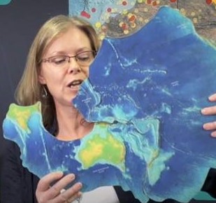
In November, 2018 a workshop of experts sponsored by UNESCO’s Intergovernmental Oceanographic Commission was convened in Wellington, New Zealand. The meeting was organized by Working Group (WG) 1 of the Pacific Tsunami Warning System (PTWS). The meeting brought together fourteen experts from various disciplines and four different countries (New Zealand, Australia, USA and French Polynesia) and four observers from Pacific Island countries (Tonga, Fiji), with the objective of understanding the tsunami hazard posed by the Tonga-Kermadec trench, evaluating the current state of seismic and tsunami instrumentation in the region and assessing the level of readiness of at-risk populations. The meeting took place in the “Beehive” Annex to New Zealand’s Parliament building nearby the offices of the Ministry of Civil Defence and Emergency Management. The meeting was co-chaired by Mrs. Sarah-Jayne McCurrach (New Zealand) from the Ministry of Civil Defence and Emergency Management and Dr. Diego Arcas (USA) from NOAA’s Pacific Marine Environmental Laboratory. As one of the meeting objectives, the experts used their state-of-the-science knowledge of local tectonics to identify some of the potential, worst-case seismic scenarios for the Tonga-Kermadec trench. These scenarios were ranked as low, medium and high probability events by the same experts. While other non-seismic tsunamigenic scenarios were acknowledged, the level of uncertainty in the region, associated with the lack of instrumentation prevented the experts from identifying worse case scenarios for non-seismic sources. The present report synthesizes some of the findings of, and presents the seismic sources identified by the experts to pose the largest tsunami risk to nearby coastlines. In addition, workshop participants discussed existing gaps in scientific knowledge of local tectonics, including seismic and tsunami instrumentation of the trench and current level of tsunami readiness for at-risk populations, including real-time tsunami warnings. The results and conclusions of the meeting are presented in this report and some recommendations are summarized in the final section.
-
This short video by the Geoscience Australia Education Team is targeted at upper primary students but is suitable for a wider audience. It introduces the concept of tectonic plates making use of a tectonic plates puzzle. Students are asked to predict the direction and speed of plate movement and consider where and why earthquakes happen on the Australian Plate. It is an introduction to major concepts of Earth science delivered in a light-hearted manner with an interactive presentation style.
-
This web service contains marine geospatial data held by Geoscience Australia. It includes bathymetry and backscatter gridded data plus derived layers, bathymetry coverage information, bathmetry collection priority and planning areas, marine sediment data and other derived products. It also contains the 150 m and optimal resolution bathymetry, 5 m sidescan sonar (SSS) and synthetic aperture sonar (SAS) data collected during phase 1 and 2 marine surveys conducted by the Governments of Australia, Malaysia and the People's Republic of China for the search of Malaysian Airlines Flight MH370 in the Indian Ocean. This web service allows exploration of the seafloor topography through the compilation of multibeam sonar and other marine datasets acquired.
-
We present a seismic reflection section acquired across the western margin of the Lake George Basin near Geary's Gap which images the stratigraphy of the basin sediments and the interaction between faults and these sediments. When coupled with high resolution topographic data, key aspects of the evolution of the Lake George Basin may be deduced. The Lake George Basin formed as the result of west-dipping reverse faulting and associated fault propagation folding at the eastern margin of the Lake George Range in the interval between ca. 3.93 Ma and the present. Assuming that elevated gravels in Geary's Gap and to the west along Brooks Creek are correlative with similar lithology at the base of the basin (as suggested by previous workers), vertical displacement in the order of 250 m has occurred in this time interval. This is one of the larger rates of displacement recorded for an Australian intraplate fault, averaged over a timescale of several million years. Three prominent angular unconformities, separating packages of approximately parallel strata, indicate that deformation was episodic, with up to 1 million years separating active periods on the fault. The ~75 km active length of the Lake George Fault is consistent with a MW7.4 characteristic earthquake. An event of this magnitude has the potential to cause significant damage to the Australian Capital Territory, given that the surface trace of the fault approaches to within 25 km of Parliament House. Assuming periodic recurrence, a characteristic event might be expected every ~3040 kyr. However, the evidence for temporal clustering suggests that such events might be much more tightly spaced in time (perhaps by an order of magnitude) in an active period on the fault. This neotectonic activity is allied to the Late Pliocene to Pleistocene `Kosciuszko Uplift, which may be responsible for adding several hundred metres of relief to the Eastern Highlands of Australia. Few crustal fault systems which might have accommodated such large-scale uplift have yet been characterised. Consequently, the seismic hazard of the Eastern Highlands, which is based largely upon the short historic record of seismicity, is likely to be underestimated. Nearby candidate faults for similar activity include the Queanbeyan, Murrumbidgee, Shoalhaven, Crookwell, Mulwaree, Binda, Tawonga, Khancoban-Yellow Bog and Jindabyne faults.
-
In probabilistic seismic hazard modelling the choice of whether faults behave with Characteristic or Gutenberg-Richter recurrence statistics has a high impact on the hazard level. Compared to a model that does not include fault sources, the addition of a high slip rate (by intraplate standards) Characteristic fault results in a modest increase in hazard for a 500 years return period event, and a modest increase at longer return periods (i.e. ~2500 years). A Gutenberg-Richter fault with the same slip rate will result in a comparatively higher hazard at 500 years, similar hazard at 2500 years and a lower hazard a very long return periods (i.e. ~5000 years). Results from interplate and active intraplate paleoseismological investigations since the mid-1980s have been used to suggest that earthquakes recurrent on a given fault often have the same characteristic rupture length and amount of slip (i.e. a Characteristic Rupture Model). Stable asperities and barriers, which survive many earthquakes, are proposed to explain these results. The scarcity of data precludes definitive validation of the model in Australian Stable Continental Region crust. However, preliminary indications are that the Characteristic Rupture Model has some merit in cratonic regions of the country while faults in non-cratonic regions may behave in a more complex fashion.
-
Paleoproterozoic arc and backarc assemblages accreted to the south Laurentian margin between 1800 Ma and 1600 Ma, and previously thought to be indigenous to North America, more likely represent fragments of a dismembered marginal sea developed outboard of the formerly opposing Australian-Antarctic plate. Fugitive elements of this arc-backarc system in North America share a common geological record with their left-behind Australia-Antarctic counterparts, including discrete peaks in tectonic and/or magmatic activity at 1780 Ma, 1760 Ma, 1740 Ma, 1710-1705 Ma, 1690-1670 Ma, 1650 Ma and 1620 Ma. Subduction rollback, ocean basin closure and the arrival of Laurentia at the Australian-Antarctic convergent margin first led to arc-continent collision at 1650-1640 Ma and then continent-continent collision by 1620 Ma as the last vestiges of the backarc basin collapsed. Collision induced obduction and transfer of the arc and more outboard parts of the Australian-Antarctic backarc basin onto the Laurentian margin where they remained following later breakup of the Neoproterozoic Rodinia supercontinent. North American felsic rocks generally yield Nd depleted mantle model ages consistent with arc and backarc assemblages built on early Paleoproterozoic Australian crust as opposed to older Archean basement making up the now underlying Wyoming and Superior cratons. Appeared in Lithosphere (2019) 11 (4): 551–559, June 10, 2019.
-
This release comprises the 3D geological model of the Yilgarn-Officer-Musgrave (YOM) region, Western Australia, as Gocad voxets and surfaces. The YOM 3D geological model was built to highlight the broad-scale crustal architecture of the region and extends down to 60 km depth.
-
Abstract for the Asia Oceania Geosciences Society (AOGS) conference on 24-28 June 2013.
-
On 23 March 2012 a MW 5.4 intraplate earthquake occurred in the eastern Musgrave Ranges of north-central South Australia, near the community of Ernabella (Pukatja). This was the largest earthquake recorded on mainland Australia in the past 15 years and resulted in the formation of a 1.6 km-long surface deformation zone that included reverse fault scarps with a maximum vertical displacement of ~0.5 m (average ~0.1 m), extensive ground cracking, and numerous rock falls. Fifteen months later, on 09 June 2013 a MW 5.6 earthquake (the Mulga Park earthquake) occurred ~15-20 km northwest of the 2012 rupture. The P-axes of the focal mechanisms constructed for both events indicate northeast-oriented horizontal compressive stress. However, the focal mechanism for the Mulga Park earthquake suggests strike-slip failure, with a sub-vertical northerly-trending nodal plane favoured as the failure plane, in contrast to the thrust mechanism for the 2012 event. Despite being felt more widely than the 2012 event, ground cracking and minor dune settlement were the only surface expressions relating to the Mulga Park earthquake. No vertical displacements were evident, nor were patterns indicative of a significant lateral displacement. An 18 km long north to north east trending arcuate band of moderate to high cracking density was mapped parallel to the surface trace of the Woodroffe Thrust, a major crust-penetrating fault system. A lobe of high-density cracking ~5km long, coincident with the calculated epicentral location, extended to the north from the centre of the main arc. We speculate that the rupture progressed to the south beneath the northern high-density lobe (consistent with the dimensions expected from new scaling relations), and that the larger arcuate band of cracking might relate to positive interference resulting from reflection of energy from the Woodroffe Thrust interface. Both events provide new insight into the rupture behaviour of faults in non-extended cratonic crust.
-
These data comprises the 3D geophysical and geological map of the Georgina-Arunta region, Northern Territory. This 3D map summarises the key basement provinces of this region, including the geometric relationships between these provinces. Depth of cover data, and approximate thicknesses of key basins within the region are also provided. Supporting geophysical studies, including inversions of gravity and magnetic data, and seismic data and their corresponding interpretations acquired under the Australian Government's Onshore Energy Security Program, are included with this 3D map. Finally, additional data, such as topographic data, are also included.