EDUCATION
Type of resources
Keywords
Publication year
Topics
-

<div>The A1 poster incorporates 4 images of Australia taken from space by Earth observing satellites. The accompanying text briefly introduces sensors and the bands within the electromagnetic spectrum. The images include examples of both true and false colour and the diverse range of applications of satellite images such as tracking visible changes to the Earth’s surface like crop growth, bushfires, coastal changes and floods. Scientists, land and emergency managers use satellite images to analyse vegetation, surface water or human activities as well as evaluate natural hazards.</div>
-
These videos are recordings of online secondary teacher professional learning sessions, delivered by Geoscience Australia’s Education Team. “Can I Fall Down the Cracks?” Plate Tectonic Misconceptions Part 1 This session focused on common misconceptions that are encountered when teaching plate tectonics. The student misconceptions addressed are: 1. We can’t see the tectonic plates (starting at 5:35) 2. The mantle is made of liquid rock (starting at 11:25) 3. The plates move by convection in the mantle (starting at 17:35) 4. When plates collide one always goes under the other (starting at 22:15) 57 minutes total duration, with Q&A with an expert scientist starting at 34 minutes. “Can I Fall Down the Cracks?” Plate Tectonic Misconceptions Part 2 This session focused on common misconceptions that are encountered when teaching hazards associated with plate tectonics. The student misconceptions addressed are: 1. Earthquakes are measured using the Richter scale (starting at 3:15) 2. The magnitude of an earthquake depends on how far away it is (starting at 7:20) 3. Earthquakes can be predicted (starting at 10:52) This section includes a description of Raspberry Shake equipment: low cost earthquake monitoring for the classroom 4. There are no volcanoes in Australia (starting at 18:25) 5. You can surf a tsunami (starting at 24:17) 51 minutes total duration, with Q&A with an expert scientist starting at 37 minutes.
-
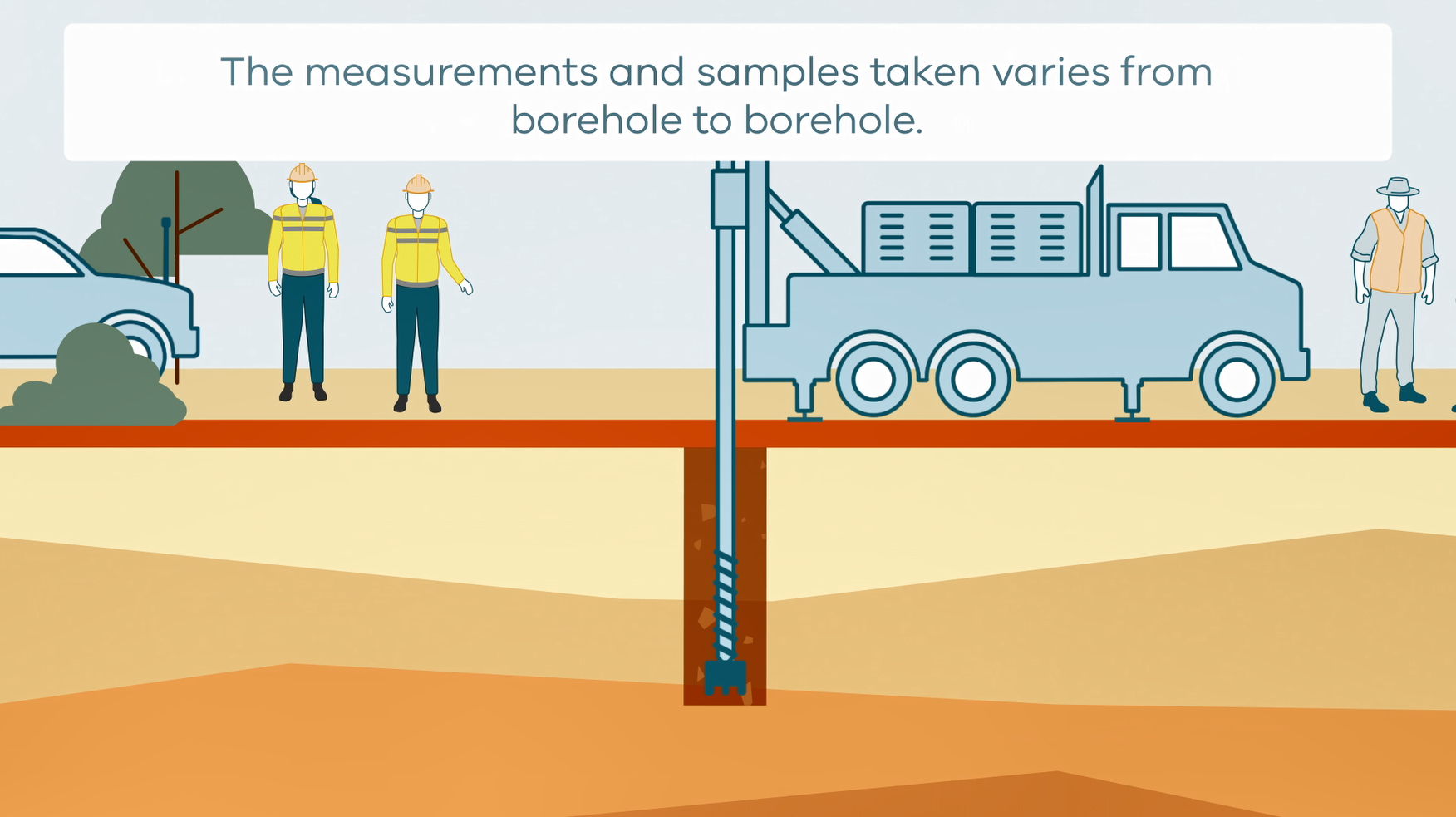
This animation shows how stratigraphic drilling is conducted. It is part of a series of Field Activity Technique Engagement Animations. The target audience are the communities that are impacted by GA's data acquisition activities. There is no sound or voice over. The 2D animation includes a simplified view of what stratigraphic drilling looks like, what measurements and samples are taken, and how scientists use the data.
-
Promotional Video designed to highlight the appeal of the Geological TimeWalk and attract visitors to Geoscience Australia, featuring GA Chief Scientist Dr. Steve Hill.
-
Flyer for year 9 students promoting careers in geoscience
-
This collection of documents detail various field techniques and processes that GA conduct. They are in conjunction with a series of Field Activity Technique Engagement Animations. The target audience are the communities that are impacted by our data acquisition activities. Field techniques in this collection include; • AEM fixed wing • AEM Helicopter • Borehole Geophysics • Goundwater sampling • Magnetotelluric (MT) surveys • Passive seismic surveys • Rapid Deployment Kits (RDKs) • Reflection seismic surveys • Surface Magnetic Resonance (SMR) surveys • Stratigraphic drilling
-
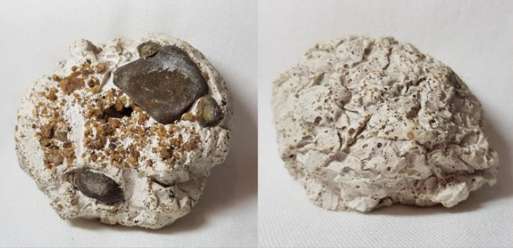
Would you like to make your own rock? In this set of activities you can simulate the natural processes that form sedimentary rocks in just a few hours, instead of taking millions and millions of years. All the activities can be undertaken using readily available materials. Supervision recommended.
-
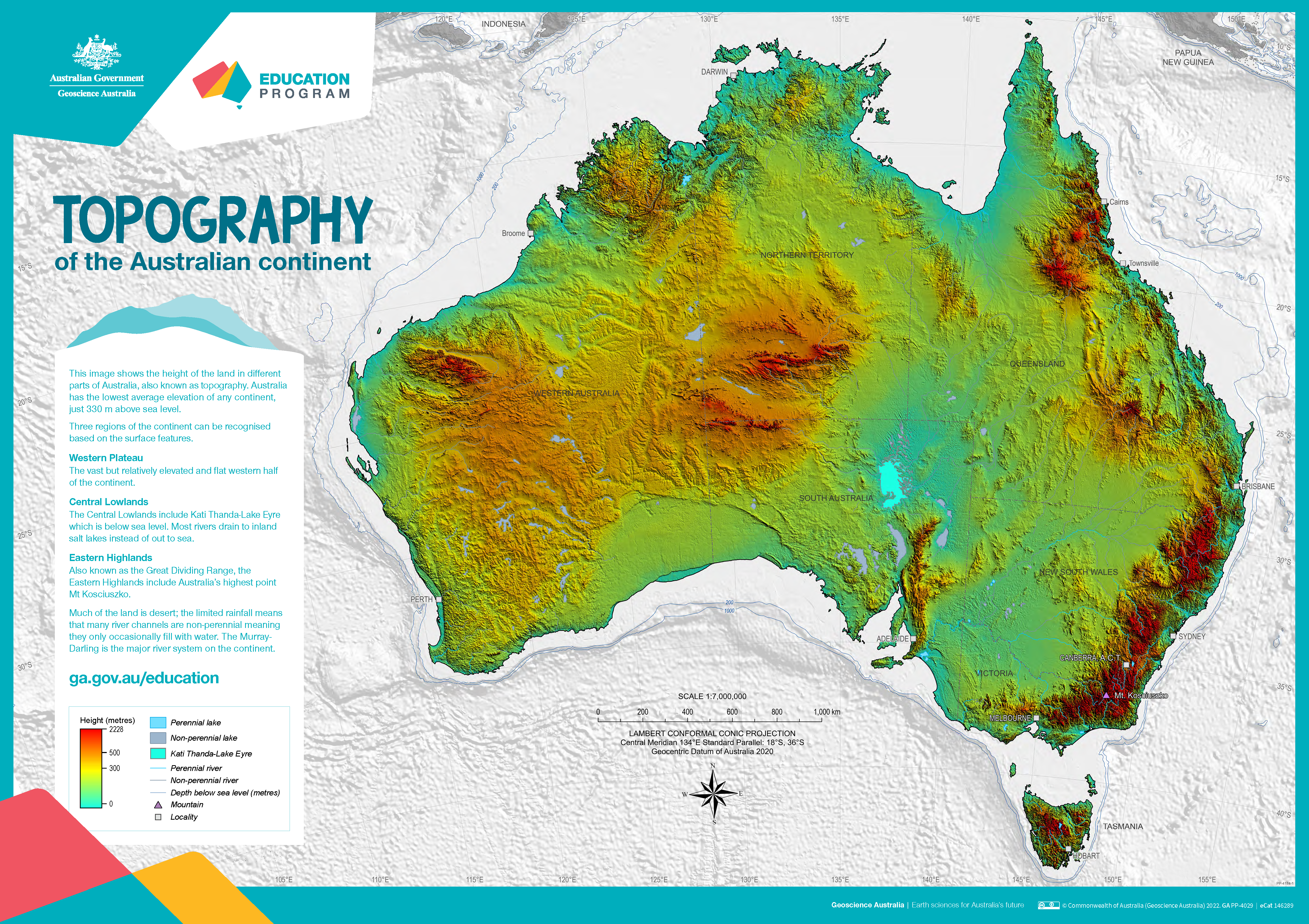
The poster uses a colourful digital elevation model to show the topography of the Australian continent. Low land is shown in green, higher land is yellow and orange and the highest parts of the country appear red. The map also shows perennial and non-perennial lakes and rivers as well as the location of the highest point in Australia and Kati Thanda-Lake Eyre at below sea level. The surrounding 200 m and 1000 m seabed depths contours are shown against a grey background. An accompanying text box outlines the three main physical regions of the county: the western plateau, central lowlands and eastern highlands. The poster is designed to be printed at A1 size which is 1:7 000 000 scale.
-
This short video by the Geoscience Australia Education Team is targeted at upper primary students but is suitable for a wider audience. It introduces the concept of tectonic plates making use of a tectonic plates puzzle. Students are asked to predict the direction and speed of plate movement and consider where and why earthquakes happen on the Australian Plate. It is an introduction to major concepts of Earth science delivered in a light-hearted manner with an interactive presentation style.
-
Videos of our primary professional learning sessions: Year 3-4 Stage 2 (middle primary): This session focussed on ‘Earth’s surface changes over time as a result of natural processes and human activity’. The activities emphasised practical investigations of weathering and erosion processes. 30 minutes long. Year 5-6 Stage 3 (upper primary): This session focused on teaching about ‘Sudden geological changes and extreme weather events that can affect Earth’s surface’. Geohazards were the main topic covered and suggested activities to undertake with students were demonstrated. 50 minutes long. These sessions are recordings of Zoom presentations. The accompanying PowerPoint slides are available for download, the presentations also include demonstrations of hands on activities. <p>