DCD
Type of resources
Keywords
Publication year
Topics
-
A poster presenting the new comprehensive compilation of geochemical data from a range of sample media has been undertaken across the highly prospective, but largely buried, Curnamona Province and cover sequences. The data has sourced from Geoscience Australia and State Geological Survey databases, company reports and academic studies. Each dataset has been run through rigorous quality control processes to correct or remove major data problems, remove duplicates, and standardise the data structures. This will be the go-to source for geochemical data in the Curnamona, enabling quick access to usable geochemical data, which is valuable to quickly feed into geochemical exploration and mineral modelling activities. Concurrently, the compilation is supporting Geoscience Australia’s ongoing research in the next two years into characterising geochemical baselines to enable more sensitive anomaly detection. This presentation was given to the 2022 Uncover Curnamona 2022 Conference 31 May - 2 June:<br>(https://www.gsa.org.au/common/Uploaded%20files/Events/Uncover%20Curnamona%202021/UC2022_short_program_A4_web%20(003).pdf)
-
<div>A keynote talk talk given at Uncover Curnamona 2022 by Angela O'Rourke outlining the rationale, work program and new data acquisition for Geoscience Australia's Darling-Curnamona-Delamerian Project within Exploring for the Future</div> This presentation was given to the 2022 Uncover Curnamona 2022 Conference 31 May - 2 June:<br>(https://www.gsa.org.au/common/Uploaded%20files/Events/Uncover%20Curnamona%202021/UC2022_short_program_A4_web%20(003).pdf)
-
The AusArray program aims to install small temporary passive seismic stations every 200 km across Australia. The seismic stations will passively measure small natural vibrations that travel through the Earth to help scientists understand the distribution and composition of rocks beneath the ground. Seismometers are sensitive instruments used to measure small natural vibrations that travel through the Earth caused by earthquakes, waves breaking on the shore and even wind. The data collected are analysed to create a three-dimensional model of the Earth’s subsurface. Passive seismic data can be used to model the Earth‘s structure, which is used to infer the geological history and assess the resource potential and natural hazards of the region.
-
<div>As part of the Australia's Resources Framework Project, in the Exploring for the Future Program, Geoscience Australia and CSIRO have undertaken a magnetic source depth study across four areas. These are: 1) the western part of Tasmania that is the southernmost extension of the Darling-Curnamona-Delamerian (DCD) project area; 2) northeastern Queensland; 3) the Officer Basin area of western South Australia and southeastern West Australia; and 4) the 'Eastern Resources Corridor' (ERC) covering eastern South Australia, southwest Queensland, western New South Wales and western Victoria. This study has produced 2005 magnetic estimates of depth to the top of magnetization. The solutions are derived by a consistent methodology (targeted magnetic inversion modelling, or TMIM; also known as ‘sweet-spot’ modelling). </div><div><br></div><div>The magnetic depth estimates produced as part of this study provide depth constraints in data-poor areas. They help to construct a better understanding of the 3D geometry of the Australian continent, and aid cover thickness modelling activities. </div><div><br></div><div>A supplementary interpretation data release is also available through Geoscience Australia's enterprise catalogue (ecat) at https://pid.geoscience.gov.au/dataset/ga/149499.</div><div><br></div><div>Geoscience Australia’s Exploring for the Future program provides precompetitive information to inform decision-making by government, community and industry on the sustainable development of Australia's mineral, energy and groundwater resources. By gathering, analysing and interpreting new and existing precompetitive geoscience data and knowledge, we are building a national picture of Australia’s geology and resource potential. This leads to a strong economy, resilient society and sustainable environment for the benefit of all Australians. This includes supporting Australia’s transition to net zero emissions, strong, sustainable resources and agriculture sectors, and economic opportunities and social benefits for Australia’s regional and remote communities. The Exploring for the Future program, which commenced in 2016, is an eight year, $225m investment by the Australian Government. This work contributes to building a better understanding of the Australian continent, whilst giving the Australian public the tools they need to help them make informed decisions in their areas of interest.</div>
-
<div>Poster for the Specialist Group in Geochemistry, Mineralogy & Petrology (SGGMP) conference in Yallingup WA in November 2022.</div><div><br></div>This Poster was presented to the 2022 Specialist Group in Geochemistry, Mineralogy and Petrology (SGGMP) Conference 7-11 November (https://gsasggmp.wixsite.com/home/biennial-conference-2021)
-
Geoscience Australia, in collaboration with state government agencies, has been collecting magnetotelluric (MT) data as part of the Australian Lithospheric Architecture Magnetotelluric Project (AusLAMP) for several years. This program aims to map the electrical resistivity of the rock layers, at depths from ten kilometres to hundreds of kilometres, across the entire continent. AusLAMP sites are each about 55 km apart from each other. Locations are chosen in consultation with landholders and other stakeholders to minimise impacts and avoid disturbance.MT data is collected using sensors that record naturally occurring variations of the Earth’s magnetic and electric fields. The equipment does not produce or transmit and signals. After four to six weeks the equipment is retrieved and the site restored to its original condition.
-
<div>This data package contains interpretations of airborne electromagnetic (AEM) conductivity sections in the Exploring for the Future (EFTF) program’s Eastern Resources Corridor (ERC) study area, in south eastern Australia. Conductivity sections from 3 AEM surveys were interpreted to provide a continuous interpretation across the study area – the EFTF AusAEM ERC (Ley-Cooper, 2021), the Frome Embayment TEMPEST (Costelloe et al., 2012) and the MinEx CRC Mundi (Brodie, 2021) AEM surveys. Selected lines from the Frome Embayment TEMPEST and MinEx CRC Mundi surveys were chosen for interpretation to align with the 20 km line-spaced EFTF AusAEM ERC survey (Figure 1).</div><div>The aim of this study was to interpret the AEM conductivity sections to develop a regional understanding of the near-surface stratigraphy and structural architecture. To ensure that the interpretations took into account the local geological features, the AEM conductivity sections were integrated and interpreted with other geological and geophysical datasets, such as boreholes, potential fields, surface and basement geology maps, and seismic interpretations. This approach provides a near-surface fundamental regional geological framework to support more detailed investigations. </div><div>This study interpreted between the ground surface and 500 m depth along almost 30,000 line kilometres of nominally 20 km line-spaced AEM conductivity sections, across an area of approximately 550,000 km2. These interpretations delineate the geo-electrical features that correspond to major chronostratigraphic boundaries, and capture detailed stratigraphic information associated with these boundaries. These interpretations produced approximately 170,000 depth estimate points or approximately 9,100 3D line segments, each attributed with high-quality geometric, stratigraphic, and ancillary data. The depth estimate points are formatted for compliance with Geoscience Australia’s (GA) Estimates of Geological and Geophysical Surfaces (EGGS) database, the national repository for standardised depth estimate points. </div><div>Results from these interpretations provided support to stratigraphic drillhole targeting, as part of the Delamerian Margins NSW National Drilling Initiative campaign, a collaboration between GA’s EFTF program, the MinEx CRC National Drilling Initiative and the Geological Survey of New South Wales. The interpretations have applications in a wide range of disciplines, such as mineral, energy and groundwater resource exploration, environmental management, subsurface mapping, tectonic evolution studies, and cover thickness, prospectivity, and economic modelling. It is anticipated that these interpretations will benefit government, industry and academia with interest in the geology of the ERC region.</div>
-
A comprehensive compilation of rock, regolith and groundwater geochemistry across the Curnamona Province and overlying basins. This product is part of the Curnamona Geochemistry module of GA's Exploring for the Future program, which is seeking to understand geochemical baselines within the Curnamona Province to support mineral exploration under cover. Data is sourced from GA, CSIRO and state databases, and run through a quality control process to address common database issues (such as unit errors). The data has been separated by sample type and migrated into a standard data structure to make the data internally consistent. A central source for cleaned geochemical data in the same data format is a valuable resource for further research and exploration in the region.
-
As part of the program, the Darling-Curnamona-Delamerian project is investigating the groundwater potential of the upper Darling River floodplain, as well as the mineral and groundwater potential of parts of eastern South Australia, western New South Wales, western Victoria and western Tasmania. Communities, industries and the environment in the upper Darling River region have been impacted by recent droughts. During periods of low flow in the Darling River, groundwater has the potential to be an alternative water source for towns, agriculture and mining. The aim of the Upper Darling River Floodplain Groundwater study is to identify and better understand groundwater supplies beneath the floodplain and its surrounds. When combined with innovative water storage options, these groundwater resources could provide enhanced drought security and promote regional development. The study area covers ~31,000 km2 and includes a 450 km stretch of the Darling River floodplain from Wilcannia upstream to Bourke and Brewarrina.
-
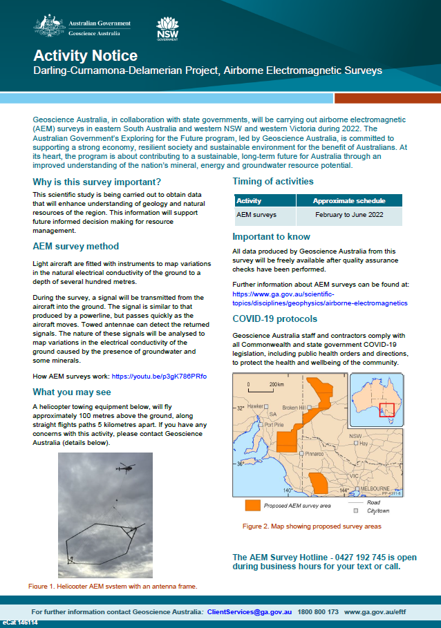
Geoscience Australia, in collaboration with state governments, will be carrying out airborne electromagnetic (AEM) surveys in eastern South Australia and western NSW and Victoria during 2022. The Australian Government’s Exploring for the Future program, led by Geoscience Australia, is committed to supporting a strong economy, resilient society and sustainable environment for the benefit of Australians. At its heart, the program is about contributing to a sustainable, long-term future for Australia through an improved understanding of the nation’s mineral, energy and groundwater resource potential <p>