Hazard
Type of resources
Keywords
Publication year
Service types
Topics
-
The Philippine Institute of Volcanology and Seismology (PHIVOLCS) and Geoscience Australia (GA) have developed a long-term partnership in order to better understand and reduce the risks associated with earthquake hazards in the Philippines. The Project discussed herein was supported by the Australian Agency for International Development (AusAID). Specifically, this partnership was designed to enhance the exposure and damage estimation capabilities of the Rapid Earthquake Damage Assessment System (REDAS), which has been designed and built by PHIVOLCS. Prior to the commencement of this Project, REDAS had the capability to model a range of potential earthquake hazards including ground shaking, tsunami inundation, liquefaction and landslides, as well as providing information about elements at risk (e.g., schools, bridges, etc.) from the aforementioned hazards. The current Project enhances the exposure and vulnerability modules in REDAS and enable it to estimate building damage and fatalities resulting from scenario earthquakes, and to provide critical information to first-responders on the likely impacts of an earthquake in near real-time. To investigate this emergent capability within PHIVOLCS, we have chosen the pilot community of Iloilo City, Western Visayas. A large component of this project has been the compilation of datasets to develop building exposure models, and subsequently, developing methodologies to make these datasets useful for natural hazard impact assessments. Collection of the exposure data was undertaken at two levels: national and local. The national exposure dataset was gathered from the Philippines National Statistics Office (NSO) and comprises basic information on wall type, roof type, and floor area for residential buildings. The NSO census dataset also comprises crucial information on the population distribution throughout the Philippines. The local exposure dataset gathered from the Iloilo City Assessors Office includes slightly more detailed information on the building type for all buildings (residential, commercial, government, etc.) and appears to provide more accurate information on the floor area. However, the local Iloilo City dataset does not provide any information on the number of people that occupy these buildings. Consequently, in order for the local data to be useful for our purposes, we must merge the population data from the NSO with the local Assessors Office data. Subsequent validation if the Iloilo City exposure database has been conducted through targeted foot-based building inventory surveys and has allowed us to generate statistical models to approximate the distribution of engineering structural systems aggregated at a barangay level using simple wall and roof-type information from the NSO census data. We present a comparison of the national and local exposure data and discuss how information assembled from the Iloilo City pilot study - and future study areas where detailed exposure assessments are conducted - could be extended to describe the distribution of building stock in other regions of the Philippines using only the first-order national-scale NSO data. We present exposure information gathered for Iloilo City at barangay level in a format that can be readily imported to REDAS for estimating earthquake impact.
-
Severe TC Vance was one of the most intense cyclones to impact mainland Australia. The observed damage to buildings could be explained in terms of structural performance of those buildings. Combining the structural vulnerability of housing with an estimate of the maximum wind gusts, we can explore the possible impacts that a repeat of Vance would cause in Exmouth, and compare the outcomes with what occurred in 1999. The analysis of the impacts of TC Vance on present-day Exmouth shows that very few houses would be completely destroyed. Not surprisingly, older houses (pre-1980’s construction era, excluding the US Navy block houses) would dominate those destroyed, and most likely the timber-framed style houses, many of which were substantially damaged in TC Vance.
-
With a population of over 250 million people, Indonesia is the fourth most populous country in the world (United Nations, 2013). Indonesia also experiences more earthquakes than any other country in the world (USGS, 2015). Its borders encompass one of the most active tectonic regions on Earth including over 18 000 km of major tectonic plate boundary, more than twice that of Japan or Papua New Guinea (Bird, 2003). The potential for this tectonic activity to impact large populations has been tragically demonstrated by the 20004 Sumatra earthquake and tsunami. In order to inform earthquake risk reduction in Indonesia, a new national earthquake hazard map was developed in 2010 (Irsyam et al., 2010). In this report historical records of damaging earthquakes from the 17th to 19th centuries are used to test our current understanding of earthquake hazard in Indonesia and identify areas where further research is needed. In this report we address the following questions: - How well does our current understanding of earthquake hazard in Indonesia reflect historical activity? - Can we associate major historical earthquakes with known active faults, and are these accounted for in current assessments of earthquake hazard? - Does the current earthquake hazard map predict a frequency and intensity of shaking commensurate with the historical record? - What would the impact of these historical earthquakes be if they were to reoccur today? To help answer questions like these, this report collates historical observations of eight large earthquakes from Java, Bali and Nusa Tenggara between 1699 and 1867. These observations are then used to: - Identify plausible sources for each event; - Develop ground shaking models using the OpenQuake Engine (GEM Foundation, 2015); - Assess the validity of the current national seismic hazard map; and - Estimate fatalities were the historical events to occur today using the InaSAFE (InaSAFE.org, 2015) software.
-
Probabilistic seismic hazard map of Papua New Guinea, in terms of Peak Ground Acceleration, is developed for return period of 475 years. The calculations were performed for bedrock site conditions (Vs30=760 m/s). Logic-tree framework is applied to include epistemic uncertainty in seismic source as well as ground-motion modelling processes. In this regard two source models, using area source zones and smoothed seismicity, are developed. Based on available geological and seismological data, defined seismic sources are classified into 4 different tectonic environments. For each of the tectonic regimes three Ground Motion Prediction Equations are selected and used to estimate the ground motions at a grid of sites with spacing of 0.1 degree in latitude and longitude. Results show high level of hazard in the coastal areas of Huon Peninsula and New Britain/ Bougainville regions and relatively low level of hazard in the southern part of the New Guinea highlands block. In Huon Peninsula, as shown by seismic hazard disaggregation results, high level of hazard is caused by modelled frequent moderate to large earthquakes occurring at Ramu-Markham Fault zone. On the other hand in New Britain/Bougainville region, the geometry and distance to the subduction zone along New Britain Trench mainly controls the calculated level of hazard. It is also shown that estimated level of PGAs is very sensitive to the selection of GMPEs and overall the results are closer to the results from studies using more recent ground-motion models.
-
Probabilistic earthquake hazard maps were prepared for the Fiji Islands. Damage has been caused by Fiji earthquakes around 1850, in 1884, 1902, 1919, 1932 (twice), 1953 and 1979. No previous assessment had produced a comprehensive description of the earthquake hazard in Fiji and the present study was initiated in 1990 when the author was attached to the Mineral Resources Department, Fiji. Collection and analysis of data continued at MRD until 1992 and the study was completed at the Australian Geological Survey Organisation in 1993-1997. The aim of the study was to produce probabilistic earthquake hazard maps which can be used in the National Building Code for Fiji, for design of special structures, for planning, for emergency management and for risk management. Few, if any, similar studies have been undertaken in the seismically active Southwest Pacific.
-
The present study reports on recent developments of the Indonesia Tsunami Early Warning System (InaTEWS), especially with respect to the tsunami modeling components used in that system. It is a dual system: firstly, InaTEWS operates a high-resolution scenario database pre-computed with the finite element model TsunAWI; running in parallel, the system also contains a supra real-time modeling component based on the GPU-parallelized linear long-wave model easyWave capable of dealing with events outside the database coverage. The evolution of the tsunami scenario database over time is covered in the first sections. Starting from the mere coverage of the Sunda Arc region, the current state contains scenarios in 15 fault zones. The study is augmented by an investigation of warning products used for early warning like the estimated wave height (EWH) and the estimated time of arrival (ETA). These quantities are determined by easyWave and TsunAWI with model specific approaches. Since the numerical setup of the models is very different, the extent of variations in warning products is investigated for a number of scenarios, where both pure database scenarios and applications to real events are considered.
-
On the 30th September 2009 a magnitude 7.6 earthquake struck West Sumatra in the Padang and Pariaman regions. It caused widespread damage to buildings and resulted and an estimated 1,117 fatalities. Thankfully the event was not accompanied by a tsunami that could have had additional devastating impacts and a greatly increased mortality. Under its mandate the AIFDR responded to the earthquake event with the objective of deriving an understanding of the factors that had contributed to outcome. It supported a team of Indonesian and international engineers and scientists who collected and analysed damage information that could subsequently be used for future disaster risk reduction in West Sumatra and Indonesia more broadly. The activity was jointly led by the Centre for Disaster Mitigation at the Institut Teknologi Bandung (ITB) and Geoscience Australia. This report provides a background to the region, describes the nature of the earthquake and its impacts, details the survey activity and outlines the significant outcomes that has come from it. Importantly, it makes several recommendations to assist in the regional reconstruction after the event and to guide future development in the Padang region and Indonesia more generally.
-
Indonesia is located in one of the most seismically active regions in the world and often experiences damaging earthquakes. In the past the housing sector has sustained more damage and losses than other sectors due to earthquakes. This is often attributed to the fact that the most common houses in Indonesia are non-engineered, built with poor quality workmanship, poor quality materials and without resilient seismic design features. However little effort has been made to quantify how fragile these houses are, or how the fragility of these houses may vary according to location or wealth. It is not possible to derive empirical fragility functions for Indonesia due to insufficient damage data. The aim of this study is to determine whether existing earthquake fragility functions can be used for common houses in Indonesia. Scenario damage analyses were undertaken several times using different sets of fragility functions for the 2006 Yogyakarta and 2009 Padang events. The simulated damage results were then compared to the damage observed post event to determine whether an accurate damage prediction could be achieved. It was found that the common houses in Yogyakarta and Central Java vary according to age, location and wealth and can be reasonably well represented by existing fragility functions. However, the houses in Padang and surrounding West Sumatra did not vary in a predictable manner and are more fragile than anticipated. Therefore, the fragility of the most common houses in Indonesia is not uniform across the country. This has important implications for seismic damage and risk assessment undertaken in Indonesia. <b>Citation:</b> Weber, R., Cummins, P. & Edwards, M. Fragility of Indonesian houses: scenario damage analysis of the 2006 Yogyakarta and 2009 Padang earthquakes. <i>Bull Earthquake Eng</i> (2024). https://doi.org/10.1007/s10518-024-01930-z
-
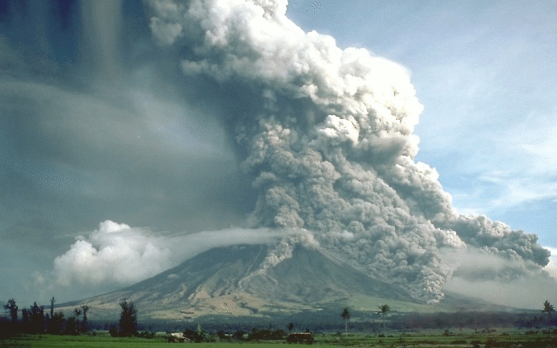
Activity for secondary and senior secondary students examining a hypothetical city and its vulnerability to volcanic hazard risk. Includes background information for teachers, PowerPoint presentation, student activity sheet and worked answers.
-
As part of the 2018 Tropical Cyclone Hazard Assessment (TCHA), we compiled the geospatial raster dataset that can be accessible to internal and external users via ArcGIS online and can be integrated for building additional geoprocessing applications. This web service gives more stable and easy access to data and interactive maps. With having separate geospatial layers for each recurrence interval- i.e. 5 through 10000 years, users can toggle between the layers and evaluate the changes in wind speed (km/hr) and potential areas at risk on the fly.