Hazard
Type of resources
Keywords
Publication year
Service types
Topics
-
Severe TC Vance was one of the most intense cyclones to impact mainland Australia. The observed damage to buildings could be explained in terms of structural performance of those buildings. Combining the structural vulnerability of housing with an estimate of the maximum wind gusts, we can explore the possible impacts that a repeat of Vance would cause in Exmouth, and compare the outcomes with what occurred in 1999. The analysis of the impacts of TC Vance on present-day Exmouth shows that very few houses would be completely destroyed. Not surprisingly, older houses (pre-1980’s construction era, excluding the US Navy block houses) would dominate those destroyed, and most likely the timber-framed style houses, many of which were substantially damaged in TC Vance.
-

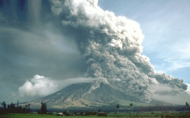
Activity for secondary and senior secondary students examining a hypothetical city and its vulnerability to volcanic hazard risk. Includes background information for teachers, PowerPoint presentation, student activity sheet and worked answers.
-
As part of the 2018 Tropical Cyclone Hazard Assessment (TCHA), we compiled the geospatial raster dataset that can be accessible to internal and external users via ArcGIS online and can be integrated for building additional geoprocessing applications. This web service gives more stable and easy access to data and interactive maps. With having separate geospatial layers for each recurrence interval- i.e. 5 through 10000 years, users can toggle between the layers and evaluate the changes in wind speed (km/hr) and potential areas at risk on the fly.
-
Data used to generate the National Seismic Hazard Assessments (NSHA). Data includes: original and modified earthquake catalogues, earthquake rate models, probabilistic seismic hazard outputs. The most recent assessment was completed in 2018 and can be viewed on Geoscience Australia's <a href="http://www.ga.gov.au/about/projects/safety/nsha">National Seismic Hazard Assessment (NSHA) Internet Page</a> <b>Value: </b> Data used to generate the NSHA <b>Scope: </b>Continental scale
-
The Philippine archipalego is tectonically complex and seismically hazardous, yet few seismic hazard assessments have provided national coverage. This paper presents an updated probabilistic seismic hazard analysis for the nation. Active shallow crustal seismicity is modeled by faults and gridded point sources accounting for spatially variable occurrence rates. Subduction interfaces are modelled with faults of complex geometry. Intraslab seismicity is modeled by ruptures filling the slab volume. Source geometries and earthquake rates are derived from seismicity catalogs, geophysical datasets, and historic-to-paleoseismic constraints on fault slip rates. The ground motion characterization includes models designed for global use, with partial constraint by residual analysis. Shallow crustal faulting near metropolitan Manila, Davao, and Cebu dominates shaking hazard. In a few places, peak ground acceleration with 10% probability of exceedance in 50 years on rock reaches 1.0 g. The results of this study may assist in calculating the design base shear in the National Structural Code of the Philippines.
-
An evaluation of the likelihood of tropical cyclone-related extreme winds, incorporating local effects on wind speed.
-
Hot emissions of mainly sulphur dioxide and carbon dioxide took place from a mound in Koranga open cut, near Wau, following a landslide at the end of May, 1967. Rocks of the Holocene volcano, Koranga, are exposed in the open cut. The emissions lasted about three months, and ceased on 13 August after another landslide removed the active mound. During the period of activity, recorded temperatures ranged up to 680°C; no anomalous seismic or tilt phenomena were recorded. The cause of the activity is not known, but it is thought that the high temperatures and gases may have been the result of the spontaneous combustion of reactive sulphides and carbonaceous material present in the altered rocks of Koranga volcano.
-
The Greater Metro Manila Area is one of the world's megacities and is home to about 12 million people. It is located in a region at risk from earthquakes, volcanic eruptions, tropical cyclones, riverine flooding, landslides and other natural hazards. Major flooding affected the Greater Metro Manila Area in September 2009 following the passage of Typhoon Ketsana (known locally as Typhoon Ondoy). Following this event, the Australian Aid Program supported Geoscience Australia to undertake a capacity building project with its partner agencies in the Government of the Philippines. The output of this project has been a series of risk information products developed by agencies in the Collective Strengthening of Community Awareness for Natural Disasters (CSCAND) group. These products quantify the expected physical damage and economic loss to buildings caused by earthquakes, tropical cyclone severe wind and riverine flooding across the Greater Metro Manila Area. Spatial data is a key input to the development of hazard models and information on exposure, or the 'elements at risk'. The development of a spatially enabled exposure database was a crucial element in the construction of risk information products for the Greater Metro Manila Area. The database provides one central repository to host consistent information about the location, size, type, age, residential population and structural characteristics of buildings within the area of interest. Unique spatial analysis techniques were employed to quantify and record important aspects of the built environment, for inclusion in the database. The process of exposure data development within the Greater Metro Manila Area, including a new application developed by Geoscience Australia for estimating the geometric characteristics of buildings from high resolution elevation data and multi-spectral imagery, will be presented.
-
Many scientific talks by Geoscience Australia staff are published on YouTube. These documents provide summaries (‘crib sheets’) of the presentations along with easy access links to each part of the video. They are intended to help teachers of Year 11/12 classes learning about natural hazards
-
Tsunami hazard modelling for Tonga shows the potential impacts of tsunami generated by a very large earthquake on the nearby Tongan Trench.

