EDUCATION
Type of resources
Keywords
Publication year
Topics
-

<div>The A1 poster incorporates 4 images of Australia taken from space by Earth observing satellites. The accompanying text briefly introduces sensors and the bands within the electromagnetic spectrum. The images include examples of both true and false colour and the diverse range of applications of satellite images such as tracking visible changes to the Earth’s surface like crop growth, bushfires, coastal changes and floods. Scientists, land and emergency managers use satellite images to analyse vegetation, surface water or human activities as well as evaluate natural hazards.</div>
-
This activity introduces the concepts of weathering and erosion by investigating why river pebbles are often rounded. The download includes background information for teachers and an activity sheet for students. The activity demonstrates the process of erosion using sugar cubes. Participants are asked to predict what might happen (a hypothesis) and then observe what does happen and relate this to the natural environment. A supporting video is available from YouTube.
-
Article for the Australian Journal of Emergency Management (AJEM), October 2019 ed. Lead authors were Department of Fire and Emergency Services (WA), co-authored by GA. This article includes discussion of how GA's data and products - specifically felt report data and trial ShakeMap and Did-You-Feel-It products were used by DFES in the days following the Magnitude 6.6 earthquake which occurred 210km offshore from Broome, WA, on 14 July 2019. The data and products contributed to DFES' understanding of what local communities experienced, how they responded, and the extent of building and infrastructure damage caused by the earthquake. This understanding will contribute to DFES' community awareness programs focusing on safety and preparedness, and to DFES' own response and recovery planning.
-
A two part Indigenous-led and produced Aboriginal cultural heritage awareness training video for Geoscience Australia staff. The video explores a number of topics from the perspective of Traditional Owners and Custodians. Topics covered include: What is Country, Lore and Kinship; the importance of listening, connecting to Country and the transference of knowledge; Aboriginal cultural heritage legislation and policy in Australia, native title and cultural heritage; the impact of past policies; and, working towards best practice. The video complements Geoscience Australia's Land Access and Cultural Heritage Policy, Procedures and Best Practice Standards.
-
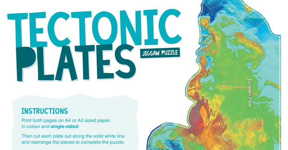
World elevation map that shows the shape of the major tectonic plates. Physical print in colour for giveaway. When completed the 'Tectonic Plates Jigsaw Puzzle' will fit on a desk. Suitable for primary Years 5-6 and secondary Years 7-12.
-
This video is a flythrough around the coast of Australia shows the major topographic features of the seafloor around the continent. Starting in the south west the viewer can see the continental shelf and slope of the southern coast followed by the seamount chains and the Great Barrier Reef to the east. Continuing around the north then west coast the eastern end of the Java Trench is shown before returning to Perth and pulling out to show the whole continent. The bathymetry is shown at x12 exaggeration and uses a modern colour ramp. Video length 2min 30 sec.
-
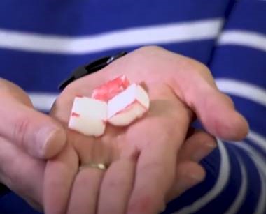
Background information for teachers/parents and an activity about earthquake magnitude using spaghetti pasta.
-
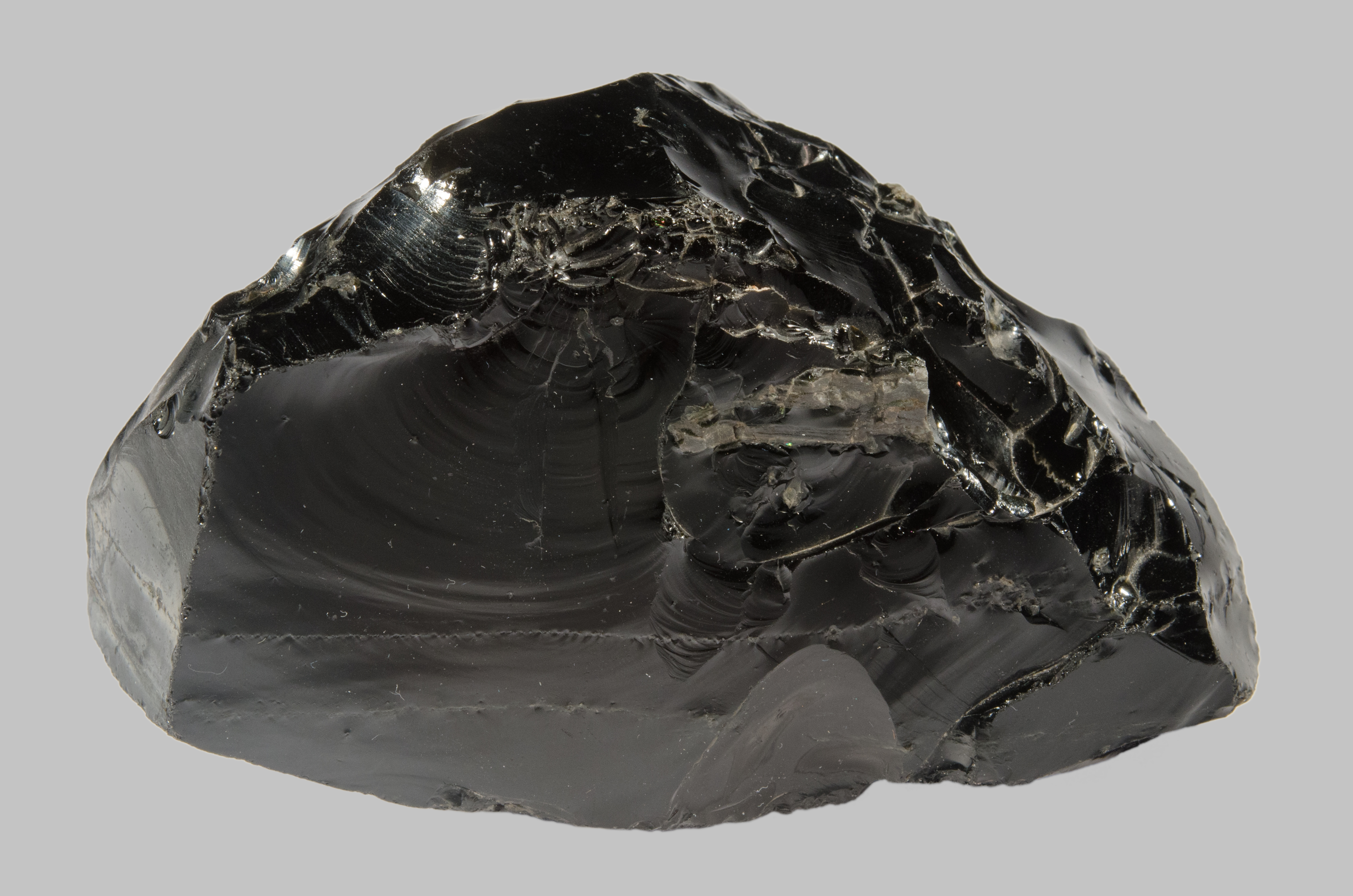
Google Arts and Culture exhibit explaining how man-made and natural glass is formed and the key characteristics of glass. The exhibit features high quality images of fulgurites (glass created by lightning), obsidian (glass from volcanoes) and Australites (glass created by meteorite impacts). The accompanying crossword draws upon content within the exhibit.
-
In 1969, an explosive shower of meteorites fell outside the town of Murchison in country Victoria. Containing organic material as well as space dust grains older than the solar system, the Murchison Meteorite has become one of the most studied meteorites and a treasure trove for science. Hear about an eye-witness account of its fall to Earth and see samples of the meteorite in the National Mineral and Fossil Collection at Geoscience Australia.
-
Explore important concepts about groundwater using this comprehensive teaching resource. This mini unit includes case studies of Australian groundwater topics, First Nations Australian perspectives about water use and groundwater are also included. This mini unit included four files - the guide, 2 x student activities and a kml file. The guide includes educator tips as well as answers to the student activities. Suitable for upper primary to lower secondary students.