OGC:WFS
Type of resources
Keywords
Publication year
Distribution Formats
Service types
Topics
-
This web service delivers metadata for onshore active and passive seismic surveys conducted across the Australian continent by Geoscience Australia and its collaborative partners. For active seismic this metadata includes survey header data, line location and positional information, and the energy source type and parameters used to acquire the seismic line data. For passive seismic this metadata includes information about station name and location, start and end dates, operators and instruments. The metadata are maintained in Geoscience Australia's onshore active seismic and passive seismic database, which is being added to as new surveys are undertaken. Links to datasets, reports and other publications for the seismic surveys are provided in the metadata.
-
This web service provides access to the National Telephone Exchanges dataset and presents the spatial locations of all the known telephone exchange facilities located within Australia, all complemented with feature attribution.
-
This web service contains sediment and geochemistry data for the Oceanic Shoals Commonwealth Marine Reserve (CMR) in the Timor Sea collected by Geoscience Australia during September and October 2012, on RV Solander (survey GA0339/SOL5650).
-
This web service provides access to the National Dam Walls dataset and presents the spatial locations of major dam walls located within Australia, all complemented with feature attribution.
-
This web service provides access to the Australian Stratigraphic Units Database (ASUD), the national authority on stratigraphic names in Australia. The database is maintained by Geoscience Australia on behalf of the Australian Stratigraphy Commission, a standing committee of the Geological Society of Australia. Where possible this service conforms to the GeoSciML v4.1 data transfer standard.
-
This web service provides access to the National Local Government Area Council Offices dataset and presents the spatial locations of all known Local Government Area council office facilities within Australia, all complemented with feature attribution.
-
Publicly available bathymetry and geophysical data has been used to map geomorphic features of the Antarctic continental margin and adjoining ocean basins at scales of 1:1-2 million. The key bathymetry datasets used were GEBCO08 and ETOPO2 satellite bathymetry (Smith & Sandwell 1997), in addition to seismic lines in key areas. Twenty-seven geomorphic units were identified based on interpretation of the seafloor bathymetry with polygons digitised by hand in ArcGIS.
-
This service provides access to inorganic geochemistry data obtained from chemical analyses of rock and regolith samples collected during mapping and sampling programs in Australia. This service will provide a spatial distribution of the sample attributes as well as provide a spatial distribution of the analytical composition of the samples with respect to major elements, minor elements and rare earth elements. This service includes original inorganic geochemistry data levelled to reference datasets.
-
This web service provides access to the Geoscience Australia (GA) ISOTOPE database containing compiled age and isotopic data from a range of published and unpublished (GA and non-GA) sources. The web service includes point layers (WFS, WMS, WMTS) with age and isotopic attribute information from the ISOTOPE database, and raster layers (WMS, WMTS, WCS) comprising the Isotopic Atlas grids which are interpolations of the point located age and isotope data in the ISOTOPE database.
-

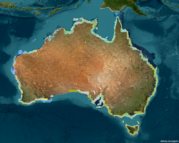
The service contains the Australian Coastal Geomorphology Environments, used to support a national coastal risk assessment. It describes the location and extent primary geomorphological environments (both dispositional and erosional) present along the Australia coast and the processes acting on the features within.
