Parks Australia
Type of resources
Keywords
Publication year
Service types
Topics
-
This OGC Web Feature Service (WFS) contains geospatial seabed morphology and geomorphology information for Cairns Seamount within the Coral Sea Marine Park and are intended for use by marine park managers, regulators, the general public and other stakeholders. This web service uses the data product published in McNeil et al. (2023); eCat Record 147998.
-
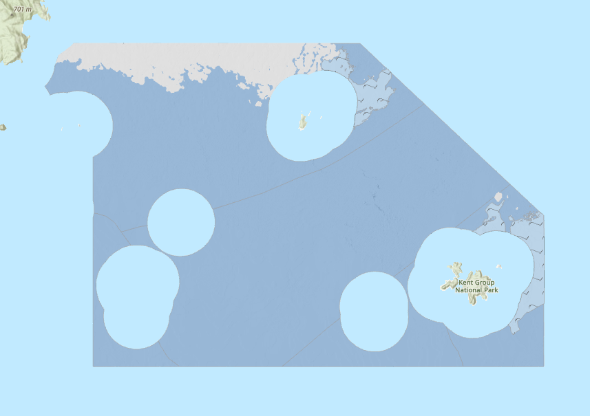
This OGC Web Map Service (WMS) contains seabed morphology and geomorphology information for a subset area of Zeehan Marine Park (South-east Marine Parks Network) and is intended for use by marine park managers, regulators and other stakeholders. This web service uses the data product published in McNeil et al. (2023); eCat Record 148620.
-
This OGC Web Map Service (WMS) contains geospatial seabed morphology and geomorphology information for Cairns Seamount within the Coral Sea Marine Park and are intended for use by marine park managers, regulators, the general public and other stakeholders. This web service uses the data product published in McNeil et al. (2023); eCat Record 147998.
-
This OGC Web Feature Service (WFS) contains geospatial seabed morphology and geomorphology information for Flinders Reefs within the Coral Sea Marine Park and are intended for use by marine park managers, regulators, the general public and other stakeholders. This web service uses the data product published in McNeil et al. (2023); eCat Record 147998.
-
This ESRI map (web) service contains geospatial seabed morphology and geomorphology information for the Beagle Marine Park (South-east Marine Parks Network) and is intended for use by marine park managers, regulators and other stakeholders. This web service uses the data product published in Nanson et al. (2023); eCat Record 147976.
-
This OGC Web Map Service (WMS) contains geospatial seabed morphology and geomorphology information for the Beagle Marine Park (South-east Marine Parks Network) and is intended for use by marine park managers, regulators and other stakeholders. This web service uses the data product published in Nanson et al. (2023); eCat Record 147976.
-
This ESRI map (web) service contains geospatial seabed morphology and geomorphology information for Flinders Reefs within the Coral Sea Marine Park and are intended for use by marine park managers, regulators, the general public and other stakeholders. This web service uses the data product published in McNeil et al. (2023); eCat Record 147998.
-
This OGC Web Map Service (WMS) contains geospatial seabed morphology and geomorphology information for Flinders Reefs within the Coral Sea Marine Park and are intended for use by marine park managers, regulators, the general public and other stakeholders. This web service uses the data product published in McNeil et al. (2023); eCat Record 147998.
-
This OGC Web Feature Service (WFS) contains seabed morphology and geomorphology information for a subset area of Zeehan Marine Park (South-east Marine Parks Network) and is intended for use by marine park managers, regulators and other stakeholders. This web service uses the data product published in McNeil et al. (2023); eCat Record 148620.
-
This ESRI map (web) service contains geospatial seabed morphology and geomorphology information for Cairns Seamount within the Coral Sea Marine Park and are intended for use by marine park managers, regulators, the general public and other stakeholders. This web service uses the data product published in McNeil et al. (2023); eCat Record 147998.