Geoscience Knowledge Sharing
Type of resources
Keywords
Publication year
Topics
-
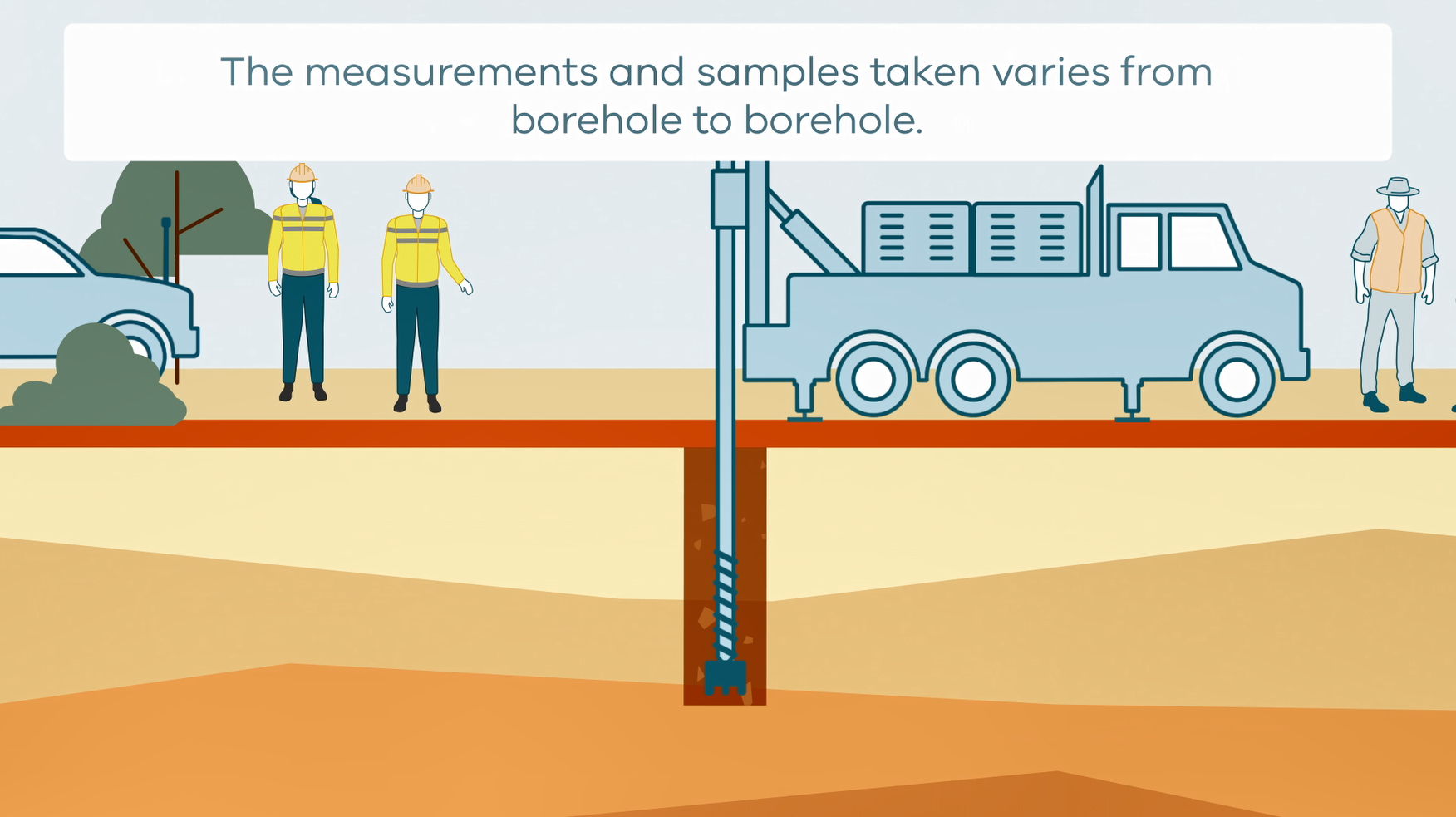
This animation shows how stratigraphic drilling is conducted. It is part of a series of Field Activity Technique Engagement Animations. The target audience are the communities that are impacted by GA's data acquisition activities. There is no sound or voice over. The 2D animation includes a simplified view of what stratigraphic drilling looks like, what measurements and samples are taken, and how scientists use the data.
-
This animation shows how Airborne Electromagnetic Surveys Work, when conducted by a rotary wing (helicopter) aircraft. It is part of a series of Field Activity Technique Engagement Animations. The target audience are the communities that are impacted by our data acquisition activities. There is no sound or voice over. The 2D animation includes a simplified view of what AEM equipment looks like, what the equipment measures and how the survey works.
-
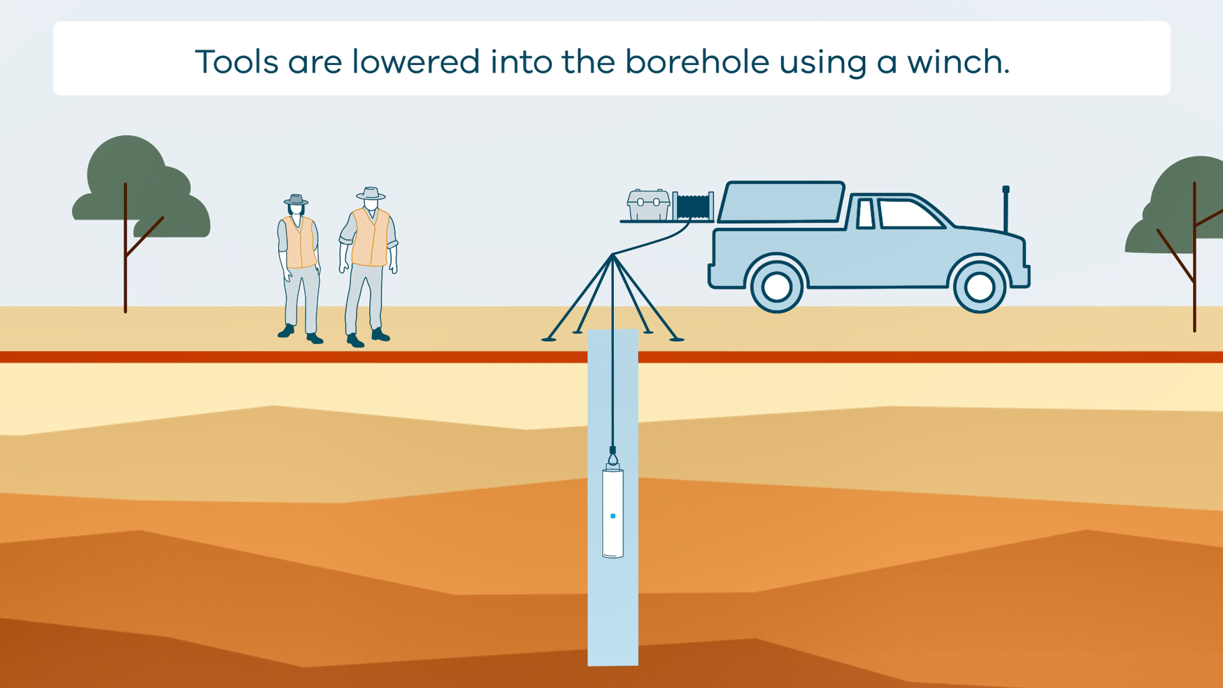
This animation shows how borehole geophysical surveys are conducted. It is part of a series of Field Activity Technique Engagement Animations. The target audience are the communities that are impacted by GA's data acquisition activities. There is no sound or voice over. The 2D animation includes a simplified view of what borehole geophysics equipment looks like, what the equipment measures and how scientists use the data.
-
The Exploring for the Future program Showcase 2023 was held on 15-17 August 2023. Day 2 - 16th August talks included: Highways to Discovery and Understanding Session AusAEM - Unraveling Australia's Landscape with Airborne Electromagnetics – Dr Yusen Ley Cooper Exploring for the Future Data Discovery Portal: A scenic tour – Simon van der Wielen Towards equitable access to regional geoscience information– Dr Kathryn Waltenberg Community engagement and geoscience knowledge sharing: towards inclusive national data and knowledge provision – Dr Meredith Orr Foundational Geoscience Session The power of national scale geological mapping – Dr Eloise Beyer New surface mineralogical and geochemical maps of Australia – Dr Patrice de Caritat Imaging Australia’s Lithospheric Architecture – Dr Babak Hejrani Metallogenic Potential of the Delamerian Margin– Dr Yanbo Cheng You can access the recording of the talks from YouTube here: <a href="https://youtu.be/ZPp2sv2nuXI">2023 Showcase Day 2 - Part 1</a> <a href="https://youtu.be/dvqP8Z5yVtY">2023 Showcase Day 2 - Part 2</a>
-
The Exploring for the Future program Showcase 2023 was held on 15-17 August 2023. Day 1 - 15th August talks included: Resourcing net zero – Dr Andrew Heap Our Geoscience Journey – Dr Karol Czarnota You can access the recording of the talks from YouTube here: <a href="https://youtu.be/uWMZBg4IK3g">2023 Showcase Day 1</a>
-
<div><strong>Output Type: </strong>Exploring for the Future Extended Abstract</div><div><br></div><div><strong>Short Abstract:</strong> Under the Exploring for the Future (EFTF) program, Geoscience Australia staff and collaborators engaged with land-connected stakeholders that managed or had an interest in land comprising 56% of the total land mass area of Australia. From 2020 to 2023, staff planning ground-based and airborne geophysical and geological data acquisition projects consulted farmers, National Park rangers and managers, Native Title holders, cultural heritage custodians and other land-connected people to obtain land access and cultural heritage clearances for surveys proposed on over 122,000 parcels of land. Engagement did not always result in field activities proceeding. To support communication with this diverse audience, animations, comic-style factsheets, and physical models, were created to help explain field techniques. While the tools created have been useful, the most effective method of communication was found to be a combination of these tools and open two-way discussions.</div><div><br></div><div><strong>Citation: </strong>Sweeney, M., Kuoni, J., Iffland, D. & Soroka, L., 2024. Improving how we engage with land-connected people about geoscience. In: Czarnota, K. (ed.) Exploring for the Future: Extended Abstracts. Geoscience Australia, Canberra. https://doi.org/10.26186/148760</div>
-
<div><strong>Output Type: </strong>Exploring for the Future Extended Abstract</div><div><br></div><div><strong>Short Abstract: </strong>The last three decades have seen growing investment in land management by First Nations Australians across the continent, arising from increases in formally recognised rights and interests of First Nations Australian peoples in land and waters and the demonstrated environmental, economic and social benefits of their natural resource management. The Exploring for the Future program worked with three types of organisations—a Registered Native Title Body Corporate (RNTBC), a First Nations ranger program and a land council—to learn how geoscience knowledge and data can support First Nations Australians in managing Country. The Nguddaboolgan Native Title Aboriginal Corporation, the Lake Eyre Basin Rangers and the Anindilyakwa Land Council all shared their perspectives and priorities in managing Country. Soil geoscience, groundwater and Earth observation from satellites emerged as three themes under which geoscience data and knowledge could be shared in new ways for environmental, economic and community benefits. New partnerships with First Nations groups were established which developed clear pathways for geoscience data and information to address First Nations peoples’ priorities in caring for Country.</div><div><br></div><div><strong>Citation: </strong>Orr, M.L., Burns, C.P., Halliday, L., Lafferty, J., Rees, S. & Chau, D., 2024. Building partnerships and sharing geoscience knowledge with First Nations Australians for managing Country In: Czarnota, K. (ed.) Exploring for the Future: Extended Abstracts, Geoscience Australia, Canberra, https://doi.org/10.26186/149721</div>
-
<div>A document outlining how geoscience data can be useful for natural resource managers and engagement tool for geoscientists interacting with these people.</div><div><br></div>
-
<div>As part of the Exploring for the Future Geoscience Knowledge Sharing project, a mobile laboratory was designed and built to help with field work and enhance opportunistic outreach experiences for communities in the areas where field work is taking place. This seminar explores some of the lessons learned from outreach programs planned and evaluated during 2023. The presenters will describe how the craft of stakeholder engagement can be improved by well researched and designed models and engagement exhibits. Outreach not only promotes the field program but also the work an agency does more broadly and can help scientists to better understand the general community who are consumers of data. This in turn can help with future planning of field and other work programs. </div><div><br></div>
-
<div>A document outlining how geoscientific data can be useful for farmers and engagement tool for geoscientists interacting with farmers and pastoralists.</div>