Darling-Curnamona-Delamerian
Type of resources
Keywords
Publication year
Service types
Topics
-
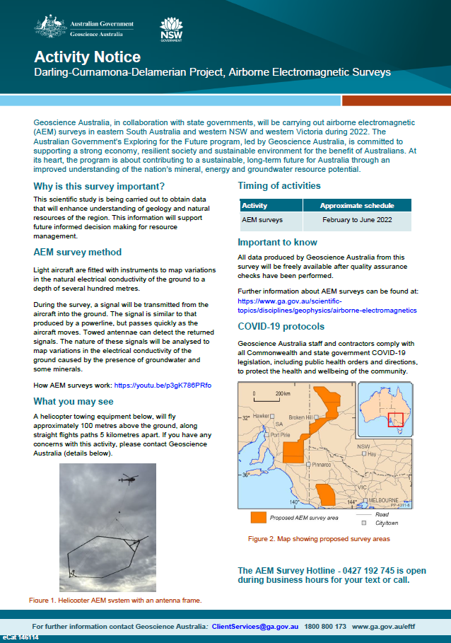
Geoscience Australia, in collaboration with state governments, will be carrying out airborne electromagnetic (AEM) surveys in eastern South Australia and western NSW and Victoria during 2022. The Australian Government’s Exploring for the Future program, led by Geoscience Australia, is committed to supporting a strong economy, resilient society and sustainable environment for the benefit of Australians. At its heart, the program is about contributing to a sustainable, long-term future for Australia through an improved understanding of the nation’s mineral, energy and groundwater resource potential <p>
-
The Exploring for the Future program Showcase 2023 was held on 15-17 August 2023. Day 2 - 16th August talks included: Highways to Discovery and Understanding Session AusAEM - Unraveling Australia's Landscape with Airborne Electromagnetics – Dr Yusen Ley Cooper Exploring for the Future Data Discovery Portal: A scenic tour – Simon van der Wielen Towards equitable access to regional geoscience information– Dr Kathryn Waltenberg Community engagement and geoscience knowledge sharing: towards inclusive national data and knowledge provision – Dr Meredith Orr Foundational Geoscience Session The power of national scale geological mapping – Dr Eloise Beyer New surface mineralogical and geochemical maps of Australia – Dr Patrice de Caritat Imaging Australia’s Lithospheric Architecture – Dr Babak Hejrani Metallogenic Potential of the Delamerian Margin– Dr Yanbo Cheng You can access the recording of the talks from YouTube here: <a href="https://youtu.be/ZPp2sv2nuXI">2023 Showcase Day 2 - Part 1</a> <a href="https://youtu.be/dvqP8Z5yVtY">2023 Showcase Day 2 - Part 2</a>
-
The Exploring for the Future program Showcase 2023 was held on 15-17 August 2023. Day 3 - 17th August talks included: Geological Processes and Resources Session Large scale hydrogen storage: The role of salt caverns in Australia’s transition to net zero – Dr Andrew Feitz Basin-Hosted Base Metal Deposits – Dr Evgeniy Bastrakov Upper Darling Floodplain: Groundwater dependent ecosystem assessment – Dr Sarah Buckerfield Atlas of Australian Mine Waste: Waste not, want not – Jane Thorne Resource Potential Theme National-scale mineral potential assessments: supporting mineral exploration in the transition to net zero – Dr Arianne Ford Australia’s Onshore Basin Inventories: Energy – Tehani Palu Prioritising regional groundwater assessments using the national hydrogeological inventory – Dr Steven Lewis Assessing the energy resources potential in underexplored regions – Dr Barry Bradshaw You can access the recording of the talks from YouTube here: <a href="https://youtu.be/pc0a7ArOtN4">2023 Showcase Day 3 - Part 1</a> <a href="https://youtu.be/vpjoVYIjteA">2023 Showcase Day 3 - Part 2</a>
-
The Exploring for the Future program Showcase 2023 was held on 15-17 August 2023. Day 1 - 15th August talks included: Resourcing net zero – Dr Andrew Heap Our Geoscience Journey – Dr Karol Czarnota You can access the recording of the talks from YouTube here: <a href="https://youtu.be/uWMZBg4IK3g">2023 Showcase Day 1</a>
-
Geoscience Australia’s Exploring for the Future program provides precompetitive information to inform decision-making by government, community and industry on the sustainable development of Australia's mineral, energy and groundwater resources. By gathering, analysing and interpreting new and existing precompetitive geoscience data and knowledge, we are building a national picture of Australia’s geology and resource potential. This leads to a strong economy, resilient society and sustainable environment for the benefit of all Australians. This includes supporting Australia’s transition to net zero emissions, strong, sustainable resources and agriculture sectors, and economic opportunities and social benefits for Australia’s regional and remote communities. The Exploring for the Future program, which commenced in 2016, is an eight year, $225m investment by the Australian Government. This Record presents new U-Pb zircon geochronology from the Loch-Lilly Kars and Lake Wintlow (as described by Clark et al. 2024) Belts of the central Delamerian Orogen (Foden et al., 2020; Gilmore et al., 2023; Mole et al., 2023), performed on Geoscience Australia’s (GA) sensitive high-resolution ion microprobe (SHRIMP). The eight samples presented here (three sedimentary and five igneous rocks; Table i) were collected during Geoscience Australia’s drilling campaign across the region, which consisted of 17 drill-holes (Pitt et al., 2023), using two drilling techniques (coiled-tube rotary and conventional diamond). This work was performed as part of the MinEx CRC National Drilling initiative (NDI) and Geoscience Australia’s Darling-Curnamona-Delamerian project of the Exploring for the Future program (EFTF; <a href="https://www.eftf.ga.gov.au/">https://www.eftf.ga.gov.au/</a>). The primary aims of this drilling were to (1) understand and constrain the geology of the southern Loch-Lilly Kars Belt; and (2) assess whether Cambrian magmatic rocks continued to the south-west in the Lake Wintlow Belt, marking a possible continuation of the Stavely Belt volcanic arc rocks observed in western Victoria (Bowman et al., 2019; Lewis et al., 2016; Lewis et al., 2015; Schofield, 2018; Figure i). As both these regions are covered, this new drilling and the geochronology they allow provide the first constraints on the age of these rock units. In addition, due to the lack of surface correlation and detailed geological mapping, these units currently have no officially-defined stratigraphic nomenclature and remain unnamed. For detailed information on all drill-holes completed as part of the survey, we direct readers to the summary report by Pitt et al. (2023): <a href="https://ecat.ga.gov.au/geonetwork/srv/eng/catalog.search#/metadata/148639">eCat 148639</a>.
-
This report contains new whole-rock and isotope geochemical data, associated sample metadata, an assessment of the data’s quality assurance, for 742 samples collected in and around the Curnamona and Delamerian provinces, across numerous drillcore sampling campaigns through 2021-23. The data can be downloaded via the Geoscience Australia EFTF portal (https://portal.ga.gov.au/persona/eftf) or in the files attached with this record (http://pid.geoscience.gov.au/dataset/ga/148651). Geochemical sampling in the Curnamona region straddles both South Australia and New South Wales. The objective of sampling was to obtain representative coverage (both stratigraphically and spatially) to support developing regional geochemical baselines (in conjunction with existing geochemistry). Thus, this sampling included both the Curnamona Province and the overlying basins (Eromanga Basin, Lake Eyre Basin). Whole-rock geochemistry is reported for 562 samples, with a subset of 13 samples analysed for Pb and Sr isotopes, and another subset of 36 samples analysed by thin section petrography (all presented herein). Geochemical sampling in the Delamerian region has focussed on available legacy drill core in South Australia, New South Wales and Victoria. The objective of sampling was to (systematically) constrain the geochemical character of magmatic rocks across the mainland extent of the Delamerian Orogen, as well as younger volcanics within the Delamerian Orogen and/or overlying cover. This geochemical sampling was conducted in conjunction with geochronology, mineral systems sampling and stratigraphic drilling (all components of the DCD project) to reinterpret the timing, character and fertility of the Delamerian Orogen. Whole-rock geochemistry is reported for 180 samples. Version 2.0 (published 28 November 2023) has added whole rock geochemistry for 22 new samples in the Delamerian region. The data products and report have been updated accordingly.
-
As part of the program, the Darling-Curnamona-Delamerian project is investigating the groundwater potential of the upper Darling River floodplain, as well as the mineral and groundwater potential of parts of eastern South Australia, western New South Wales, western Victoria and western Tasmania. Communities, industries and the environment in the upper Darling River region have been impacted by recent droughts. During periods of low flow in the Darling River, groundwater has the potential to be an alternative water source for towns, agriculture and mining. The aim of the Upper Darling River Floodplain Groundwater study is to identify and better understand groundwater supplies beneath the floodplain and its surrounds. When combined with innovative water storage options, these groundwater resources could provide enhanced drought security and promote regional development. The study area covers ~31,000 km2 and includes a 450 km stretch of the Darling River floodplain from Wilcannia upstream to Bourke and Brewarrina.
-
The Upper Darling Floodplain AEM Survey is part of the Exploring for the Future Program. This scientific research is being carried out to obtain data that will enhance understanding of the groundwater resources of the upper Darling River region. This information will support future water resource management decision-making in the region.
-
<div>Geoscience Australia’s Exploring for the Future program provides precompetitive information to inform decision-making by government, community and industry on the sustainable development of Australia's mineral, energy and groundwater resources. By gathering, analysing and interpreting new and existing precompetitive geoscience data and knowledge, we are building a national picture of Australia’s geology and resource potential. This leads to a strong economy, resilient society and sustainable environment for the benefit of all Australians. This includes supporting Australia’s transition to net zero emissions, strong, sustainable resources and agriculture sectors, and economic opportunities and social benefits for Australia’s regional and remote communities. The Exploring for the Future program, which commenced in 2016, is an eight year, $225m investment by the Australian Government. This work contributes to building a better understanding of the Australian continent, whilst giving the Australian public the tools they need to help them make informed decisions in their areas of interest.</div><div><br></div><div>As part of the Australia's Resources Framework Project, in the Exploring for the Future Program, Geoscience Australia and CSIRO undertook a magnetic source depth study across four areas, with the objectives of generating cover model constraints from magnetic modelling to expand national coverage, and to improve our subsurface understanding of these areas. During this study, 2005 magnetic estimates of depth to the top of magnetization were generated, with solutions derived using a consistent methodology (targeted magnetic inversion modelling, or TMIM; also known as ‘sweet-spot’ modelling). The methodology for these estimates are detailed in a summary report by Foss et al (2024), and is available for download through Geoscience Australia’s enterprise catalogue (https://pid.geoscience.gov.au/dataset/ga/149239). </div><div><br></div><div>The new points were generated over four areas: 1) the western part of Tasmania that is the southernmost extension of the Darling-Curnamona-Delamerian (DCD) project area; 2) northeastern Queensland; 3) the Officer Basin area of western South Australia and southeastern West Australia; and 4) the Eastern Resources Corridor (ERC), covering eastern South Australia, southwest Queensland, western New South Wales and western Victoria. These depth estimates have been released, together with a summary report detailing the data and methodology used to generate the results, through Geoscience Australia's product catalogue (ecat) at https://pid.geoscience.gov.au/dataset/ga/149239.</div><div><br></div><div>This supplementary data release contains the chronostratigraphic attribution of the new TMIM magnetic depth estimates, which range in depth from at surface to 13,294 m below ground. To ensure that the interpretations took into account the local geological features, the magnetic depth estimates were integrated and interpreted with other geological and geophysical datasets, including borehole stratigraphic logs, potential fields images, surface and solid geology maps, and airborne electromagnetic interpretations (where available). </div><div><br></div><div>Each depth-solution is interpretively ascribed to either a chronostratigraphic boundary with the stratigraphic units above and below the depth estimate, or the stratigraphic unit that the depth estimate occurs within, populated from the Australian Stratigraphic Units Database (ASUD). Stratigraphic attribution adds value and informs users of the depth to certain stratigraphic units in their areas of interest. Each solution is accompanied by confidence estimates. The depth estimate points are formatted for compliance with Geoscience Australia’s (GA) Estimates of Geological and Geophysical Surfaces (EGGS) database, the national repository for standardised depth estimate points. </div><div><br></div><div>Results from these interpretations provided some support to stratigraphic drillhole targeting, as part of the Delamerian Margins NSW National Drilling Initiative campaign, a collaboration between GA’s EFTF program, the MinEx CRC National Drilling Initiative and the Geological Survey of New South Wales. The magnetic depth-estimate solutions produced within this study provide important depth constraints in data-poor areas. These data help to construct a better understanding of the 3D geometry of the Australian continent and aid in cover thickness modelling activities. The availability of the depth-estimate solutions via the EGGS database through Geoscience Australia’s Portal creates enduring value to the public.</div>
-
<div>This study is part of the Mineral Potential Assessment (MPA) module of Geoscience Australia's Darling-Curnamona-Delamerian (DCD) project, a deep-dive project within the Exploring for the Future Program (EFTF) 2020-2024. An objective of the DCD project is to further the understanding of the geological architecture of the Delamerian Orogen into a cohesive framework enable a regional mineral potential assessment of this under-explored and mostly under cover Orogen. The MPA module is one of eight modules under the umbrella of the DCD project. To facilitate assessment of the mineral potential of the project area, the mineral potential assessment study has 3 key scientific objectives: (1) Defining the characteristics of the mineral systems / prospects. (2) Evaluating the temporal framework of the formation of mineral systems / prospects; and (3) Understanding the regional magma fertility. This study delivers Objective 1, i.e., outlining the principle geological and metallogenic characteristics of reported mineral prospects in the project area. </div><div><br></div><div>Legacy drill cores best demonstrating metallogenic features of different mineral system types at key prospects across the project area were selected for viewing and sampling following review of historical exploration reports and assay results. Four sets of data are included in the appendices of this report: (1) HyLogger spectral images of 20 drill holes of 8 prospects in New South Wales. (2) 143 high-resolution scan files of legacy drill core samples across the project area. (3) 16 microscopic images of thin sections for 4 prospects of the Loch Lilly-Kars Belt, New South Wales. (4) 53 Backscattered Electron (BSE) images and 53 Advanced Mineral Identification and Characterization System (AMICS) high-resolution mineral maps of 53 samples from 18 prospects across the whole Delamerian Margin. </div><div><br></div><div>Metallogenic characteristics of samples from four different mineral deposit types were studied, along deposits of uncertain affiliation (referred here as undefined systems), including (1) Porphyry-epithermal mineral systems. (2) Volcanic hosted massive sulfide (VHMS) mineral systems. (3) Orogenic gold mineral systems. (4) Mafic-ultramafic Cu-Ni-PGE mineral systems. (5) Metallogenetically undefined systems. Detailed metallogenic characteristics of the samples from 22 key prospects in Delamerian Orogen are documented in this report. </div><div><br></div><div>This is the first systemic study on the essential metallogenic characteristics of the mineral systems in Delamerian. The characterisations outlined in this report are foundational for understanding the regional metallogenesis and assessing the potential of multiple types of mineral systems in the Delamerian Belt, which should be useful in both academic and the mineral exploration sector.</div><div><br></div><div>The high-resolution BSE and AMICS mineral maps are available at Geoscience Australia. Please reach out to the senior author of this GA Record, Dr. Yanbo Cheng (Yanbo.cheng@ga.gov.au). </div>