dating
Type of resources
Keywords
Publication year
Topics
-
Canning Basin Chart updated August 2013
-
Canning Basin Biozonation and Stratigraphy updated in February 2008
-
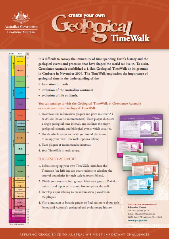
This teaching aid includes instructions and layout calculations for creating a Geological TimeWalk of your own. A set of information plaques marking each geological time interval is also available to download and use with the TimeWalk.
-
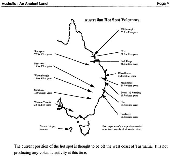
This black and white resource is an 18 page booklet including geological time, rock clocks, the age of famous Australian places, Australia on the move, Australian volcanoes, Ice Ages, Ancient Australian life, how fossils form and some common Australian fossils. Includes student activities suitable for primary Years K-6.
-
The Nolans Bore deposit, located in the Aileron Province of south-central Northern Territory, is an emerging Australian rare earth development. It consists of steeply northwest dipping apatite veins hosted by ~1806 Ma granite gneiss. A preliminary ~1240 Ma U-Pb age for apatite may correspond to a major global period of alkalic magmatism between 1300 and 1130 Ma, including emplacement of the Bayan Obo deposit in China. Low ?Nd and 87Sr/86Sr in the mineralisation is reminiscent of modern EM-1 ocean island basalts and may indicate a link to carbonatitic magmatism. Oxygen isotope thermometry indicates a mineralisation temperature of 410°C, with '18Ofluid of ~8.0'. Fertilisation of the mantle to produce the EM-1 source may relate to subduction associated with convergence along the southern margin of the North Australian Craton.
-
The Lower Darling Valley (LDV) contains Cenozoic shallow marine, fluvial, lacustrine and aeolian sediments capped by a number of Quaternary fluvial units associated with the Darling River and its anabranches, which were poorly dated prior to this study. Recent investigations in the LDV area have used an Airborne Electromagnetic (AEM) survey, a new high-resolution LiDAR survey, sonic drilling, shallow hand-augering, examination of tractor-dug pits, sediment sample analyses, landform mapping, and river bottom profiling in combination with OSL and radiocarbon dating to provide new insights into the nature and chronology of Quaternary fluvial landscape evolution. The Quaternary sequence in the LDV consists of scroll-plain tracts of different ages incised into higher, older and more featureless floodplain sediments. Samples for OSL and radiocarbon dating were taken in tractor-excavated pits, from sonic cores and from hand-auger holes from a number of scroll-plain and older floodplain sediments. The youngest, now inactive, scroll-plain phase associated with the modern Darling River, was active in the period 5-2 ka. A previous anabranch scroll-plain phase has Last Glacial Maximum dates around 20 ka. Less distinct scroll-plain tracts, older than the anabranch system, have ages around 30ka. A poorly preserved scroll-plain phase with very indistinct scroll and channel traces is associated with the Darling River tract and has ages around 45-50 ka. Older dates of 85 ka and >150 ka have been obtained beneath the higher floodplain from lateral-migration sediments that lack visible scroll-plain traces. This chronologic sequence suggests regular recurrence of approximately 5 ka lateral-migration episodes separated by approximately 10 ka periods of quiescence. There is a lack of coincidence with the glacial-interglacial climate cycles. This suggests that the onset and termination of lateral-migration phases is probably a combination of changes in discharge and sediment regimes r
-
This report describes the ornamental stones used in the ground floor foyer of the Geoscience Australia building. There are three ornamental stones used. The flooring tiles are basalt. The 'fault' line through this is a polished norite and the blade walls are covered by a Persian red Travertine. Investigations have established that the basalt and norite are from Australian quarries and the travertine is from an unknown source overseas possibly Italy.
-
This record contains zircon U-Pb geochronological data obtained between July 2001 and May 2003 on diamond drillcore from the Olympic Domain, Gawler Craton, South Australia. The data were collected as part of the Gawler Craton Project; a collaboration between Geoscience Australia (GA) and the Division of Mineral and Energy, Primary Industry and Resources, South Australia (PIRSA). The project aims to provide an improved geological and metallogenic framework for the Gawler Craton, with initial emphasis on the Olympic Domain. The term Olympic Domain (formerly 'Olympic Subdomain'; Daly et al. 1998) refers to the eastern extension of the Gawler Craton, concealed beneath Mesoproterozoic, Neoproterozoic and Cambrian sedimentary rocks of the Stuart Shelf. It also encompasses outcrop and subcrop of the Gawler Craton further south in the Moonta-Wallaroo region of the Yorke Peninsula. The sedimentary cover sequence of the Stuart Shelf is between about 300 and 1000 m thick, and the only knowledge of the underlying crystalline basement comprising the Olympic Domain is derived from exploratory drillholes. The long distances between drillholes impede inter-hole correlations. Thus U-Pb isotope dating of rocks intersected by (diamond) drillcore plays a key role in regional stratigraphic studies, establishing an absolute basis for temporal correlations across the Olympic Domain. This record describes the samples analysed and the analytical results obtained, and provides a brief discussion of their geochronological interpretation. The broader geological implications of the data will be published elsewhere.
-
Bonaparte Basin biostratigraphic chart
-
2004 updated version of Helby, Morgan & Partridge (1987)