DEA
Type of resources
Keywords
Publication year
Topics
-

<div>The A1 poster incorporates 4 images of Australia taken from space by Earth observing satellites. The accompanying text briefly introduces sensors and the bands within the electromagnetic spectrum. The images include examples of both true and false colour and the diverse range of applications of satellite images such as tracking visible changes to the Earth’s surface like crop growth, bushfires, coastal changes and floods. Scientists, land and emergency managers use satellite images to analyse vegetation, surface water or human activities as well as evaluate natural hazards.</div>
-
<b>BACKGROUND</b> <p> <p>The United States Geological Survey's (USGS) Landsat satellite program has been capturing images of the Australian continent for more than 30 years. This data is highly useful for land and coastal mapping studies. <p>In particular, the light reflected from the Earth’s surface (surface reflectance) is important for monitoring environmental resources – such as agricultural production and mining activities – over time. <p>We need to make accurate comparisons of imagery acquired at different times, seasons and geographic locations. However, inconsistencies can arise due to variations in atmospheric conditions, sun position, sensor view angle, surface slope and surface aspect. These need to be reduced or removed to ensure the data is consistent and can be compared over time. <p> </p> <b>WHAT THIS PRODUCT OFFERS</b> <p> <p>GA Landsat 5 TM Analysis Ready Data Collection 3 takes Landsat 5 Thematic Mapper (TM) imagery captured over the Australian continent and corrects for inconsistencies across land and coastal fringes. The result is accurate and standardised surface reflectance data, which is instrumental in identifying and quantifying environmental change. <p> <p>The TM instrument is an advanced, multispectral scanning, Earth resources sensor which is designed to categorise the Earth's surface. It is particularly useful for agricultural applications and identification of land use. <p> <p>This product is a single, cohesive Analysis Ready Data (ARD) package, which allows you to analyse surface reflectance data as is, without the need to apply additional corrections. <p> <p>It contains three sub-products that provide corrections or attribution information: <p> <p> 1) GA Landsat 5 TM NBAR Collection 3 <p> 2) GA Landsat 5 TM NBART Collection 3 <p> 3) GA Landsat 5 TM OA Collection 3 <p> <p>The resolution is a 30 m grid based on the USGS Landsat Collection 1 archive.
-
<b>BACKGROUND</b> <p> <p>The United States Geological Survey's (USGS) Landsat satellite program has been capturing images of the Australian continent for more than 30 years. This data is highly useful for land and coastal mapping studies. <p>In particular, the light reflected from the Earth’s surface (surface reflectance) is important for monitoring environmental resources – such as agricultural production and mining activities – over time. <p>We need to make accurate comparisons of imagery acquired at different times, seasons and geographic locations. However, inconsistencies can arise due to variations in atmospheric conditions, sun position, sensor view angle, surface slope and surface aspect. These need to be reduced or removed to ensure the data is consistent and can be compared over time. <p> </p> <b>WHAT THIS PRODUCT OFFERS</b> <p> <p>GA Landsat 7 ETM+ Analysis Ready Data Collection 3 takes Landsat 7 Enhanced Thematic Mapper (ETM+) imagery captured over the Australian continent and corrects for inconsistencies across land and coastal fringes. The result is accurate and standardised surface reflectance data, which is instrumental in identifying and quantifying environmental change. <p> <p>The ETM+ instrument is a fixed ‘whisk broom’, eight-band, multispectral scanning radiometer capable of providing high-resolution imaging information of the Earth’s surface. It is an enhanced version of the Thematic Mapper (TM) sensor. <p> <p>This product is a single, cohesive Analysis Ready Data (ARD) package, which allows you to analyse surface reflectance data as is, without the need to apply additional corrections. <p> <p>It contains three sub-products that provide corrections or attribution information: <p> <p> 1) GA Landsat 7 ETM+ NBAR Collection 3 <p> 2) GA Landsat 7 ETM+ NBART Collection 3 <p> 3) GA Landsat 7 ETM+ OA Collection 3 <p> <p>The resolution is a 30 m grid based on the USGS Landsat Collection 1 archive.
-
<div>In recent years Geoscience Australia has undertaken a successful continental scale validation program, targeting Landsat and Sentinel analysis ready data surface reflectance products. The field validation model used for this program successfully built on earlier studies and the measurement uncertainties associated with these protocols have been quantified and published. As a consequence, the Australian earth observation community was well-placed to respond to the United States Geological Survey (USGS) call for collaborators with the 2021 Landsat 8 (L8) and Landsat 9 (L9) 6 underfly. Despite a number of challenges, seven validation datasets were captured across five sites. As there was only a single 100% overlap transit across Australia and with the country in the midst of a strong La Niña climate cycle, it was decided to deploy teams to the two available overpasses with only 15% side lap. The validation sites encompassed rangelands, chenopod scrublands and a large inland lake. Apart from instrument problems at one site, good weather enabled the capture of high quality field data allowing for meaningful comparisons between the radiometric performance of L8 and L9, as well as the USGS and Australian Landsat analysis ready data processing models. Duplicate (cross calibration) spectral sampling at different sites provides evidence of the field protocol reliability, while the off-nadir view of L9 over the water site has been used to better compare the performance of different water and atmospheric correction (ATCOR) processing models. </div> <b>Citation: </b>Byrne, G.; Broomhall, M.; Walsh, A.J.; Thankappan, M.; Hay, E.; Li, F.; McAtee, B.; Garcia, R.; Anstee, J.; Kerrisk, G.; et al. Validating Digital Earth Australia NBART for the Landsat 9 Underfly of Landsat 8. <i>Remote Sens.</i> <b>2024</b>, 16, 1233. https://doi.org/10.3390/rs16071233
-
<b>This record was retired 02/03/2023 with approval from M. Wilson as it has been superseded by <a href="https://dx.doi.org/10.26186/146552">eCat 146552 </a>& <a href="https://dx.doi.org/10.26186/146551">eCat 146551</a></b> Surface Reflectance product has been corrected to account for variations caused by atmospheric properties, sun position and sensor view angle at time of image capture. These corrections have been applied to all satellite imagery in the Sentinel-2 archive. This is undertaken to allow comparison of imagery acquired at different times, in different seasons and in different geographic locations. These products also indicate where the imagery has been affected by cloud or cloud shadow, contains missing data or has been affected in other ways. The Surface Reflectance products are useful as a fundamental starting point for any further analysis, and underpinall other optical derivedDigital Earth Australiaproducts.
-
<b>This record was retired 29/03/2022 with approval from S.Oliver as it has been superseded by eCat 146261 DEA Geometric Median and Median Absolute Deviation (Landsat)</b> This product provides ‘second order’ statistical techniques that follow from the geometric median, which is useful for environmental characterisation and change detection. The Median Absolute Deviation (MAD) is a generalisation of the classic one-dimensional statistic for multidimensional applications, and is a measure of variance in a dataset through comparison to the median. It is similar in concept to the way that the standard deviation in statistics can be used to understand variance compared to the mean.
-
<div>This document steps educators and students through some of the uses of the satellite data on the Digital Earth Australia (DEA) Portal, with a particular focus on changes to landscapes and coasts over time. Instructions and questions are provided so educators and students can explore the data sets as they work their way through the document. The document also gives a brief background on how satellites operate and how they capture imagery.</div><div><br></div>
-
<div>The DEA Geometric Median and Median Absolute Deviation products use statistical analyses to provide information on variance in the landscape over a given year. They provide insight into the “average” conditions observed over Australia in a given year, as well as the amount of variability experienced around that average. These products are useful for monitoring change detection, such as from cropping, urban expansion or burnt area mapping. </div><div><br></div><div>Satellite imagery allows us to observe the Earth with significant accuracy and detail. However, missing data — such as gaps caused by cloud cover — can make it difficult to create a complete image. In order to produce a single, complete view of a certain area, satellite data must be consolidated by stacking measurements from different points in time to create a composite image. </div><div><br></div><div>The Digital Earth Australia GeoMAD (Geometric Median and Median Absolute Deviation) data product is a cloud-free composite of satellite data compiled annually over each calendar year. </div><div><br></div><div>Large-scale image composites are increasingly important for a variety of applications such as land cover mapping, change detection, and the generation of high-quality data to parameterise and validate bio-physical and geophysical models. A number of compositing methodologies are being used in remote sensing in general, however, challenges still exist. These challenges include mitigating against boundary artifacts due to mosaicking scenes from different epochs ensuring spatial regularity across the mosaic image and maintaining the spectral relationship between bands. </div><div><br></div><div>The creation of good composite images is especially important due to the opening of the United States Geological Survey’s Landsat archive. The greater availability of satellite imagery has resulted in demand to provide large regional mosaics that are representative of conditions over specific time periods while also being free of clouds and other unwanted visual noise. One approach is to ‘stitch together’ multiple selected high-quality images. Another is to create mosaics in which pixels from a time series of observations are combined (using an algorithm). This ‘pixel composite’ approach to mosaic generation provides more consistent results than with stitching high-quality images due to the improved colour balance created by combining one-by-one pixel-representative images. Another strength of pixel-based composites is their ability to be automated, hence enabling their use in large data collections and time series datasets. </div><div><br></div><div>The DEA GeoMAD product can be used for seeing how an area of land usually looks rather than only viewing it at a single point in time. Hence you can assess the land cover and land use on a general basis rather than at a specific date. It can also be used to assess how much an area changes over time. You will notice areas like bare rock that are very stable versus those like cropping areas that change dramatically. </div><div><br></div><div>The DEA GeoMAD product combines the Geometric Median and the Median Absolute Deviation algorithms in a single package. The Geometric Median output provides information on the general conditions of the landscape for a given year. Meanwhile the Median Absolute Deviation output provides information on how the landscape is changing in the same year. </div><div><br></div>
-
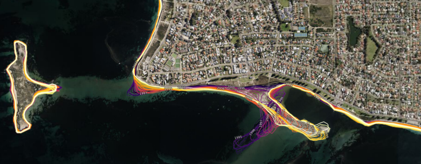
<b>This record has been superseded by eCat 148920 DEA Waterbodies v3.0 (Landsat) with approval from N.Mueller on 01/02/2024 This record was retired 15/09/2022 with approval from S.Oliver as it has been superseded by eCat 146197 DEA Waterbodies (Landsat) </b> <p>Up to date information about the extent and location of surface water provides all Australians with a common understanding of this valuable and increasingly scarce resource. <p>Digital Earth Australia Waterbodies shows the wet surface area of waterbodies as estimated from satellites. It does not show depth, volume, purpose of the waterbody, nor the source of the water. <p>Digital Earth Australia Waterbodies uses Geoscience Australia’s archive of over 30 years of Landsat satellite imagery to identify where almost 300,000 waterbodies are in the Australian landscape and tells us the wet surface area within those waterbodies. <p>It supports users to understand and manage water across Australia. For example, users can gain insights into the severity and spatial distribution of drought, or identify potential water sources for aerial firefighting during bushfires. <p>The tool uses a water classification for every available Landsat satellite image and maps the locations of waterbodies across Australia. It provides a timeseries of wet surface area for waterbodies that are present more than 10% of the time and are larger than 3125m2 (5 Landsat pixels). <p>The tool indicates changes in the wet surface area of waterbodies. This can be used to identify when waterbodies are increasing or decreasing in wet surface area.
-
The Digital Earth Australia (DEA) Program Roadmap describes the high level work plan to be undertaken by the DEA Program in order to achieve its objectives and deliver benefits to the Australian Government and industry.