GEOSCIENCES non-specific
Type of resources
Keywords
Publication year
Topics
-
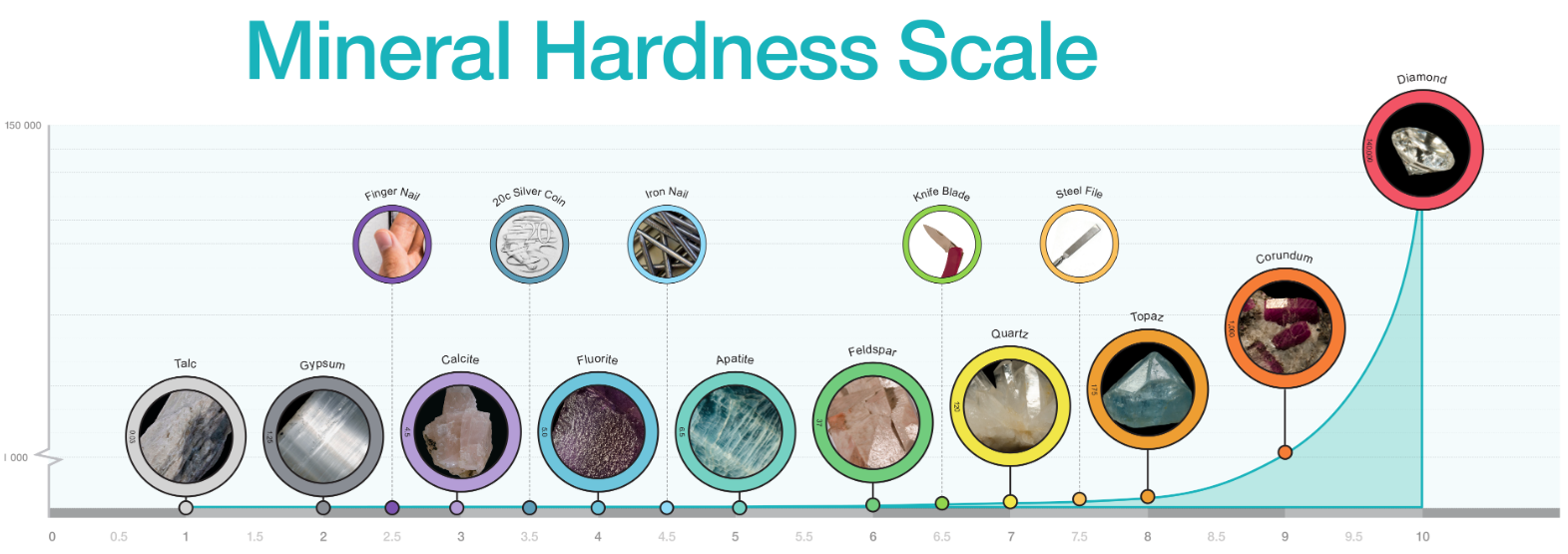
Diagram of mineral hardness comparing Mohs relational scale and Rosiwal absolute hardness. Includes photographs of specimens for each number on Mohs Hardness Scale. Best printed in colour at A3 or larger.
-
The Australian Government is investing in a world first analysis platform for satellite imagery and other Earth observations. From sustainably managing the environment to developing resources and optimising our agricultural potential, Australia must overcome a number of challenges to meet the needs of our growing population. Digital Earth Australia (DEA) will deliver a unique capability to process, interrogate, and present Earth observation satellite data in response to these issues. It will track changes across Australia in unprecedented detail, identifying soil and coastal erosion, crop growth, water quality, and changes to cities and regions. DEA will build on the globally recognised innovation, the Australian Geoscience Data Cube1; which was the winner of the 2016 Content Platform of the Year at the Geospatial World Leadership Awards and was developed as a partnership between GA, CSIRO and the National Collaborative Research Infrastructure Strategy (NCRIS) supported National Computational Infrastructure (NCI).
-
The Neoproterozoic to Paleozoic Thomson Orogen is a major component of the Tasmanides of eastern Australia that extends through large portions of central and southwest Queensland and northwest New South Wales. Much of the Thomson Orogen is buried under younger sedimentary basins (some up to several kilometres thick) and regolith cover, making it one of the most poorly understood elements of Australia’s geology. As a result, the mineral potential of the region is also poorly defined. The Southern Thomson Project (the Project) is a collaborative investigation between the Commonwealth of Australia (Geoscience Australia – GA) and its partners the State of New South Wales (Department of Trade and Investment, Geological Survey of New South Wales – GSNSW) and the State of Queensland (Department of Natural Resources and Mines, Geological Survey of Queensland – GSQ). The Project aims to better understand the geological character and mineral potential of the southern Thomson Orogen region, focusing on the border between New South Wales and Queensland, by acquiring and interpreting multi-disciplinary geophysical, geochemical and geological data. The primary intended impact of this work is to provide the mineral exploration industry with pre-competitive data and knowledge that reduces risk and encourages mineral exploration in the region.