Stratigraphy
Type of resources
Keywords
Publication year
Topics
-
Palaeogrographic analysis of the Early Cretaceous South Perth Supersequence.
-
One page article discussing aspects of Australian stratigraphy; this article discusses the issues to consider when reviewing and/or revising a unit or the stratigraphy of an area.
-
One page article discussing aspects of Australian stratigraphy; this article discusses practical Australian solutions to igneous nomenclature and the indexing of relevant Antarctic units
-
part-page article on stratigraphic issues
-
One page article discussing aspects of Australian stratigraphy; this article discusses new unit definitions, ne regional publications and changes to the membership of the Australian Stratigraphy Commission.
-
One page article discussing aspects of Australian stratigraphy; this article is about the need for more unit definitions.
-
Discussion of the uses made of the Australian Stratigraphic units database (ASUD), the sources of data to update it, and issues with maintaining quality. The importance of correct and consistent terminology, and the value of good reviews and editing are highlighted with examples.
-
The advent of Chemical Abrasion-Isotope Dilution Thermal Ionisation Mass Spectrometry (CA-IDTIMS) has revolutionised U-Pb dating of zircon, and the enhanced precision of eruption ages determined on volcanic layers within basin successions permits an improved calibration of biostratigraphic schemes to the numerical timescale. The Guadalupian and Lopingian (Permian) successions in the Sydney, Gunnedah, Bowen and Canning basins are mostly non-marine and include numerous airfall tuff units, many of which contain zircon. The eastern Australian palynostratigraphic scheme provides the basis for much of the local correlation, but the present calibration of this scheme against the numerical timescale depends on a correlation to Western Australia, using rare ammonoids and conodonts in that succession to link to the standard global marine biostratigraphic scheme. High-precision U¿Pb zircon dating of tuff layers via CA-IDTIMS allows this tenuous correlation to be circumvented¿the resulting direct calibration of the palynostratigraphy to the numerical timescale highlights significant inaccuracies in the previous indirect correlation. The new data show: the top of the Praecolpatites sinuosus (APP3.2) Zone lies in the early Roadian, not the middle Kungurian; the top of the Microbaculispora villosa (APP3.3) Zone lies in the middle Roadian, not the early Roadian; the top of the Dulhuntyispora granulata (APP4.1) Zone lies in the Wordian, not in the latest Roadian; the top of the Didecitriletes ericianus (APP4.2) Zone lies in the first half of the Wuchiapingian, not the latest Wordian; the Dulhuntyispora dulhuntyi (APP4.3) Zone is exceptionally short and lies within the Wuchiapingian, not the early Capitanian; and the top of the Dulhuntyispora parvithola (APP5) Zone lies at or near the Permo-Triassic boundary, not in the latest Wuchiapingian.
-
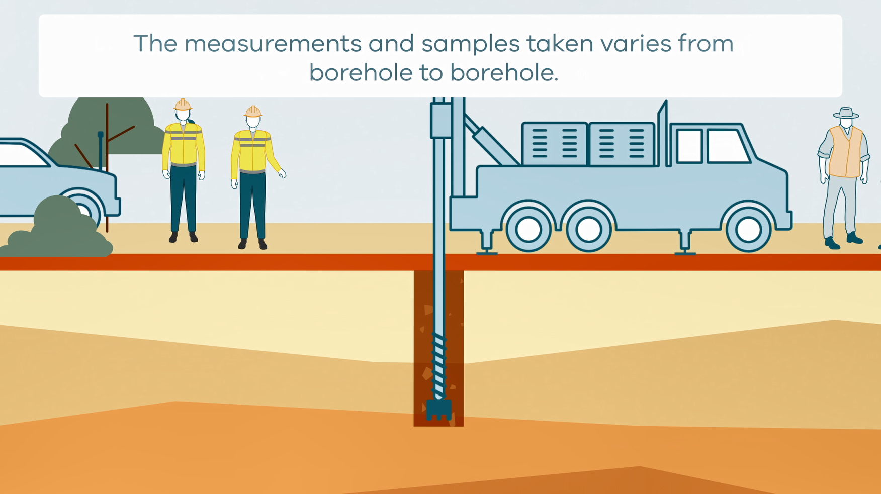
This animation shows how stratigraphic drilling is conducted. It is part of a series of Field Activity Technique Engagement Animations. The target audience are the communities that are impacted by GA's data acquisition activities. There is no sound or voice over. The 2D animation includes a simplified view of what stratigraphic drilling looks like, what measurements and samples are taken, and how scientists use the data.
-
This report was compiled and written to summarise the four-year Palaeovalley Groundwater Project which was led by Geoscience Australia from 2008 to 2012. This project was funded by the National Water Commission's Raising National Water Standards Program, and was supported through collaboration with jurisdictional governments in Western Australia, South Australia and the Northern Territory. The summary report was published under the National Water Commission's 'Waterlines' series. This document is supported by related publications such as the palaeovalley groundwater literature review, the WASANT Palaeovalley Map and associated datasets, and four stand-alone GA Records that outline the detailed work undertaken at several palaeovalley demonstration sites in WA, SA and the NT. Palaeovalley aquifers are relied upon in outback Australia by many groundwater users and help underpin the economic, social and environmental fabric of this vast region. ‘Water for Australia’s arid zone – Identifying and assessing Australia’s palaeovalley groundwater resources’ (the Palaeovalley Groundwater Project) investigated palaeovalleys across arid and semi-arid parts of Western Australia (WA), South Australia (SA) and the Northern Territory (NT). The project aimed to (a) generate new information about palaeovalley aquifers, (b) improve our understanding of palaeovalley groundwater resources, and (c) evaluate methods available to identify and assess these systems.