Geomorphology
Type of resources
Keywords
Publication year
Service types
Topics
-
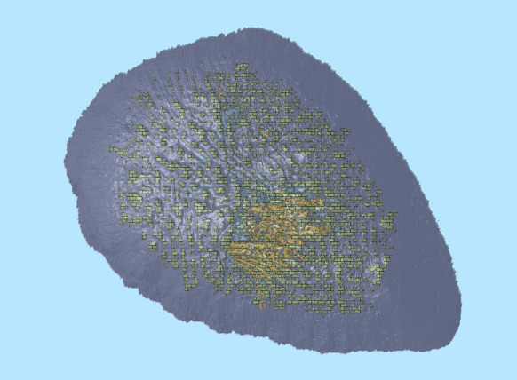
This OGC Web Map Service (WMS) contains geospatial seabed morphology and geomorphology information for the Beagle Marine Park (South-east Marine Parks Network) and is intended for use by marine park managers, regulators and other stakeholders. This web service uses the data product published in Nanson et al. (2023); eCat Record 147976.
-
<div>This data product contains geospatial seabed morphology and geomorphology information for the Beagle Marine Park and is intended for use by marine park managers, regulators, the general public and other stakeholders. A nationally consistent two-part (two-step) seabed geomorphology classification system was used to map and classify the distribution of key seabed features. </div><div><br></div><div>In step 1, semi-automated GIS mapping tools (GA-SaMMT; Huang et al., 2022; eCat Record 146832) were applied to bathymetry digital elevation models (DEM) in a GIS environment (ESRI ArcGIS Pro) to map polygon extents (topographic high, low, and planar) and quantitatively characterise their geometries. The geometric attributes were then used to classify each shape into discrete Morphology Feature types (Part 1: Dove et al., 2020; eCat Record 144305). In step 2, the seabed geomorphology was interpreted by applying additional datasets and domain knowledge to inform their geomorphic characterisation (Part 2: Nanson et al., 2023; eCat Record 147818). Where available, backscatter intensity, seabed imagery, seabed sediment samples and sub-bottom profiles supplemented the bathymetry DEM and morphology classifications to inform the geomorphic interpretations.</div><div><br></div><div>The Beagle Marine Park seabed morphology and geomorphology features were informed by a post survey report (Barrett et al., 2021). Seabed units were classified at multiple resolutions that were informed by the underlying bathymetry: </div><div><br></div><div>· A broad scale layer represents features that were derived from a 30 m horizontal resolution compilation DEM (Beaman et al 2022; eCat Record 147043). </div><div>· A series of medium and fine scale feature layers were derived from individual 1 m horizontal resolution DEMs (Nichol et al., 2019; eCat Record 130301). </div><div><br></div><div>The data product and application schema are fully described in the accompanying Data Product Specification. </div><div><br></div><div><em>Barrett, N, Monk, J., Nichol, S., Falster, G., Carroll, A., Siwabessy, J., Deane, A., Nanson, R., Picard, K., Dando, N., Hulls, J., and Evans, H. (2021). Beagle Marine Park Post Survey Report: South-east Marine Parks Network. Report to the National Environmental Science Program, Marine Biodiversity Hub. University of Tasmania.</em></div><div><br></div><div><em>Beaman, R.J. (2022). High-resolution depth model for the Bass Strait -30 m. <a href=https://dx.doi.org/10.26186/147043>https://dx.doi.org/10.26186/147043</a>, GA eCat Record 147043. </em></div><div><br></div><div><em>Dove, D., Nanson, R., Bjarnadóttir, L. R., Guinan, J., Gafeira, J., Post, A., Dolan, Margaret F.J., Stewart, H., Arosio, R., Scott, G. (2020). A two-part seabed geomorphology classification scheme (v.2); Part 1: morphology features glossary. Zenodo. <a href=https://doi.org/10.5281/zenodo.40752483>https://doi.org/10.5281/zenodo.4075248</a>; GA eCat Record 144305 </em></div><div><br></div><div><em>Huang, Z., Nanson, R. and Nichol, S. (2022). Geoscience Australia's Semi-automated Morphological Mapping Tools (GA-SaMMT) for Seabed Characterisation. Geoscience Australia, Canberra. <a href=https://dx.doi.org/10.26186/146832>https://dx.doi.org/10.26186/146832</a>; GA eCat Record 146832 </em></div><div><em> </em></div><div><em>Nanson, R., Arosio, R., Gafeira, J., McNeil, M., Dove, D., Bjarnadóttir, L., Dolan, M., Guinan, J., Post, A., Webb, J., Nichol, S. (2023). A two-part seabed geomorphology classification scheme; Part 2: Geomorphology classification framework and glossary (Version 1.0) (1.0). Zenodo.<a href=https://doi.org/10.5281/zenodo.7804019>https://doi.org/10.5281/zenodo.7804019</a>; GA eCat Record 147818 </em></div>
-
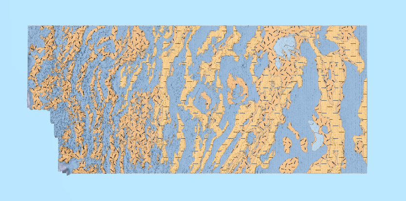
This OGC Web Map Service (WMS) contains seabed morphology and geomorphology information for a subset area of Zeehan Marine Park (South-east Marine Parks Network) and is intended for use by marine park managers, regulators and other stakeholders. This web service uses the data product published in McNeil et al. (2023); eCat Record 148620.
-
This data product contains seabed morphology and geomorphology information for a subset area of Zeehan Marine Park. A nationally consistent seabed geomorphology classification scheme was used to map and classify the distribution of key seabed features. The Zeehan Marine Park seabed morphology and geomorphology maps were derived from a 2 m horizontal resolution bathymetry DEM compiled from a multibeam survey undertaken for Parks Australia by the University of Tasmania. Semi-automated GIS mapping tools (GA-SaMMT); (Huang et. al., 2022; eCat Record 146832) were applied to a bathymetry digital elevation model (DEM) in a GIS environment (ESRI ArcGIS Pro) to map polygon extents (topographic high, low, and planar) and to quantitatively characterise polygon geometries. Geometric attributes were then used to classify each shape into discrete Morphology Feature types (Dove et. al., 2020; eCat Record 144305). Seabed geomorphology features were interpreted by applying additional datasets and domain knowledge to inform their geomorphic characterisation (Nanson et. al., 2023; eCat Record 147818). Where available, backscatter intensity, seabed imagery, and survey reports supplemented the bathymetry DEM and morphology classifications to inform the geomorphic interpretations. The data product and classification schema are fully described in the accompanying Data Product Specification. Dove, D., Nanson, R., Bjarnadóttir, L. R., Guinan, J., Gafeira, J., Post, A., Dolan, Margaret F.J., Stewart, H., Arosio, R., Scott, G. (2020). A two-part seabed geomorphology classification scheme (v.2); Part 1: morphology features glossary. Zenodo. https://doi.org/10.5281/zenodo.4075248; Huang, Z., Nanson, R., Nichol, S. 2022. Geoscience Australia's Semi-automated Morphological Mapping Tools (GA-SaMMT) for Seabed Characterisation. Geoscience Australia, Canberra. https://dx.doi.org/10.26186/146832 Nanson, R., Arosio, R., Gafeira, J., McNeil, M., Dove, D., Bjarnadóttir, L., Dolan, M., Guinan, J., Post, A., Webb, J., Nichol, S. (2023). A two-part seabed geomorphology classification scheme; Part 2: Geomorphology classification framework and glossary (Version 1.0) (1.0). Zenodo. https://doi.org/10.5281/zenodo.7804019
-
The service contains the Australian Coastal Geomorphology Smartline, used to support a national coastal risk assessment. The 'Smartline' is a representation of the geomorphic features located within 500m of the shoreline, denoted by the high water mark. The service includes geomorphology themes and stability classes.
-
This ESRI map (web) service contains geospatial seabed morphology and geomorphology information for Cairns Seamount within the Coral Sea Marine Park and are intended for use by marine park managers, regulators, the general public and other stakeholders. This web service uses the data product published in McNeil et al. (2023); eCat Record 147998.
-
This ESRI map (web) service contains seabed morphology and geomorphology information for a subset area of Zeehan Marine Park (South-east Marine Parks Network) and is intended for use by marine park managers, regulators and other stakeholders. This web service uses the data product published in McNeil et al. (2023); eCat Record 148620.
-
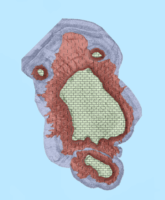
This ESRI map (web) service contains geospatial seabed morphology and geomorphology information for Flinders Reefs within the Coral Sea Marine Park and are intended for use by marine park managers, regulators, the general public and other stakeholders. This web service uses the data product published in McNeil et al. (2023); eCat Record 147998.
-
<div>Maps of seabed geomorphology derived from bathymetry data provide foundational information that is used to support the sustainable use of the marine environment across a range of activities that contribute to the Blue Economy. The global recognition of the value of the Blue Economy and several key global initiatives, notably the Seabed 2030 project to map the global ocean and the United Nations Decade of Ocean Science for Sustainable Development, are driving the proliferation and open dissemination of these data and derived map products. To effectively support these global efforts, geomorphic characterisation of the seabed requires standardized multi-scalar and interjurisdictional approaches that can be applied locally, regionally and internationally. This document describes and illustrates a geomorphic lexicon for the full range of coastal to deep ocean geomorphic Settings and related Processes that drive the formation, modification and preservation of geomorphic units on the seabed. Terms and Settings/Processes have been selected from the literature and structured to balance established terminology with the need for consistency between the range of geomorphic Settings. This document also presents a glossary of the terms and identifies the insights that can be gained by mapping each unit type, from an applied perspective.</div> <b>Citation:</b> Nanson, Rachel, Arosio, Riccardo, Gafeira, Joana, McNeil, Mardi, Dove, Dayton, Bjarnadóttir, Lilja, Dolan, Margaret, Guinan, Janine, Post, Alix, Webb, John, & Nichol, Scott. (2023). <i>A two-part seabed geomorphology classification scheme; Part 2: Geomorphology classification framework and glossary (Version 1.0) (1.0).</i> Zenodo. https://doi.org/10.5281/zenodo.7804019