Exploring for the Future
Type of resources
Keywords
Publication year
Service types
Topics
-
The Layered Geology of Australia web map service is a seamless national coverage of Australia’s surface and subsurface geology. Geology concealed under younger cover units are mapped by effectively removing the overlying stratigraphy (Liu et al., 2015). This dataset is a layered product and comprises five chronostratigraphic time slices: Cenozoic, Mesozoic, Paleozoic, Neoproterozoic, and Pre-Neoproterozoic. As an example, the Mesozoic time slice (or layer) shows Mesozoic age geology that would be present if all Cenozoic units were removed. The Pre-Neoproterozoic time slice shows what would be visible if all Neoproterozoic, Paleozoic, Mesozoic, and Cenozoic units were removed. The Cenozoic time slice layer for the national dataset was extracted from Raymond et al., 2012. Surface Geology of Australia, 1:1 000 000 scale, 2012 edition. Geoscience Australia, Canberra.
-
The petroleum systems summary report provides a compilation of the current understanding of petroleum systems for the McArthur Basin, including the prospective Beetaloo Sub-basin. The contents of this report are also available via the Geoscience Australia Portal at https://portal.ga.gov.au/, called The Petroleum Systems Summary Assessment Tool (Edwards et al., 2020). Three summaries have been developed as part of the Exploring for the Future (EFTF) program (Czarnota et al., 2020); the McArthur Basin, the Canning Basin, and a combined summary of the South Nicholson Basin and Isa Superbasin region. The petroleum systems summary reports aim to facilitate exploration by summarising key datasets related to conventional and unconventional hydrocarbon exploration, enabling a quick, high-level assessment the hydrocarbon prospectivity of the region.
-
Long-period magnetotelluric (MT) data allow geoscientists to investigate the link between mineralisation and lithospheric-scale features and processes. In particular, the highly conductive structures imaged by MT data appear to map the pathways of large-scale palaeo-fluid migration, the identification of which is an important element of several mineral system models. Given the importance of these data, governments and academia have united under the Australian Lithospheric Architecture Magnetotelluric Project (AusLAMP) to collect long-period MT data across the continent on a ~55 km-spaced grid. Here, we use AusLAMP data to demonstrate the MT method as a regional-scale tool to identify and select prospective areas for mineral exploration undercover. We focus on the region between Tennant Creek in the Northern Territory and east of Mount Isa in Queensland. Our results image major conductive structures up to 150 km deep in the lithosphere, such as the Carpentaria Conductivity Anomaly east of Mount Isa. This anomaly is a significant lithospheric-scale conductivity structure that shows spatial correlations with a major suture zone and known iron oxide–copper–gold deposits. Our results also identify similar features in several under-explored areas that are now considered to be prospective for mineral discovery. These observations provide a powerful means of selecting frontier regions for mineral exploration undercover.. <b>Citation:</b> Duan, J., Kyi, D., Jiang, W. and Costelloe, M., 2020. AusLAMP: imaging the Australian lithosphere for resource potential, an example from northern Australia. In: Czarnota, K., Roach, I., Abbott, S., Haynes, M., Kositcin, N., Ray, A. and Slatter, E. (eds.) Exploring for the Future: Extended Abstracts, Geoscience Australia, Canberra, 1–4.
-
The Upper Burdekin Chloride Mass Balance Recharge web service depicts the recharge rates have been estimated at borehole locations in the Nulla and McBride basalt provinces. Using rainfall rates, rainfall chemistry and groundwater chemistry, the recharge rates have been estimated through the Chloride Mass Balance approach.
-
The Exploring for the Future program is an initiative by the Australian Government dedicated to boosting investment in resource exploration in Northern Australia. The Paleo- to Mesoproterozoic sedimentary and volcanic sequences of the Mount Isa–McArthur Basin region of Northern Territory and Queensland are host to a range of world class mineral deposits (Hutton et al., 2012) and include the basin-hosted base metal deposits of the North Australian Zinc Belt, the world’s richest belt of zinc deposits (Huston et al., 2006; Large et al., 2005). The region demonstrably has potential for additional world class mineral systems (Hutton et al. 2012), as well as potential to host shale gas plays (Gorton & Troup, 2018). An improved understanding of the chemistry of the host sedimentary units, including associated volcanic and intrusive rocks (potential metal source rocks) within these regions is therefore an important requisite to further understand the resource potential of the region. To assist in this we have undertaken a multi-year campaign (2016-2019) of regional geochemical sampling of geological units in the southeastern McArthur Basin, it’s continuation into the Tomkinson Province, and the Lawn Hill Platform regions of Northern Territory and northwest Queensland. Chief aims of the project were to characterise, as much as possible, the inorganic geochemistry of units of the Paleoproterozoic Tawallah, McArthur, Fickling and McNamara Groups and the Mesoproterozoic Roper and South Nicholson groups, with most emphasis on the Tawallah, McNamara and Fickling Groups. Minimal attention was paid to units of the McArthur Group which have been extensively previously sampled. The project also involved exploratory geochemical characterisation of sedimentary and igneous rocks from Paleoproterozoic and Mesoproterozoic rocks of the Tomkinson Province (Tomkinson, Namerinni and Renner groups) in Northern Territory. Minimal regional geochemical data exists for these rocks which are considered time equivalents of the Tawallah, McArthur, Nathan and Roper groups. The approach followed was based on targeting as many units as possible from drill core held within the core repository facilities of the Northern Territory and Queensland Geological surveys. Sampling strategy for individual units was based on targeting all lithological variability with particular emphasis on units not previously extensively sampled. Units were sampled at moderate to high resolution, with sampling density ranging from one sample per ~10 m intervals in organic rich intervals or lithological variable units, up to one sample per 20 to 50 m intervals in lithologically-monotonous units or in units recently sampled recently by GA or others. This data release contains the results of elemental analyses (XRF, ICP-MS), ferrous iron oxide content (FeO) and Loss-on-ignition (LOI) on 805 samples selected from 42 drill cores housed in the Geological Survey of Northern Territory’s Darwin and Alice Springs core repositories and in the Geological Survey of Queensland’s Brisbane and Mount Isa core repositories. Drillholes sampled include the Amoco holes DDH 83-1, DDH 83-2, DDH 83-3, DDH 83-4, and DDH 83-5, as well as 14MCDDH001, 14MCDDH002, 87CIIDH1, 87CIIDH2, Bradley 1, Broughton 1, DD81CY1, DD91RC18, DD91DC1, DD91HC1, DD95GC001, GCD-1, GCD-2A, GSQ Lawn Hill 3, GSQ Lawn Hill 4, GSQ Westmoreland 2, MWSD05, ND1, ND2, 12BC001, and Willieray (1DD, 3DD, 8DD), Hunter (1DD, 2DD, 3DD) and HSD001, HSD002 holes from the Tomkinson Province. The data also include a small number of non-basin samples (from drill holes AAI POTALLAH CREEK 1, ADRIA DOWNS 1, Bradley 1, GSQ Normanton 1, GSQ Rutland Plains 1, MULDDH001 and MURD013), collected at the same time, largely for isotopic studies. The resultant geochemical data was largely generated at the Inorganic Geochemistry Laboratory at Geoscience Australia (509 of the 805 analyses), with two batches (296 samples) analysed by Bureau Veritas in Perth. Eighteen samples analysed at GA were also reanalysed at Bureau Veritas for QA/QC purposes. All data was collected as part of the Exploring for the Future program. The report also includes a statistical treatment of the geochemical data looking at laboratory performance, based on certified reference material (CRMs) and sample duplicates, and interlaboratory agreement, based on samples analysed at both laboratories. Results show accuracies were within acceptable tolerances (±2 SD) for the majority of major and trace elements analysed at both laboratories. Notable exceptions included significant negative bias for Fe2O3 and positive bias for Na2O at Geoscience Australia. The results also showed that Mo (and As and Be) measurements were a consistent problem at GA, and Zn a consistent problem at BV. Precision (reproducibility) for major elements at both laboratories was very good, generally between 1 to 5%. Precisions for trace elements, varied from generally 5% or better at Geoscience Australia, and mostly between 5 and 10% for Bureau Veritas. Importantly, agreement between laboratories was good, with the majority of elements falling within ±5% agreement, and a few within 5-10% (Th, Tb, Sr, Zn, Ta, and Cr). Major exceptions to this included Na2O, K2O, Rb, Ba and Cs, as well as P2O5 and SO3, as well as those trace elements commonly present in low concentrations (e.g., Cu, As, Be, Mo, Sb, Ge, Bi). The mismatch between the alkalis is notable and of concern, with differences (based on median values) of 17% and 22% for K2O and Ba (higher at Bureau Veritas) and 32% and 300% for Ba and Na2O (higher at Geoscience Australia). The geochemical data presented here have formed the basis for ongoing studies into aspects of basin-hosted mineral systems in the McArthur–Mount Isa region, including insights into sources of metals for such deposits and delineating alteration haloes around those deposits (Champion et al., 2020a, b).
-
Mafic igneous rocks are thought to be an important source of metals for the ca. 1640–1595 Ma sediment-hosted base metal deposits in the Paleo- to Mesoproterozoic Mount Isa – McArthur Basin system of northern Australia. Such rocks are widespread—the voluminous rift-related mafic magmatism at ca. 1790–1775 Ma and ca. 1730–1710 Ma—and show local evidence for intense hydrothermal alteration and metal leaching. To better constrain the nature, degree, and regional and temporal extent of alteration and metal leaching in these rocks, we have undertaken regional sampling of mafic igneous units from available drillcore, for geochemistry, stable isotopes and petrological examination. Sampling focused on magmatism of both ages in the southeastern MacArthur Basin, complementing the extensive pre-existing data for the Mount Isa region. Alteration in the mafic igneous rocks of the southeastern McArthur Basin ranges from mildly to strongly chloritic in the older units to strongly potassic (K-feldspar–chlorite–hematite) in the younger units. The latter alteration is ubiquitous, well developed and characterised by strong K2O enrichment and extreme depletion in CaO and Na2O. Geochemical data show that this intense and pervasive potassic alteration extends to similar-aged mafic rocks in the western Mount Isa region. Metal leaching is present in both alteration types, with strong Cu and Pb depletion in the most chlorite-altered rocks, and Zn and Cu depletion in the potassic alteration. Our oxygen isotope data for these mafic rocks (of both ages) in the southeastern McArthur Basin show a limited range of values (δ18O of 6–10‰) that are negatively correlated with K2O content. Our values are significantly lighter than published data for similar igneous rocks to the west, and indicate either a temperature zonation (ca. 250 °C in the east versus ca. 100 °C in the west; preferred) and/or different fluids. Results from our geochemical forward modelling indicate the requirement for exogenous K2O to produce the observed potassic alteration. The most likely source of this K was saline brines, consistent with the interpreted lacustrine and/or evaporitic environments for much of the McArthur Basin. Timing of alteration is uncertain, and the alteration may have included diagenetic low-temperature local K-rich brines and younger higher-temperature deep basinal brines. The temporal and geographically restricted nature of the potassic alteration, however, suggests restriction of K-rich, bittern evaporitic brine production in the younger and inboard parts of the Mount Isa – McArthur Basin system. Our results provide insights that directly relate to the genesis and exploration of basin-hosted Zn-Pb and Cu-Co mineral systems. They confirm that mafic igneous rocks in the region have lost significant amounts of both Zn and Cu, many times more than required for known deposits. The study also shows that metal leaching was accompanied by magnetite-destructive alteration. Hence, identifying zones of metal leaching may be possible using inversions of geophysical data, which may assist in targeting exploration. <b>Citation:</b> Champion, D.C., Huston, D.L., Bastrakov, E., Siegel, C., Thorne, J., Gibson, G.M. and Hauser, J., 2020. Alteration of mafic igneous rocks of the southern McArthur Basin: comparison with the Mount Isa region and implications for basin-hosted base metal deposits. In: Czarnota, K., Roach, I., Abbott, S., Haynes, M., Kositcin, N., Ray, A. and Slatter, E. (eds.) Exploring for the Future: Extended Abstracts, Geoscience Australia, Canberra, 1–4.
-
As global metal demands are increasing whilst new discoveries are declining, the magnetotelluric (MT) technique has shown promise as an effective technique to aid mineral systems mapping. Several case studies have shown a spatial correlation between mineral deposits and conductors, with some showing that resistivity models derived from MT are capable of mapping mineral systems from the lithosphere to deposit scale. However, until now, the statistical significance of such correlations has not been demonstrated and therefore hindered robust utilization of MT data in mineral potential assessments. Here we quantitatively analyze resistivity models from Australia, the United States of America (USA), South America and China and demonstrate that there is a statistically-significant correlation between upper mantle conductors and porphyry copper deposits, and between mid-crustal conductors and orogenic gold deposits. Volcanic hosted massive sulfide deposits show significant correlation with upper mantle conductors in Australia. Differences in the correlation pattern between these deposit types likely relate to differences in the chemistry, redox state and location of source mineralizing fluids and magmas, and indicate signatures of mineral system processes can be preserved in the crust and mantle lithosphere for hundreds of millions of years. Appeared in Scientific Reports volume 12, Article number: 8190 (2022), 17 May 2022
-
This Record presents new Sensitive High Resolution Ion Micro Probe (SHRIMP) in situ monazite U–Pb geochronological results from the East Tennant area that were obtained in March 2022 as part of Geoscience Australia’s (GA) Exploring for the Future (EFTF) program. Three samples were targeted for monazite geochronology in order to constrain the timing of metamorphism and ductile deformation in the East Tennant area. Monazites in cordierite schist from the Alroy Formation in drill hole NDIBK01 (NDIBK01.300) yielded a weighted mean 207Pb/206Pb age of 1843.6 ± 6.1 Ma (95% confidence). Paragneiss from the Alroy Formation in drill hole NDIBK10 (NDIBK10.009) yielded monazites that returned a weighted mean 207Pb/206Pb crystallisation age of 1843.5 ± 5.1 Ma. Sparse monazites in sample NDIBK04.300, a garnet phyllite from drill hole NDIBK04, yielded a weighted mean 207Pb/206Pb crystallisation age of 1831 ± 28 Ma. These ages, from samples distributed throughout the East Tennant area, are interpreted to constrain the timing of an episode of low pressure, medium-grade metamorphism and coeval deformation.
-
The Officer Basin spanning South Australia and Western Australia is the focus of a regional stratigraphic study being undertaken as part of the Exploring for the Future (EFTF) program, an Australian Government initiative dedicated to increasing investment in resource exploration in Australia. Despite numerous demonstrated oil and gas shows, the Officer Basin remains a frontier basin for energy exploration with significant uncertainties due to data availability. Under the EFTF Officer-Musgrave Project, Geoscience Australia acquired new geomechanical rock property data from forty core samples in five legacy stratigraphic and petroleum exploration wells that intersected Paleozoic and Neoproterozoic aged intervals. These samples were subjected to unconfined compressive rock strength tests, Brazilian tensile strength tests and laboratory ultrasonic measurements. Petrophysical properties were also characterised via X-ray computerised tomography scanning, grain density and porosity-permeability analysis. Accurate characterisation of static geomechanical rock properties through laboratory testing is essential. In the modern exploration environment, these datasets are a precompetitive resource that can simplify investment decisions in prospective frontier regions such as the Officer Basin. Appeared in The APPEA Journal 62 S385-S391, 13 May 2022
-
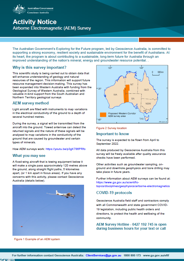
Geoscience Australia, in collaboration with state governments, will be carrying out airborne electromagnetic (AEM) surveys in western South Australia, southern NT and eastern WA during 2022. This scientific research is being carried out to obtain data that will enhance understanding of geology and natural resources of the region. This information will support future resource management decision-making. This survey has been expanded into Western Australia with funding from the Geological Survey of Western Australia, combined with valuable in-kind support from the South Australian and Northern Territory geological surveys. <p>