ESRI:ArcGIS:MapServer
Type of resources
Keywords
Publication year
Distribution Formats
Service types
Topics
-
The Layered Geology of Australia web map service is a seamless national coverage of Australia’s surface and subsurface geology. Geology concealed under younger cover units are mapped by effectively removing the overlying stratigraphy (Liu et al., 2015). This dataset is a layered product and comprises five chronostratigraphic time slices: Cenozoic, Mesozoic, Paleozoic, Neoproterozoic, and Pre-Neoproterozoic. As an example, the Mesozoic time slice (or layer) shows Mesozoic age geology that would be present if all Cenozoic units were removed. The Pre-Neoproterozoic time slice shows what would be visible if all Neoproterozoic, Paleozoic, Mesozoic, and Cenozoic units were removed. The Cenozoic time slice layer for the national dataset was extracted from Raymond et al., 2012. Surface Geology of Australia, 1:1 000 000 scale, 2012 edition. Geoscience Australia, Canberra.
-
This service has been created specifically for display in the National Map and the chosen symbology may not suit other mapping applications. The Australian Topographic web map service is seamless national dataset coverage for the whole of Australia. These data are best suited to graphical applications. These data may vary greatly in quality depending on the method of capture and digitising specifications in place at the time of capture. The web map service portrays detailed graphic representation of features that appear on the Earth's surface. These features include the administration boundaries from the Geoscience Australia 250K Topographic Data, including state forest and reserves.
-
The Historical Bushfire Boundaries service represents the aggregation of jurisdictional supplied burnt areas polygons stemming from the early 1900's through to 2022 (excluding the Northern Territory). The burnt area data represents curated jurisdictional owned polygons of both bushfires and prescribed (planned) burns. To ensure the dataset adhered to the nationally approved and agreed data dictionary for fire history Geoscience Australia had to modify some of the attributes presented. The information provided within this service is reflective only of data supplied by participating authoritative agencies and may or may not represent all fire history within a state.
-
Publicly available groundwater data have been compiled to provide a common information base to inform environmental, resource development and regulatory decisions in the Galilee Basin region. This web service summarises salinity, water levels, resource size, potential aquifer yield and surface water–groundwater interactions for the Galilee Basin located within the Galilee Basin region.
-
This service contains the limit and extent of Section 3 of the Coastal Waters (State Powers) Act 1980, and the Coastal Waters (Northern Territories Powers) Act 1980. NOTE: the Polygon depicting the area of the coastal waters is not constrained on the landward side. The polygon includes areas that fall within the constitutional limits of the States. When information depicting the landward constitutional limit of the States becomes available, the polygon will be constrained.
-
This Web Map Service displays the spatial extents of scanned images of all 1:250 000 scale geological maps of Australia. The service contains information on the edition, publication date, and map publisher, and has links to map images available as 125 DPI and 250 DPI resolution JPG files.
-
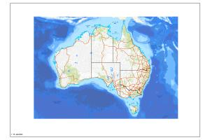
The Australian Topographic base map service is seamless national dataset coverage for the whole of Australia. The map is a representation of the Geoscience Australia 250k topographic specification and portrays a detailed graphic representation of features that appear on the Earth's surface. These features include cultural, hydrography and relief themes. The service contains layer scale dependencies.
-
Publicly available groundwater data have been compiled to provide a common information base to inform environmental, resource development and regulatory decisions in the Adavale Basin region. This web service summarises salinity, water levels, resource size, potential aquifer yield and surface water–groundwater interactions for the Lake Eyre Basin located within the Adavale Basin region.
-
The data contained in this service is not authoritative and has not been updated since 2006. This web service contains the legacy data found in the Australian Marine Spatial Information System (AMSIS) between 2006 and 2015, with a currency date of 2006. To honour the original licensing arrangements with the data holders, only the WMS is available. Users will need to contact the agency responsible for the data to check current validity and spatial precision.
-
Publicly available data was compiled to provide a common information base for resource development, environmental and regulatory decisions in the Galilee Basin. This web service summarises oil and gas prospectivity of the Galilee Basin.