Physical Oceanography
Type of resources
Keywords
Publication year
Topics
-
A fully four-dimensional (3D x time) open source (BSD-3), object-oriented biophysical dispersal model was developed to simulate the movement of marine larvae over semi-continuous surfaces. The model is capable of handling massive numbers of simulated larvae, can accommodate diverse life history patterns and distributions of characteristics, and saves point-level information to a relational database management system. The model was used to study Australia's northwest marine region, with attention given to connectivity patterns among Australia's north-western Commonwealth Marine Reserves (CMRs). This work was supported by the Marine Biodiversity Hub through the Australian Government's National Environmental Research Program (NERP).
-
Hazardous tsunamis are rare in Australia but could be generated by several mechanisms, including large plate-boundary earthquakes in locations that efficiently direct wave energy to our coast. With few hours between detection and tsunami arrival, prior planning is important to guide emergency response and risk mitigation. This drives interest in tsunami hazard information; which areas could be inundated, how likely, and how confident can we be? In practice the hazard is uncertain because historical records are short relative to tsunami frequencies, while long-term sedimentary records are sparse. Hazard assessments thus often follow a probabilistic approach where many alternative tsunami scenarios are simulated and assigned uncertain occurrence rates. This relies on models of stochastic earthquakes and their occurrence rates, which are not standardised, but depend on the scenario earthquake magnitude and other information from the source region. In this study we test three different stochastic tsunami models from the 2018 Australian Probabilistic Tsunami Hazard Assessment (PTHA18), an open-source database of earthquake-tsunami scenarios and return periods. The three models are tested against observations from twelve historical tsunamis at multiple tide gauges in Australia. For each historical tsunami, and each of the three models, sixty scenarios with similar earthquake location and magnitude are sampled from the PTHA18 database. A nonlinear shallow water model is used to simulate their effects at tide gauges in NSW, Victoria and Western Australia. The performance and statistical biases of the three models are assessed by comparing observations with the 60 modelled scenarios, over twelve separate tsunamis. Presented at the 30th Conference of the Australian Meteorological and Oceanographic Society (AMOS) 2024.
-
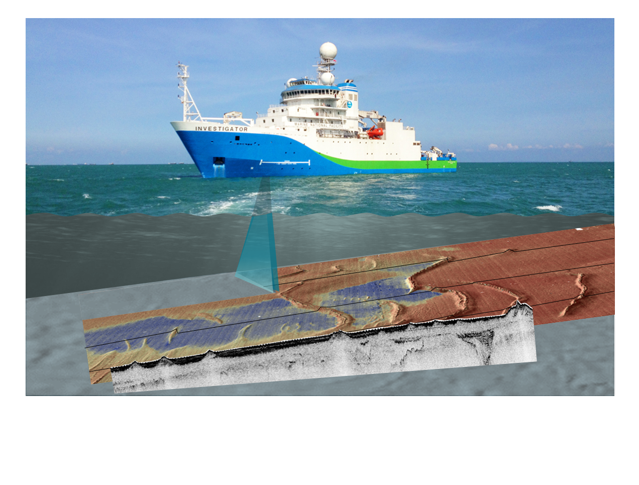
Have you ever wondered how we know the depth of the ocean? Sonar is the main technology used investigate the location of submarine canyons, seamounts, abyssal plains and if the seafloor is sand or rock. This activity builds understanding of sonar technique and applications through a) processing and plotting provided data to discover a seafloor feature or shipwreck, and b) bouncing balls on different surfaces and analysing rebound, relating this to ground hardness then extend understanding to ‘backscatter’ in bathymetry surveys. It is suitable for middle secondary students, but could be extended for senior students of Earth science, marine science/oceanography, and physics.