Geophysical survey
Type of resources
Keywords
Publication year
Service types
Topics
-
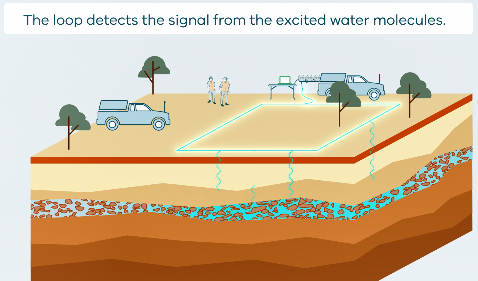
This animation shows how Surface Magnetic Resonance (SMR) Surveys are conducted. It is part of a series of Field Activity Technique Engagement Animations. The target audience are the communities that are impacted by GA's data acquisition activities. There is no sound or voice over. The 2D animation includes a simplified view of what SMR equipment looks like, what the equipment measures and how scientists use the data.
-
This service provides access to airborne electromagnetics (AEM) derived conductivity grids in the Upper Darling Floodplain region. The grids represent 30 depth intervals from modelling of AEM data acquired in the Upper Darling Floodplain, New South Wales, Airborne Electromagnetic Survey (https://dx.doi.org/10.26186/147267), an Exploring for the Future (EFTF) project jointly funded by Geoscience Australia and New South Wales Department of Planning and Environment (NSW DPE). The AEM conductivity model delineates important subsurface features for assessing the groundwater system including lithological boundaries, palaeovalleys and hydrostatigraphy.
-
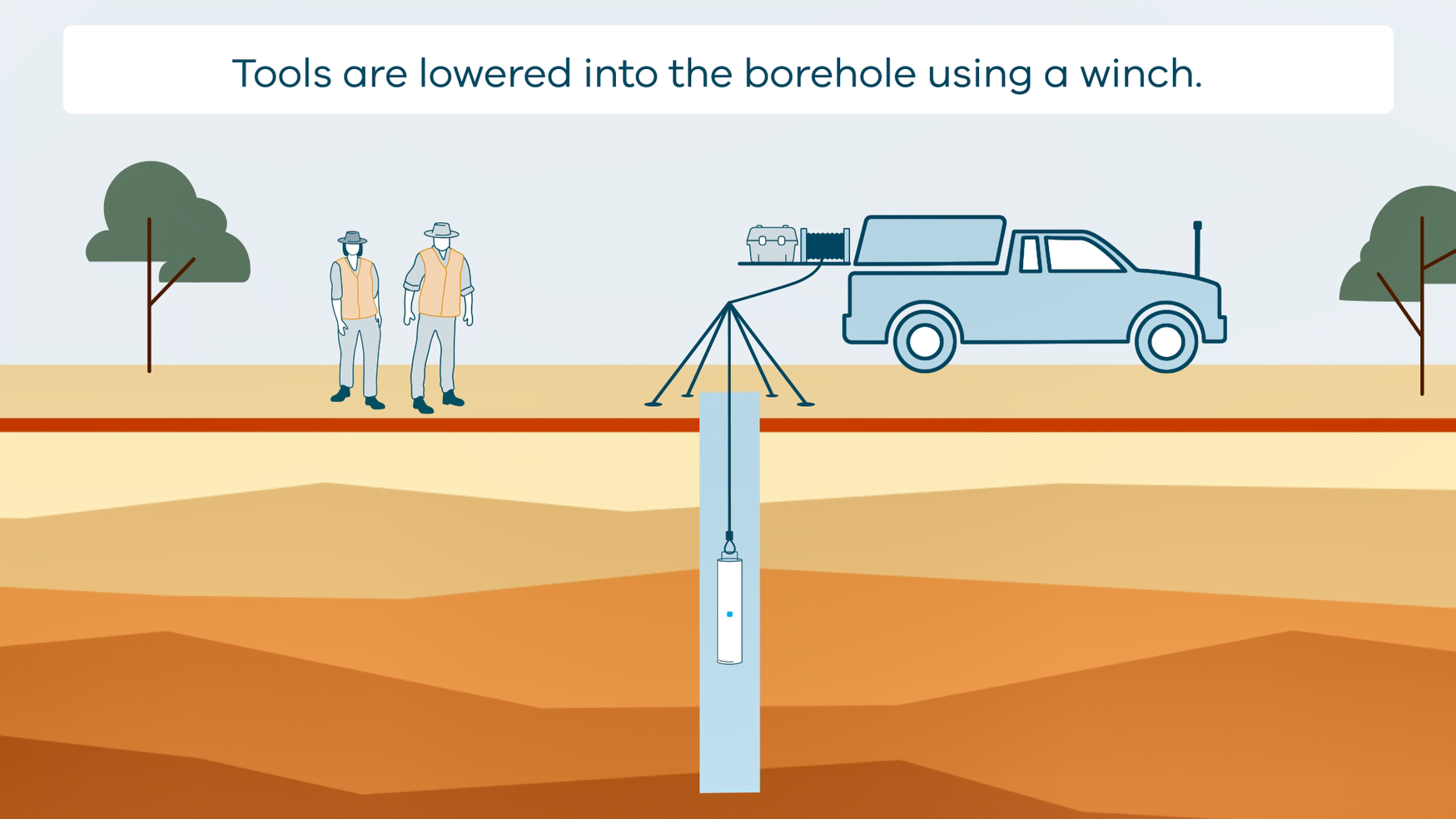
This animation shows how borehole geophysical surveys are conducted. It is part of a series of Field Activity Technique Engagement Animations. The target audience are the communities that are impacted by GA's data acquisition activities. There is no sound or voice over. The 2D animation includes a simplified view of what borehole geophysics equipment looks like, what the equipment measures and how scientists use the data.