Seabed morphology and geomorphology of Flinders Reefs within the Coral Sea Marine Park, north-eastern Australia, Version 1 MapServer
This ESRI map (web) service contains geospatial seabed morphology and geomorphology information for Flinders Reefs within the Coral Sea Marine Park and are intended for use by marine park managers, regulators, the general public and other stakeholders. This web service uses the data product published in McNeil et al. (2023); eCat Record 147998.
Simple
Identification info
- Date (Creation)
- 2024-02-15T00:00:00
- Date (Publication)
- 2024-03-15T00:00:00
- Date (Revision)
- 2024-03-28T00:43:13
- Point of contact
-
Role Organisation / Individual Name Details Author Mcneil, M.
Place and Communities Internal Contact Co-author Huang, Z.
Place and Communities Internal Contact Co-author Nanson, R.
Place and Communities Internal Contact Co-author Wenderlich, M.
Place and Communities Internal Contact Co-author Carroll, A.
Place and Communities Internal Contact Custodian Nanson, R.
Place and Communities Internal Contact
- Topic category
-
- Oceans
- Geoscientific information
Extent
))
- Maintenance and update frequency
- As needed
- Australian and New Zealand Standard Research Classification: Fields of Research
-
-
Geomorphology and Earth Surface Processes
-
- Service
-
-
MapServer
-
- Keywords
-
-
Parks Australia
-
- Keywords
-
-
Seabed
-
- Keywords
-
-
Morphology
-
- Keywords
-
-
Geomorphology
-
- Keywords
-
-
Spatial
-
- Keywords
-
-
Mapping
-
- Keywords
-
-
web service
-
- Keywords
-
-
Published_External
-
Resource constraints
- Title
-
Creative Commons Attribution 4.0 International Licence
- Alternate title
-
CC-BY
- Edition
-
4.0
- Access constraints
- License
- Use constraints
- License
Resource constraints
- Classification
- Unclassified
Associated resource
- Association Type
- Operates on
- Title
-
Seabed morphology and geomorphology of the Coral Sea Marine Park, north-eastern Australia - Version 1
- Citation identifier
- 147998
- Citation identifier
- 30892ff0-9859-46f5-849e-0ac2aeb5b8c7
- Service Version
-
11
- Coupling Type
- Tight
Contains Operations
- Operation Name
-
Services Directory
- Distributed computing platform (DCP)
- WebServices
- Operation Description
-
The Services Directory operation is used to provide a view of the ArcGIS Server REST API in HTML format, providing service-level metadata about the current web service.
Contains Operations
- Operation Name
-
REST API Information
- Distributed computing platform (DCP)
- WebServices
- Operation Description
-
The REST API Information operation is used to obtain service metadata in JSON format, which is a machinereadable description of the ArcGIS Server information content.
- Name
-
f
- Type name
-
TEXT
- Parameter direction
-
- Description
-
The mandatory f parameter indicates the format of the response. When invoking the REST API Information operation the value json or pjson shall be used.
- Optionality
- false
- Repeatability
- false
Distribution Information
- Distributor contact
-
Role Organisation / Individual Name Details Distributor Commonwealth of Australia (Geoscience Australia)
Voice
- OnLine resource
-
Seabed morphology and geomorphology of Flinders Reefs within the Coral Sea Marine Park, north-eastern Australia, Version 1 MapServer
Seabed morphology and geomorphology of Flinders Reefs within the Coral Sea Marine Park, north-eastern Australia, Version 1 MapServer
- Distribution format
-
-
ESRI Map Service
-
Resource lineage
- Statement
-
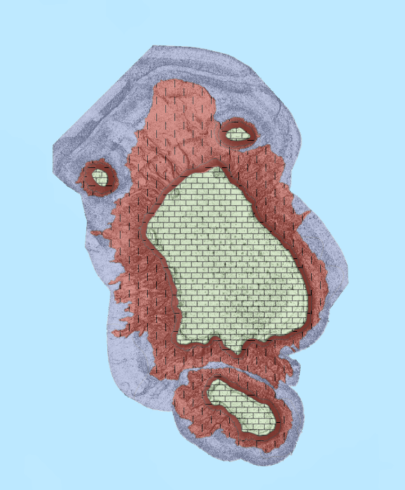
Underlying source bathymetric data were obtained from Beaman et al., 2020 (FK200429/GA4861), Brooke et al., 2020 (FK200802/GA0365) and the Australian Hydrographic Office. Morphology and geomorphology data layers were produced by applying semi-automated mapping tools to bathymetry digital elevation models (DEMs) in a GIS environment (ESRI ArcGIS Pro) using a two-step approach.
In step 1, seabed morphology Features were defined by generating polygons around topographic high, low, and planar Features using the TPI (topographic position index) tool in GA-SaMMT (Geoscience Australia semi-automated morphology mapping tools: Huang et al., 2022). Where appropriate, manual editing was also employed to modify the polygon boundaries of some features. Features were then classified by computing a set of quantitative geometric attributes and applying published Morphology Features glossary terms (Dove et al., 2020) using the GA-SaMMT. It should be noted that features of a certain size threshold or height (determined by the horizontal and vertical resolution of the underlying bathymetry grid) may not be captured by the semi-automated mapping tools. In addition, features that fall outside of the optimal user-defined parameters for the input data are not captured in the output.
In step 2, seabed geomorphology was interpreted by applying additional datasets and domain knowledge to inform the geomorphic characterisation of the seabed following Nanson et al., (2023). Where available, additional datasets include backscatter intensity data, seabed imagery (AUV and ROV), seabed samples, sub-bottom profiles and survey reports. Where a geomorphology classification has not been attributed, the following notation was applied:
NA: Classification at this level is not appropriate/applicable to the Setting/Process, or the level of detail is out of scope and has not been attempted;
Unknown: There is insufficient data available to determine a geomorphology classification for a mapped Morphology Feature.
A full list of GIS layers that comprise this data product, and their descriptions, is included in the accompanying Data Product Specification.
This web service was created using the data products from the above process using the ArcGIS server platform.
- Hierarchy level
- Service
Reference System Information
- Reference system identifier
-
EPSG/GDA94 (EPSG:4283)
- Title
-
European Petroleum Survey Group (EPSG) Geodetic Parameter Registry
- Date (Publication)
- 2008-11-12T00:00:00
- Cited responsible party
-
Role Organisation / Individual Name Details European Petroleum Survey Group
http://www.epsg-registry.org/
Reference System Information
- Reference system identifier
-
EPSG/WGS 84 (EPSG:4326)
- Title
-
European Petroleum Survey Group (EPSG) Geodetic Parameter Registry
- Date (Publication)
- 2008-11-12T00:00:00
- Cited responsible party
-
Role Organisation / Individual Name Details European Petroleum Survey Group
http://www.epsg-registry.org/
Metadata constraints
- Title
-
Australian Government Security Classification System
- Edition date
- 2018-11-01T00:00:00
- Classification
- Unclassified
Metadata
- Metadata identifier
-
urn:uuid/db8228bc-95bc-48d9-9ec5-fc025dd97e98
- Title
-
GeoNetwork UUID
- Language
- English
- Character encoding
- UTF8
- Contact
-
Role Organisation / Individual Name Details Point of contact Commonwealth of Australia (Geoscience Australia)
Voice facsimile Owner Wells, J
Internal Contact
Type of resource
- Resource scope
- Service
- Name
-
service
Alternative metadata reference
- Title
-
Geoscience Australia - short identifier for metadata record with
uuid
- Citation identifier
- eCatId/149243
- Date info (Creation)
- 2016-02-10T09:49:39
- Date info (Revision)
- 2016-05-04T13:46:02
Metadata standard
- Title
-
AU/NZS ISO 19115-1:2014
Metadata standard
- Title
-
ISO 19115-1:2014
Metadata standard
- Title
-
ISO 19115-3
- Title
-
Geoscience Australia Community Metadata Profile of ISO 19115-1:2014
- Edition
-
Version 2.0, September 2018
- Citation identifier
- https://pid.geoscience.gov.au/dataset/ga/122551
Overviews
Spatial extent
Provided by
