Australian Borehole Stratigraphic Units Compilation (ABSUC) 2026 Version 3.0 – Metadata statement
This dataset presents the third iteration of a national borehole stratigraphic unit compilation of existing source datasets from a range of federal, state and territory agencies. It builds on the previous Australian Borehole Stratigraphic Units Compilation (ABSUC) Version 2.0 (Vizy & Rollet, 2024) with new or updated stratigraphic interpretation on key boreholes. ABSUC aims to consolidate and standardise publicly available stratigraphic information, formation picks, and borehole collar data from petroleum, stratigraphy, minerals, and water bores. This compilation includes state and territory datasets, borehole logs and stratigraphic interpretations from published studies and new updated interpretations to standardise terminologies and provide consistent regional stratigraphy in key basins.
As our understanding of Australian groundwater systems grows, drawing on data from the 1970s to recent studies, it is clear that Australia is geological complexity. Recognising this complexity, there is a need to standardise diverse datasets, including borehole location and elevation, and variations in depth and nomenclature of stratigraphic picks across jurisdictions. This standardisation aims to create a consistent, continent-wide stratigraphic framework for better understanding groundwater systems to support decision-making for exploration, groundwater resource management and resource impact assessments.
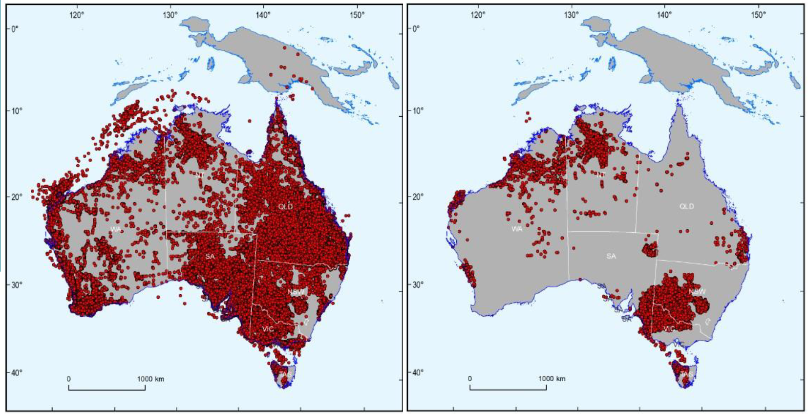
This continental-scale compilation consolidates borehole data from 71 sources, refining 1,218,930 formation picks to 1,095,617 unique records from 178,004 boreholes across Australia. It provides a consistent framework for interpreting various datasets, improving the characterisation of 3D aquifer geometry and connectivity, and supporting geological mapping of groundwater and other resources across Australia. Each data source's reliability is weighted, prioritising the most confident interpretations. Geological units conform to the Australian Stratigraphic Units Database (ASUD) ensuring consistency across national datasets and enabling updates between ABSUC, ASUD and linked databases, such as Hydrochemistry. Borehole surveys and dip measurements are excluded. As a result, stratigraphic picks are not adjusted for deviation, potentially impacting true vertical depth in deviated boreholes.
This dataset provides:
ABSUC_v3 Australian stratigraphic unit compilation dataset (ABSUC)
ABSUC_v3_TOP A subset of preferred top picks from the ABSUC_v3 dataset
ABSUC_v3_BASE A subset of preferred base picks from the ABSUC_v3 dataset
ABSUC_BOREHOLE_v3 ABSUC Borehole collar dataset
ASUD_2026 A subset of the Australia Stratigraphic Units Database (ASUD)
This study forms part of the Resourcing Australia’s Prosperity initiative, a 35-year, $3.4 billion Australian Government geoscience program led by Geoscience Australia, to accelerate the discovery and development of critical minerals, energy, and groundwater resources, support Australia’s transition to net zero emissions, and enable responsible resource management (see https://www.ga.gov.au/scientific-topics/resourcing-australias-prosperity/about-the-program). Achieving these objectives requires nationally consistent precompetitive geoscience data and analysis to inform decision-making by government, industry, and communities. By compiling, analysing, and interpreting new and existing geoscience datasets, this work contributes to building a national-scale understanding of Australia’s subsurface geology and its resource potential
Simple
Identification info
- Date (Creation)
- 2026-07-06
- Date (Publication)
- 2026-08-28T00:36:09.014Z
- Citation identifier
- Geoscience Australia Persistent Identifier/https://pid.geoscience.gov.au/dataset/ga/151276
Identifier
- Cited responsible party
-
Role Organisation / Individual Name Details Publisher Commonwealth of Australia (Geoscience Australia)
Voice Author Vizy, J.
Minerals, Energy and Groundwater Division Internal Contact Author Rollet, N.
Minerals, Energy and Groundwater Division Internal Contact Author Bishop, C.
Minerals, Energy and Groundwater Division Internal Contact
- Purpose
-
The purpose of this product is to deliver a national borehole stratigraphy dataset aligned with the Australian Stratigraphic Units Database, providing up to date, standardised consistent stratigraphic information to support geological, groundwater, and subsurface investigations nationwide.
- Status
- Completed
- Point of contact
-
Role Organisation / Individual Name Details Point of contact Commonwealth of Australia (Geoscience Australia)
Voice Resource provider Minerals, Energy and Groundwater Division
Internal Contact Point of contact Rollet, N.
Minerals, Energy and Groundwater Division Internal Contact
- Spatial representation type
- Topic category
-
- Geoscientific information
Extent
))
Vertical element
- Minimum value
- 0
- Maximum value
- 200
Identifier
- Maintenance and update frequency
- As needed
Resource format
- Title
-
Product data repository: Various Formats
- Protocol
-
FILE:DATA-DIRECTORY
- Name of the resource
-
Data Store directory containing the digital product files
- Description
-
Data Store directory containing one or more files, possibly in a variety of formats, accessible to Geoscience Australia staff only for internal purposes
- Keywords
-
-
Australia
-
- Keywords
-
-
Stratigraphy
-
- Keywords
-
-
borehole stratigraphic correlation
-
- Keywords
-
-
national borehole compilation
-
- Project
-
-
Resourcing Australia's Prosperity
-
Groundwater Mapping
-
- theme.ANZRC Fields of Research.rdf
-
-
Stratigraphy (incl. biostratigraphy, sequence stratigraphy and basin analysis)
-
- theme.ANZRC Fields of Research.rdf
-
-
EARTH SCIENCES
-
- Keywords
-
-
Published_External
-
Resource constraints
- Title
-
Creative Commons Attribution 4.0 International Licence
- Alternate title
-
CC-BY
- Edition
-
4.0
- Addressee
-
Role Organisation / Individual Name Details User Any
- Use constraints
- License
- Use constraints
- Other restrictions
- Other constraints
-
© Commonwealth of Australia (Geoscience Australia) 2026
Resource constraints
- Title
-
Australian Government Security Classification System
- Edition date
- 2018-11-01T00:00:00
- Classification
- Unclassified
- Classification system
-
Australian Government Security Classification System
Associated resource
- Language
- English
- Character encoding
- UTF8
Distribution Information
- OnLine resource
-
Download Metadata Statement (pdf) [5.02 MB]
Download Metadata Statement (pdf) [5.02 MB]
- Distribution format
-
-
pdf
-
Distribution Information
- OnLine resource
-
Download Dataset (zip) [1.24 GB]
Download Dataset (zip) [1.24 GB]
- Distribution format
-
-
gdb csv mdb
-
Distribution Information
- Distributor contact
-
Role Organisation / Individual Name Details Distributor Commonwealth of Australia (Geoscience Australia)
Voice
Resource lineage
- Statement
-
This product was undertaken as part of the National 3D Groundwater Systems Activity under the Resourcing Australia's Prosperity Groundwater Mapping Project.
Version 1 released May 2023 - <a href=" https://pid.geoscience.gov.au/dataset/ga/147641">eCat 147641</a>
Version 2 released May 2024 - <a href=" https://pid.geoscience.gov.au/dataset/ga/149324">eCat 149324</a>
Reference System Information
Identifier
Metadata constraints
- Title
-
Australian Government Security Classification System
- Edition date
- 2018-11-01T00:00:00
- Classification
- Unclassified
Metadata
- Metadata identifier
-
urn:uuid/5c8a0718-9c39-4c4d-9884-a4ef21c6c8cb
- Title
-
GeoNetwork UUID
- Language
- English
- Character encoding
- UTF8
- Contact
-
Role Organisation / Individual Name Details Point of contact Commonwealth of Australia (Geoscience Australia)
Voice Owner Rollet, N.
Minerals, Energy and Groundwater Division Internal Contact Point of contact Rollet, N.
Minerals, Energy and Groundwater Division Internal Contact
Type of resource
- Resource scope
- Dataset
- Name
-
Dataset
Alternative metadata reference
- Title
-
Geoscience Australia - short identifier for metadata record with uuid
- Citation identifier
- eCatId/151276
- Metadata linkage
-
https://ecat.ga.gov.au/geonetwork/srv/api/records/5c8a0718-9c39-4c4d-9884-a4ef21c6c8cb
- Date info (Creation)
- 2026-09-03T00:58:34.799Z
- Date info (Creation)
- 2026-09-02T23:13:46.725Z
- Date info (Creation)
- 2026-08-28T00:53:04.556Z
- Date info (Creation)
- 2026-08-28T00:52:35.765Z
- Date info (Creation)
- 2026-08-28T00:46:49.399Z
- Date info (Creation)
- 2026-08-28T00:36:29.119Z
- Date info (Creation)
- 2026-07-06T11:42:59.793Z
- Date info (Revision)
- 2026-09-03T00:59:41.218Z
Metadata standard
- Title
-
AU/NZS ISO 19115-1:2014
Metadata standard
- Title
-
ISO 19115-1:2014
Metadata standard
- Title
-
ISO 19115-3
- Title
-
Geoscience Australia Community Metadata Profile of ISO 19115-1:2014
- Edition
-
Version 2.0, September 2018
- Citation identifier
- https://pid.geoscience.gov.au/dataset/ga/122551
Overviews
Spatial extent
Provided by
