Australian Coastal Sediment Compartments WFS
The Australian Coastal Sediment Compartments Web Service provide a hierarchical spatial classification relevant to the assessment of sediment movement in the Australian coastal zone, and represent a tool to assist coastal planning and management. Additional spatial data layers produced during the development of the compartments are provided for reference.
Simple
Identification info
- Date (Creation)
- 2016-01-01T00:00:00
- Date (Publication)
- 2016-01-01T00:00:00
- Date (Revision)
- 2017-12-07T23:52:12
- Date (Revision)
- 2019-04-12T07:04:04
- Date (Revision)
- 2019-05-06T03:00:57
- Citation identifier
- Geoscience Australia Persistent Identifier/https://pid.geoscience.gov.au/service/ga/90090
- Point of contact
-
Role Organisation / Individual Name Details Point of contact Commonwealth of Australia (Geoscience Australia)
Voice Point of contact Nanson, R.
Place and Communities Internal Contact
- Topic category
-
- Geoscientific information
Extent
))
- Maintenance and update frequency
- Annually
- Keywords
-
-
web service
-
- Theme
-
-
Sediment
-
coasts
-
- Australian and New Zealand Standard Research Classification (ANZSRC)
-
-
Earth Sciences
-
- Service
-
-
WFS
-
- Keywords
-
-
Published_External
-
Resource constraints
- Title
-
Creative Commons Attribution 4.0 International Licence
- Alternate title
-
CC-BY
- Edition
-
4.0
- Access constraints
- License
- Use constraints
- License
Resource constraints
- Title
-
Australian Government Security ClassificationSystem
- Edition date
- 2018-11-01T00:00:00
- Classification
- Unclassified
- Service Version
-
2.0.0
- Service Version
-
1.1.0
- Service Version
-
1.0.0
- Coupling Type
- Tight
Contains Operations
- Operation Name
-
GetCapabilities
- Distributed computing platform (DCP)
- Web Services
- Name
-
SERVICE
- Type name
-
TEXT
- Parameter direction
-
- Description
-
The mandatory SERVICE parameter indicates which of the available service types at a particular server is being invoked. When invoking GetCapabilities on a WMS the value WMS shall be used.
- Optionality
- true
- Repeatability
- false
- Name
-
REQUEST
- Type name
-
TEXT
- Parameter direction
-
- Description
-
The mandatory REQUEST parameter indicates which service operation is being invoked. To invoke the GetCapabilities operation, the value GetCapabilities shall be used.
- Optionality
- true
- Repeatability
- false
- Name
-
VERSION
- Type name
-
TEXT
- Parameter direction
-
- Description
-
The optional VERSION parameter indicates the service type version number to use. In response to a GetCapabilities request that does not specify a version number, the server shall respond with the highest version it supports.
- Optionality
- true
- Repeatability
- false
- Operates On
Distribution Information
- Distributor contact
-
Role Organisation / Individual Name Details Distributor Geoscience Australia
Voice
- OnLine resource
-
Australian Coastal Sediment Compartments WFS
Australian Coastal Sediment Compartments WFS
Resource lineage
- Statement
-
The method used to create the polygon extents for the Realms, Regions and Divisions is not recorded but a review of the products suggests that they have not been derived from a digital elevation model or from buffering the coastline. It is believed the extents were digitised on-screen by hand with no further review of the extents, e.g. not clipped back to within Australia's Exclusive Economic Zone (EEZ). In developing the Primary and Secondary Compartment (polygon) data sets, the input data sets and basic process are presented below.
Input data sets
- The Australian Bathymetry and Topography Grid 2009 (used to define onshore and offshore bathymetric/elevation limits)
- Primary and Secondary boundary points defining compartment limits on (or near) the coastline
- Break lines connecting the landward to seaward extent via the Primary and Secondary compartment boundary points
o Manually digitised on-screen through visual interpretation of the Australian Bathymetry and Topography Grid and SPOT/Landsat optical imagery to define onshore topographic barriers to sediment movement (e.g. ridges.
- Australia's Exclusive Economic Zone (EEZ)
- Hierarchy level
- Service
- Other
-
Web Service
- Description
-
Source data not available.
Reference System Information
- Reference system identifier
- EPSG/GDA94 (EPSG:4283)
Metadata constraints
- Title
-
Australian Government Security ClassificationSystem
- Edition date
- 2018-11-01T00:00:00
- Classification
- Unclassified
Metadata
- Metadata identifier
-
urn:uuid/2d1ab6df-0956-e48a-e053-12a3070a0486
- Title
-
GeoNetwork UUID
- Language
- English
- Character encoding
- UTF8
- Contact
-
Role Organisation / Individual Name Details Point of contact Commonwealth of Australia (Geoscience Australia)
Voice
Type of resource
- Resource scope
- Service
- Name
-
service
Alternative metadata reference
- Title
-
Geoscience Australia - short identifier for metadata record with uuid
- Citation identifier
- eCatId/90090
- Date info (Creation)
- 2025-06-24T05:58:44.017Z
- Date info (Revision)
- 2025-06-24T05:59:22.46Z
- Date info (Creation)
- 2016-03-03T00:00:00
Metadata standard
- Title
-
AU/NZS ISO 19115-1:2014
Metadata standard
- Title
-
ISO 19115-1:2014
Metadata standard
- Title
-
ISO 19115-3
- Title
-
Geoscience Australia Community Metadata Profile of ISO 19115-1:2014
- Edition
-
Version 2.0, September 2018
- Citation identifier
- https://pid.geoscience.gov.au/dataset/ga/122551
Overviews
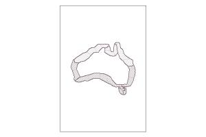
Spatial extent
Provided by
