Total Magnetic Intensity (TMI)
Type of resources
Keywords
Publication year
Topics
-
<div>This document defines the technical standards set by Geoscience Australia for the acquisition, processing and supply of airborne magnetic, horizontal magnetic gradient and radiometric (gamma-ray spectrometric) data. The technical standards cover the requirements for equipment, calibrations, quality control checks, reporting and data formats for airborne surveys.</div><div><br></div><div><br></div><div><strong>Table of Contents</strong></div><div><br></div><div>Attachment 1A – Data Acquisition and Processing</div><div><br></div><div>1 Aircraft</div><div>2 Flight and Tie Lines</div><div>3 Global Navigation Satellite System (GNSS)</div><div>4 Parallax Correction</div><div>5 Altimeter</div><div>6 Barometer</div><div>7 Digital Elevation Model</div><div>8 Magnetic System Equipment</div><div>9 Magnetic Gradient System Equipment</div><div>10 Magnetic / Gradient Calibration and Quality Tolerances</div><div>11 Magnetic Base Station (Diurnal Monitoring)</div><div>12 Magnetic Data Reduction</div><div>13 Magnetic Gradient Data Reduction</div><div>14 Radiometric System Equipment</div><div>15 Radiometric Calibration and Quality Tolerances</div><div>16 Radiometric Data Reduction</div><div><br></div><div>Attachment 1B – Reporting and Data Supply</div><div><br></div><div>1 General</div><div>2 Calibration Report</div><div>3 Daily Acquisition Report</div><div>4 Weekly Acquisition Report</div><div>5 Operations and Processing Summary Report</div><div>6 Supply Schedule</div><div><br></div><div>Attachment 1C – Data Formats</div><div><br></div><div>1 General</div><div>2 Point-Located Data Files</div><div>3 Definition Files</div><div>4 Description Files</div><div>5 Raw-Edited Magnetic Data File</div><div>6 Reduced Magnetic Data File</div><div>7 Diurnal Magnetic Data File</div><div>8 Raw-Edited Magnetic Gradient Data File</div><div>9 Reduced Magnetic Gradiometry Data File</div><div>10 Raw-Edited Radiometric Data File</div><div>11 Reduced Radiometric Data File</div><div>12 Gridded Data Files</div><div>13 Image Enhanced GeoTIFF Files
-

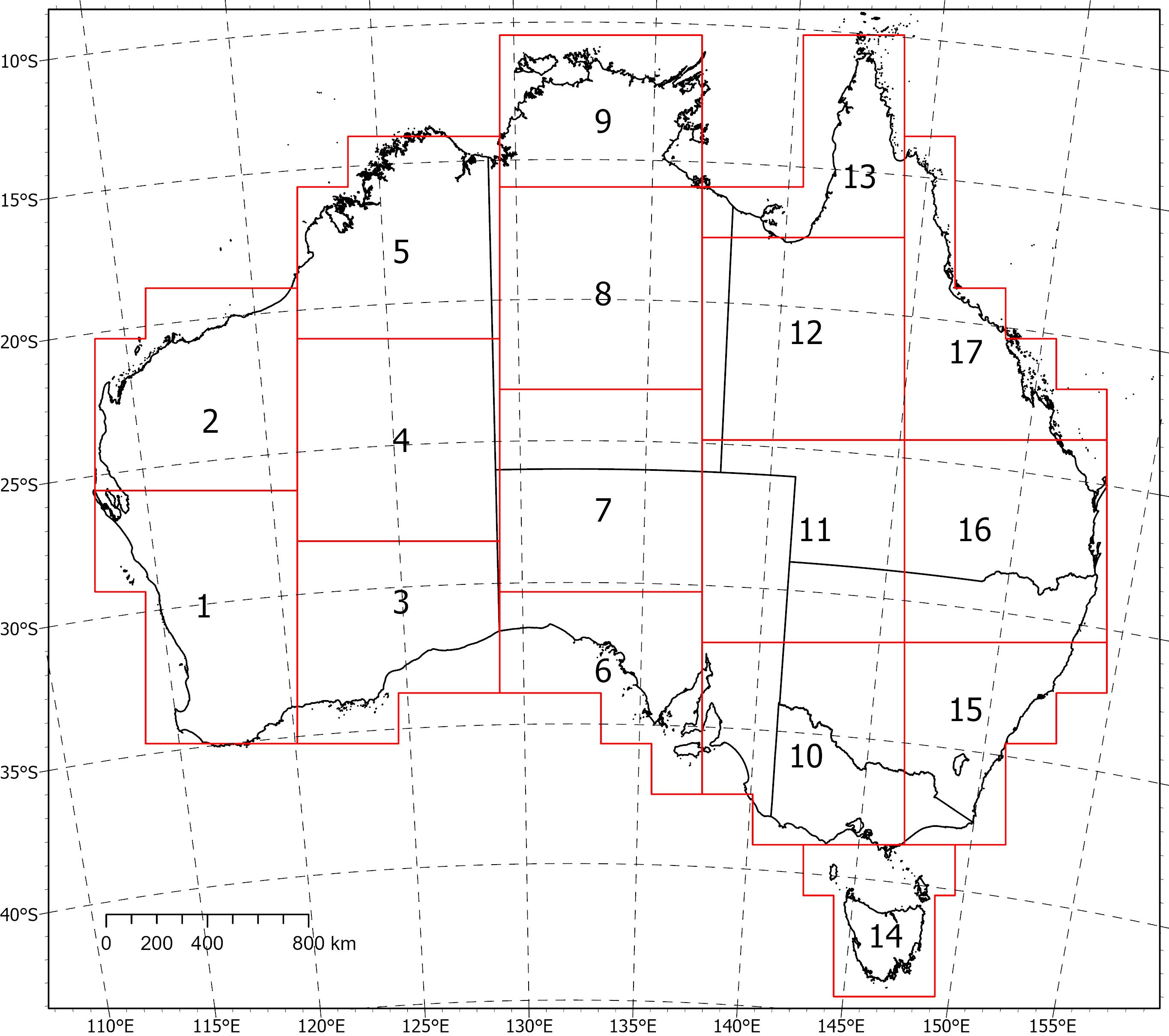
<div>Two coincident, crustal-scale models, one of magnetic susceptibility and one of density, have been produced for a volume covering the Australian continent and extending down to 55.5 km depth. These models were produced using the UBC‑GIF MAG3D and GRAV3D inversion programs, respectively.</div><div><br></div><div>The inversions were constrained with geological reference models with layers for sediments, undifferentiated crust and the mantle. The reference model for the magnetic inversion incorporated a Curie depth surface below which magnetic susceptibility was set to zero.</div><div><br></div><div>Due to the size of the inversion problem to be solved, the volume was divided into 235 overlapping inversions, which were inverted separately and then recombined. The method of recombining the inversions relies on a cosine function to determine the weight of each property and then takes a weighted average. This method successfully attenuated the edge effects that would otherwise occur between models and allows them to be viewed as one seamless model that covers the whole of Australia.</div><div><br></div><div>Regions of coincident high-density (>2.83 g/cm<sup>3</sup>) and high-magnetic susceptibility (>0.0125 SI) within the top 8‑9 km of the undifferentiated crust are suggested to be related to ultramafic rocks and the magnetite-forming hydrothermal alteration stages of potentially fertile IOCG systems. Currently the models are available in UBCGIF format (.den/.sus) only. Other formats and all supporting input data will be added in the near future. Due to their size, the models have been divided into subsets (labelled 1-17) for download. Please refer to the image below for the extent of the subsets.
