Australian Coastal Geomorphology Depositional Environment MapServer
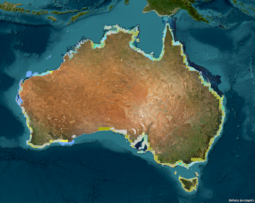
The service contains the Australian Coastal Geomorphology Environments, used to support a national coastal risk assessment. It describes the location and extent primary geomorphological environments (both depositional and erosional) present along the Australia coast and the processes acting on the features within.
Simple
Identification info
- Date (Creation)
- 2016-12-01T00:00:00
- Date (Revision)
- 2017-12-07T23:52:10
- Date (Publication)
- 2024-09-27
- Citation identifier
- Geoscience Australia Persistent Identifier/https://pid.geoscience.gov.au/service/ga/103361
- Point of contact
-
Role Organisation / Individual Name Details Point of contact Commonwealth of Australia (Geoscience Australia)
Voice Point of contact Nanson, R.
Place and Communities Internal Contact Custodian Audas, D.
Place and Communities Internal Contact
- Topic category
-
- Geoscientific information
Extent
))
- Maintenance and update frequency
- Periodic
- Australian and New Zealand Standard Research Classification: Fields of Research
-
-
Earth Sciences
-
- Keywords
-
-
geomorphology
-
geomorphic
-
shoreline
-
hazard
-
risk
-
smartline
-
dune
-
beach
-
coastal
-
coast
-
- Service
-
-
web service
-
MapServer
-
- Keywords
-
-
Published_External
-
Resource constraints
- Title
-
Creative Commons Attribution 4.0 International Licence
- Alternate title
-
CC-BY
- Edition
-
4.0
- Access constraints
- License
- Use constraints
- License
Resource constraints
- Title
-
Australian Government Security ClassificationSystem
- Edition date
- 2018-11-01T00:00:00
- Classification
- Unclassified
Associated resource
- Association Type
- Operates on
- Title
-
A Nationally Consistent Geomorphic Classification of the Australian Coastal Zone
- Citation identifier
- 71333
- Citation identifier
- a05f7892-fabe-7506-e044-00144fdd4fa6
- Service Version
-
10.2
- Coupling Type
- Tight
Contains Operations
- Operation Name
-
Services Directory
- Distributed computing platform (DCP)
- WebServices
- Operation Description
-
The Services Directory operation is used to provide a view of the ArcGIS Server REST API in HTML format, providing service-level metadata about the current web service.
Contains Operations
- Operation Name
-
REST API Information
- Distributed computing platform (DCP)
- WebServices
- Operation Description
-
The REST API Information operation is used to obtain service metadata in JSON format, which is a machinereadable description of the ArcGIS Server information content.
- Name
-
f
- Type name
-
TEXT
- Parameter direction
-
- Description
-
The mandatory f parameter indicates the format of the response. When invoking the REST API Information operation the value json or pjson shall be used.
- Optionality
- false
- Repeatability
- false
Distribution Information
- Distributor contact
-
Role Organisation / Individual Name Details Distributor Geoscience Australia
Voice
- OnLine resource
-
Australian Coastal Geomorphology Depositional Environment MapServer
Australian Coastal Geomorphology Depositional Environment MapServer
- Distribution format
-
-
ESRI:ArcGIS:MapServer
-
Resource lineage
- Statement
-
This is the third iteration of this web service. The service was revised in 2024 and 2016 as part of an infrastructure platform upgrade.
- Hierarchy level
- Service
Reference System Information
- Reference system identifier
-
EPSG/GDA94 (EPSG:4283)
- Title
-
European Petroleum Survey Group (EPSG) Geodetic Parameter Registry
- Date (Publication)
- 2008-11-12T00:00:00
- Cited responsible party
-
Role Organisation / Individual Name Details European Petroleum Survey Group
http://www.epsg-registry.org/
Metadata constraints
- Title
-
Australian Government Security ClassificationSystem
- Edition date
- 2018-11-01T00:00:00
- Classification
- Unclassified
Metadata
- Metadata identifier
-
urn:uuid/a38d7f5f-ab10-4470-92e3-cdcc2d5e65a8
- Title
-
GeoNetwork UUID
- Language
- English
- Character encoding
- UTF8
- Contact
-
Role Organisation / Individual Name Details Point of contact Commonwealth of Australia (Geoscience Australia)
Voice Point of contact Nanson, R.
Place and Communities Internal Contact
Type of resource
- Resource scope
- Service
- Name
-
service
Alternative metadata reference
- Title
-
Geoscience Australia - short identifier for metadata record with uuid
- Citation identifier
- eCatId/103361
- Date info (Creation)
- 2025-06-11T01:22:56.846Z
- Date info (Creation)
- 2016-02-10T09:49:39
- Date info (Revision)
- 2025-06-11T01:23:29.168Z
Metadata standard
- Title
-
AU/NZS ISO 19115-1:2014
Metadata standard
- Title
-
ISO 19115-1:2014
Metadata standard
- Title
-
ISO 19115-3
- Title
-
Geoscience Australia Community Metadata Profile of ISO 19115-1:2014
- Edition
-
Version 2.0, September 2018
- Citation identifier
- https://pid.geoscience.gov.au/dataset/ga/122551
Overviews
Spatial extent
Provided by
